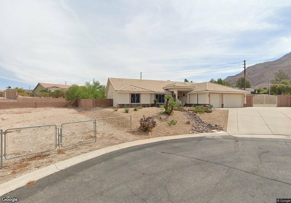
6686 Network Cir Las Vegas, NV 89156
Estimated Value: $468,000 - $605,000
3
Beds
2
Baths
2,270
Sq Ft
$231/Sq Ft
Est. Value
About This Home
This home is located at 6686 Network Cir, Las Vegas, NV 89156 and is currently estimated at $525,213, approximately $231 per square foot. 6686 Network Cir is a home located in Clark County with nearby schools including Mountain View Elementary School, Dr. William H. Bailey Middle School, and Sunrise Mountain High School.
Ownership History
Date
Name
Owned For
Owner Type
Purchase Details
Closed on
Sep 29, 2017
Sold by
Marmurowsk Philp and Marmurowsk Patricia
Bought by
Marmurowski Philip H and Marmurowski Patricia
Current Estimated Value
Purchase Details
Closed on
Dec 12, 2016
Sold by
Marmurowski Philip Henry and Marmurowski Patricia Ann
Bought by
Kessler Mylissa Ann and Marmurowski Philip Jayson
Purchase Details
Closed on
Jul 25, 2000
Sold by
Briggs Charlene A and Briggs William A
Bought by
Marmurowski Philip H and Marmurowski Patricia A
Purchase Details
Closed on
Sep 24, 1998
Sold by
Briggs William A and Briggs Charlene A
Bought by
Briggs William A and Briggs Charlene A
Purchase Details
Closed on
Nov 23, 1996
Sold by
American Family Homes Llc
Bought by
Briggs William A and Briggs Charlene A
Create a Home Valuation Report for This Property
The Home Valuation Report is an in-depth analysis detailing your home's value as well as a comparison with similar homes in the area
Home Values in the Area
Average Home Value in this Area
Purchase History
| Date | Buyer | Sale Price | Title Company |
|---|---|---|---|
| Marmurowski Philip H | -- | None Available | |
| Kessler Mylissa Ann | -- | None Available | |
| Marmurowski Philip H | $57,000 | First American Title Co | |
| Briggs William A | -- | -- | |
| Briggs William A | -- | -- | |
| Briggs William A | $62,000 | Nevada Title Company |
Source: Public Records
Tax History Compared to Growth
Tax History
| Year | Tax Paid | Tax Assessment Tax Assessment Total Assessment is a certain percentage of the fair market value that is determined by local assessors to be the total taxable value of land and additions on the property. | Land | Improvement |
|---|---|---|---|---|
| 2025 | $2,201 | $145,980 | $34,913 | $111,067 |
| 2024 | $2,137 | $145,980 | $34,913 | $111,067 |
| 2023 | $2,137 | $139,768 | $34,913 | $104,855 |
| 2022 | $2,075 | $121,767 | $25,725 | $96,042 |
| 2021 | $2,015 | $115,058 | $23,888 | $91,170 |
| 2020 | $1,953 | $117,646 | $27,563 | $90,083 |
| 2019 | $1,896 | $111,768 | $23,153 | $88,615 |
| 2018 | $1,841 | $94,060 | $22,995 | $71,065 |
| 2017 | $2,512 | $85,652 | $22,050 | $63,602 |
| 2016 | $1,744 | $81,913 | $15,435 | $66,478 |
| 2015 | $1,740 | $66,839 | $11,025 | $55,814 |
| 2014 | $1,689 | $61,250 | $11,025 | $50,225 |
Source: Public Records
Map
Nearby Homes
- 2085 N Hollywood Blvd
- 6755 Warthog Ave
- 6435 Heatherton Ave
- 6958 Lazy Sunset Ct
- 1330 Honey Lake St
- 1345 Morning Sun Way
- 6800 E Lake Mead Blvd Unit 1034
- 6800 E Lake Mead Blvd Unit 2011
- 6800 E Lake Mead Blvd Unit 2083
- 6800 E Lake Mead Blvd Unit 2028
- 6800 E Lake Mead Blvd Unit 2072
- 6800 E Lake Mead Blvd Unit 2024
- 6800 E Lake Mead Blvd Unit 2076
- 1239 N Hollywood Blvd
- 6271 Brynhurst Dr
- 6741 Solaron Ave
- 1905 Eskam St
- 2147 Bridle Wreath Ln
- 2093 Scanlon Ferry Ct Unit 103
- 6760 Fallona Ave
- 6687 Network Cir
- 6693 Chapel Bells Ct
- 6658 Network Cir
- 6679 Chapel Bells Ct
- 6673 Network Cir
- 6720 Targhee Ct
- 6659 Network Cir
- 6671 Chapel Bells Ct
- 6644 Network Cir
- 6719 Hathaway Dr
- 6645 Network Cir
- 6651 Chapel Bells Ct
- 6692 Chapel Bells Ct
- 6721 Targhee Ct
- 6630 Network Cir
- 6740 Targhee Ct
- 6678 Chapel Bells Ct
- 6737 Hathaway Dr
- 6631 Network Cir
- 6680 E Owens Ave