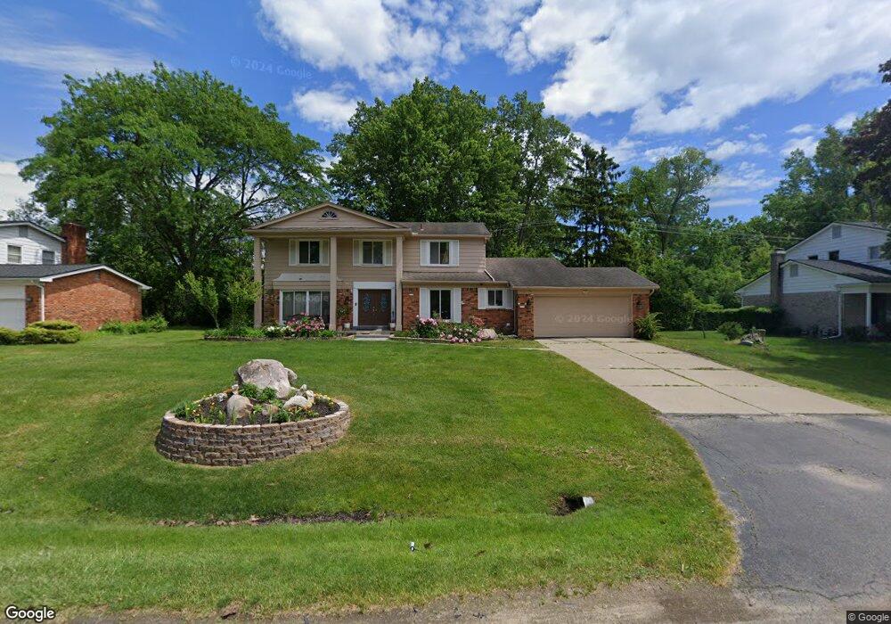
6689 Post Oak Dr West Bloomfield, MI 48322
Estimated Value: $428,601 - $486,000
4
Beds
3
Baths
2,670
Sq Ft
$171/Sq Ft
Est. Value
About This Home
This home is located at 6689 Post Oak Dr, West Bloomfield, MI 48322 and is currently estimated at $455,900, approximately $170 per square foot. 6689 Post Oak Dr is a home located in Oakland County with nearby schools including Sheiko Elementary School, West Bloomfield Middle School, and Bloomfield Maples Montessori.
Ownership History
Date
Name
Owned For
Owner Type
Purchase Details
Closed on
Feb 6, 2024
Sold by
Maroghi Munther
Bought by
Maroghi Maha and Maroghi Munther
Current Estimated Value
Purchase Details
Closed on
Dec 5, 2017
Sold by
Noha Haroke and Munther Harodhi
Bought by
Maroghi Munther
Purchase Details
Closed on
Nov 3, 2004
Sold by
Osagie Augustine O and Osagie Amina A
Bought by
Maroke Noha and Maroghi Munther
Purchase Details
Closed on
Feb 17, 1998
Sold by
Fuller Craig A
Bought by
Osagie Augustine O
Create a Home Valuation Report for This Property
The Home Valuation Report is an in-depth analysis detailing your home's value as well as a comparison with similar homes in the area
Home Values in the Area
Average Home Value in this Area
Purchase History
| Date | Buyer | Sale Price | Title Company |
|---|---|---|---|
| Maroghi Maha | -- | None Listed On Document | |
| Maroghi Maha | -- | None Listed On Document | |
| Maroghi Munther | -- | None Available | |
| Maroke Noha | $265,000 | Metropolitan Title Company | |
| Osagie Augustine O | $210,000 | -- |
Source: Public Records
Tax History Compared to Growth
Tax History
| Year | Tax Paid | Tax Assessment Tax Assessment Total Assessment is a certain percentage of the fair market value that is determined by local assessors to be the total taxable value of land and additions on the property. | Land | Improvement |
|---|---|---|---|---|
| 2024 | $2,739 | $180,540 | $0 | $0 |
| 2022 | $2,622 | $158,770 | $40,000 | $118,770 |
| 2021 | $3,990 | $150,050 | $0 | $0 |
| 2020 | $2,570 | $147,800 | $34,100 | $113,700 |
| 2018 | $3,065 | $136,640 | $28,150 | $108,490 |
| 2015 | -- | $110,030 | $0 | $0 |
| 2014 | -- | $98,070 | $0 | $0 |
| 2011 | -- | $87,310 | $0 | $0 |
Source: Public Records
Map
Nearby Homes
- 6545 Post Oak Dr
- 6564 Alderley Way
- 5312 Cambourne Place
- 7209 Stonebrook Rd
- 7251 N Briarcliff Knoll Dr
- 7023 Wild Ridge Ln
- 7477 Gramercy Cir Unit 17
- 7479 Gramercy Cir Unit 16
- 7507 Gramercy Cir
- 6624 Mellow Wood Ln
- 6769 Heather Heath
- 7431 N Briarcliff Knoll Dr
- 7250 Ten Hill
- 7335 Coach Ln
- 29020 Ramblewood Dr
- 7027 Beverly Crest Dr
- 28786 Rockledge Dr
- 6800 N Clunbury Rd
- 3035 Parkland Dr
- 6843 Leslee Crest Dr
- 6703 Post Oak Dr
- 6665 Post Oak Dr
- 6715 Post Oak Dr
- 6694 Post Oak Dr
- 6682 Post Oak Dr
- 6710 Post Oak Dr
- 6808 Woodside Trail
- 6670 Post Oak Dr
- 6796 Woodside Trail
- 6653 Post Oak Dr
- 6824 Woodside Trail
- 6727 Post Oak Dr
- 6724 Post Oak Dr
- 6715 Alderley Way
- 6658 Post Oak Dr
- 6701 Alderley Way
- 6737 Alderley Way
- 6687 Alderley Way
- 6784 Woodside Trail
- 6832 Woodside Trail