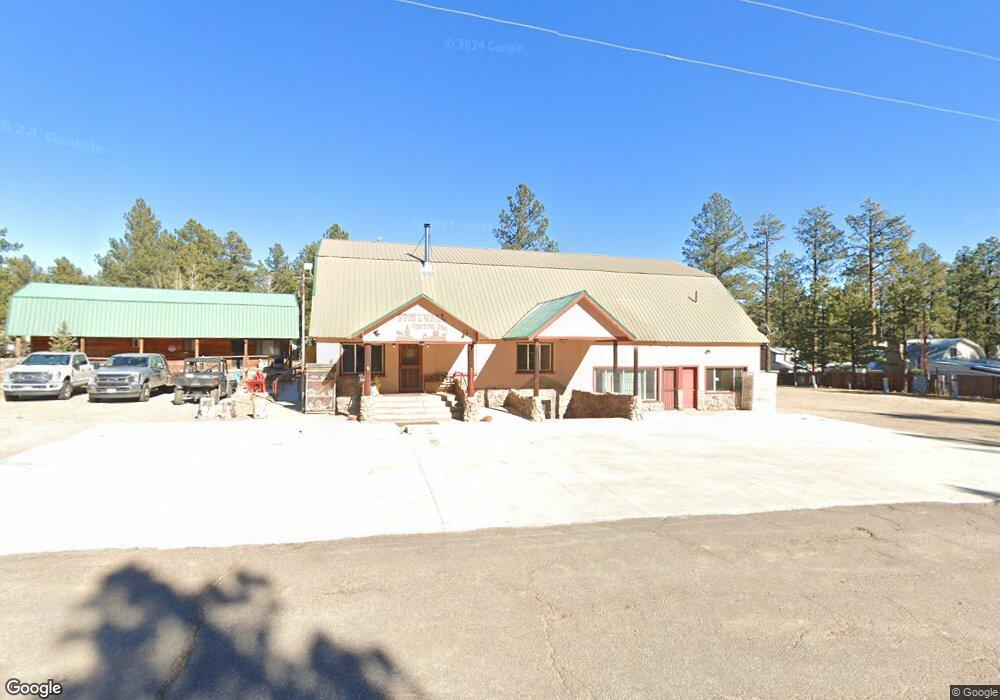
6689 State Highway 12 Weston, CO 81091
Estimated Value: $671,507
--
Bed
2
Baths
4,580
Sq Ft
$147/Sq Ft
Est. Value
About This Home
This home is located at 6689 State Highway 12, Weston, CO 81091 and is currently estimated at $671,507, approximately $146 per square foot. 6689 State Highway 12 is a home located in Las Animas County with nearby schools including Primero Elementary School and Primero Junior/Senior High School.
Ownership History
Date
Name
Owned For
Owner Type
Purchase Details
Closed on
Jun 19, 2020
Sold by
Lancaster Timothy D and Lancaster Ellen W
Bought by
Shopping Bag Center Llc
Current Estimated Value
Home Financials for this Owner
Home Financials are based on the most recent Mortgage that was taken out on this home.
Original Mortgage
$180,000
Outstanding Balance
$159,556
Interest Rate
3.2%
Mortgage Type
New Conventional
Estimated Equity
$511,951
Create a Home Valuation Report for This Property
The Home Valuation Report is an in-depth analysis detailing your home's value as well as a comparison with similar homes in the area
Home Values in the Area
Average Home Value in this Area
Purchase History
| Date | Buyer | Sale Price | Title Company |
|---|---|---|---|
| Shopping Bag Center Llc | -- | None Available |
Source: Public Records
Mortgage History
| Date | Status | Borrower | Loan Amount |
|---|---|---|---|
| Open | Shopping Bag Center Llc | $180,000 |
Source: Public Records
Tax History Compared to Growth
Tax History
| Year | Tax Paid | Tax Assessment Tax Assessment Total Assessment is a certain percentage of the fair market value that is determined by local assessors to be the total taxable value of land and additions on the property. | Land | Improvement |
|---|---|---|---|---|
| 2025 | $2,624 | $115,740 | $14,430 | $101,310 |
| 2024 | $2,624 | $76,750 | $14,430 | $62,320 |
| 2023 | $2,624 | $74,640 | $14,430 | $60,210 |
| 2022 | $2,794 | $92,160 | $15,000 | $77,160 |
| 2021 | $3,286 | $92,180 | $15,000 | $77,180 |
| 2020 | $2,428 | $72,590 | $2,630 | $69,960 |
| 2019 | $22 | $72,590 | $2,630 | $69,960 |
| 2018 | $1,971 | $66,530 | $2,630 | $63,900 |
| 2017 | $1,966 | $66,530 | $0 | $0 |
| 2015 | $1,742 | $79,797 | $0 | $0 |
| 2013 | $2,012 | $79,797 | $2,624 | $77,172 |
Source: Public Records
Map
Nearby Homes
- 6655 Colorado 12
- 6655 State Highway 12
- 6835 Colorado 12
- 0 Rancho La Garita Lot 175 Unit REC6232652
- TBD Rancho La Garita Lot 175
- 8315 Gun Barrel Ridge
- 14338 North Ridge
- 14333 North Ridge
- Rd
- 13900 Highway 12
- 0 Malcolm Rd Unit REC4332627
- 0 Rancho Escondido Lot 15
- TBD Rancho Escondido Lot 15
- 0 Rancho Escondido Lot 23c
- 14552 Timber Valley Dr
- 13121 Northridge Rd
- 13250 Mountain Meadow Trace
- TBD San Pablo Canyon Lot 6
- 0 San Pablo Canyon Rd
- 0 Loubier Unit REC4907603
- 6705 State Highway 12
- 6711 State Highway 12
- 6653 State Highway 12
- 6715 State Highway 12
- 6715 State Highway 12
- 6719 State Highway 12
- 6719 State Highway 12
- 6673 State Highway 12
- 6654 State Highway 12
- 6685 State Highway 12
- 6685 State Highway 12
- 6641 State Highway 12
- 6641 State Highway 12
- 6709 State Highway 12
- 6643 State Highway 12
- 6645 State Highway 12
- 6647 State Highway 12
- 6721 State Highway 12
- 6725 State Highway 12
- 6825 State Highway 12