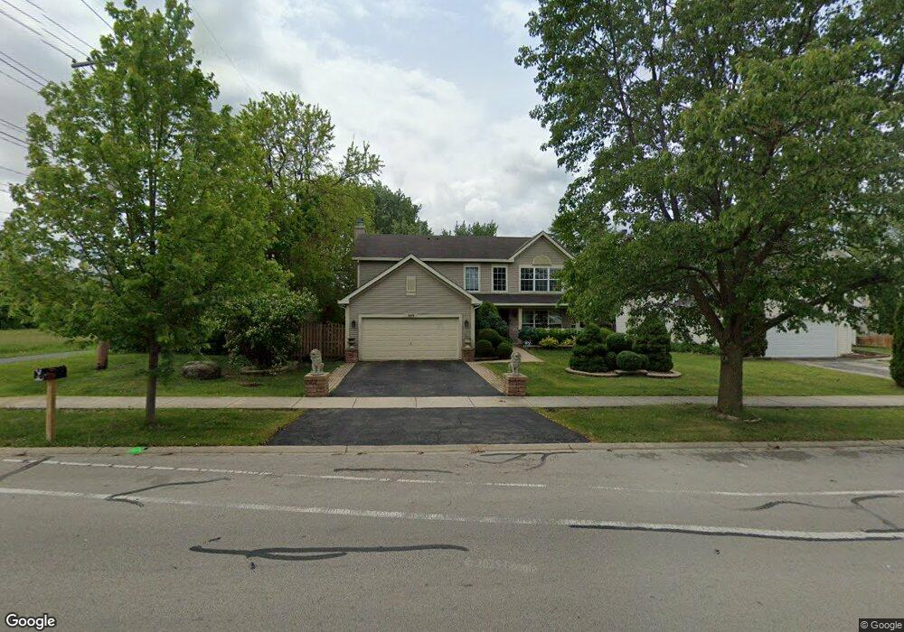
669 W Briarcliff Rd Bolingbrook, IL 60440
Lakewood Ridge NeighborhoodEstimated Value: $404,000 - $441,000
--
Bed
1
Bath
2,171
Sq Ft
$191/Sq Ft
Est. Value
About This Home
This home is located at 669 W Briarcliff Rd, Bolingbrook, IL 60440 and is currently estimated at $414,931, approximately $191 per square foot. 669 W Briarcliff Rd is a home located in Will County with nearby schools including Independence Elementary School, Jane Addams Middle School, and Bolingbrook High School.
Ownership History
Date
Name
Owned For
Owner Type
Purchase Details
Closed on
Feb 13, 2004
Sold by
Lakewood Ridge Llc
Bought by
Belocura Shirley C and Romero John C
Current Estimated Value
Home Financials for this Owner
Home Financials are based on the most recent Mortgage that was taken out on this home.
Original Mortgage
$250,900
Outstanding Balance
$118,732
Interest Rate
5.96%
Mortgage Type
Purchase Money Mortgage
Estimated Equity
$296,199
Create a Home Valuation Report for This Property
The Home Valuation Report is an in-depth analysis detailing your home's value as well as a comparison with similar homes in the area
Home Values in the Area
Average Home Value in this Area
Purchase History
| Date | Buyer | Sale Price | Title Company |
|---|---|---|---|
| Belocura Shirley C | $264,500 | -- |
Source: Public Records
Mortgage History
| Date | Status | Borrower | Loan Amount |
|---|---|---|---|
| Open | Belocura Shirley C | $250,900 |
Source: Public Records
Tax History Compared to Growth
Tax History
| Year | Tax Paid | Tax Assessment Tax Assessment Total Assessment is a certain percentage of the fair market value that is determined by local assessors to be the total taxable value of land and additions on the property. | Land | Improvement |
|---|---|---|---|---|
| 2024 | $12,225 | $119,649 | $25,776 | $93,873 |
| 2023 | $12,225 | $107,656 | $23,192 | $84,464 |
| 2022 | $10,838 | $97,058 | $20,909 | $76,149 |
| 2021 | $10,343 | $90,751 | $19,550 | $71,201 |
| 2020 | $10,071 | $87,767 | $18,907 | $68,860 |
| 2019 | $9,797 | $83,588 | $18,007 | $65,581 |
| 2018 | $9,796 | $83,343 | $17,954 | $65,389 |
| 2017 | $9,621 | $78,998 | $17,018 | $61,980 |
| 2016 | $9,374 | $75,200 | $16,200 | $59,000 |
| 2015 | $8,616 | $72,100 | $15,500 | $56,600 |
| 2014 | $8,616 | $68,700 | $14,800 | $53,900 |
| 2013 | $8,616 | $68,700 | $14,800 | $53,900 |
Source: Public Records
Map
Nearby Homes
- 118 Springleaf Dr Unit 5
- 117 Galewood Dr
- 129 Galewood Dr
- 112 S Orchard Dr
- 157 N Orchard Dr
- 565 Cottonwood Cir
- 207 Hampdon Ct
- 164 Galewood Dr
- 534 Cottonwood Cir
- 530 Cottonwood Cir
- 206 Christine Way Unit 2
- 261 Bryant Way
- 257 Plainview Dr
- 224 Radcliff Dr
- 210 Mill Stream Dr
- 228 Elkhorn Ct Unit B
- 621 Sundance Dr
- 315 Clarendon Ln Unit 1
- 329 Redwing Dr
- 650 Sundance Dr
- 704 Westwind Dr
- 104 Garden Dr
- 677 W Briarcliff Rd
- 16 Franklin Ct Unit 3
- 708 Westwind Dr
- 681 W Briarcliff Rd
- 108 Garden Dr
- 15 Franklin Ct
- 712 Westwind Dr
- 685 W Briarcliff Rd
- 1 Franklin Ct Unit 3
- 661 W Briarcliff Rd
- 112 Garden Dr
- 14 Franklin Ct Unit 3
- 716 Westwind Dr
- 101 Valley Dr
- 2 Franklin Ct Unit 3
- 105 Denver Dr
- 689 W Briarcliff Rd
- 657 Ponderosa Dr