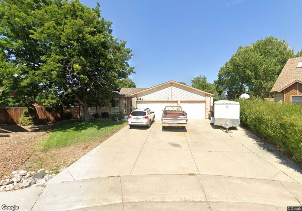
6692 Devinney Ct Arvada, CO 80004
Ralston Valley NeighborhoodEstimated Value: $596,000 - $643,000
3
Beds
3
Baths
1,312
Sq Ft
$468/Sq Ft
Est. Value
About This Home
This home is located at 6692 Devinney Ct, Arvada, CO 80004 and is currently estimated at $614,128, approximately $468 per square foot. 6692 Devinney Ct is a home located in Jefferson County with nearby schools including Stott Elementary School, Oberon Middle School, and Arvada West High School.
Ownership History
Date
Name
Owned For
Owner Type
Purchase Details
Closed on
Oct 2, 2012
Sold by
Snodgrass Larry E
Bought by
Snodgrass Living Trust
Current Estimated Value
Create a Home Valuation Report for This Property
The Home Valuation Report is an in-depth analysis detailing your home's value as well as a comparison with similar homes in the area
Home Values in the Area
Average Home Value in this Area
Purchase History
| Date | Buyer | Sale Price | Title Company |
|---|---|---|---|
| Snodgrass Living Trust | -- | None Available |
Source: Public Records
Tax History Compared to Growth
Tax History
| Year | Tax Paid | Tax Assessment Tax Assessment Total Assessment is a certain percentage of the fair market value that is determined by local assessors to be the total taxable value of land and additions on the property. | Land | Improvement |
|---|---|---|---|---|
| 2024 | $2,720 | $34,738 | $17,287 | $17,451 |
| 2023 | $2,720 | $34,738 | $17,287 | $17,451 |
| 2022 | $2,308 | $30,520 | $12,954 | $17,566 |
| 2021 | $2,346 | $31,397 | $13,326 | $18,071 |
| 2020 | $2,170 | $29,635 | $13,237 | $16,398 |
| 2019 | $2,141 | $29,635 | $13,237 | $16,398 |
| 2018 | $1,841 | $25,998 | $8,504 | $17,494 |
| 2017 | $1,685 | $25,998 | $8,504 | $17,494 |
| 2016 | $1,531 | $24,054 | $6,908 | $17,146 |
| 2015 | $1,111 | $24,054 | $6,908 | $17,146 |
| 2014 | $1,111 | $18,937 | $5,731 | $13,206 |
Source: Public Records
Map
Nearby Homes
- 14050 W 68th Ave
- 13755 W 65th Dr
- 6537 Coors St
- 13553 W 65th Place
- 13812 W 64th Place
- 6762 Beech Dr
- 13432 W 65th Place
- 7004 Beech Ct
- 7210 Devinney Ct Unit C
- 13304 W 70th Place
- 6616 Zang Cir
- 6416 Zang Ct
- 15314 W 69th Ave
- 15334 W 69th Ave
- 15344 W 69th Ave
- 15364 W 69th Ave
- 13245 W 63rd Cir
- 13155 W 63rd Place
- 13970 W 72nd Place Unit C
- 6254 Devinney Cir
- 6690 Devinney Ct
- 13850 W 67th Ct
- 6693 Devinney Ct
- 13840 W 67th Ct
- 6688 Devinney Ct
- 13860 W 67th Ct
- 6689 Deframe Ct
- 6691 Devinney Ct
- 6687 Deframe Ct
- 13830 W 67th Ct
- 6686 Devinney Ct
- 6689 Devinney Ct
- 6685 Deframe Ct
- 6691 Deframe Ct
- 13841 W 67th Ct
- 13861 W 67th Ct
- 13831 W 67th Ct
- 13820 W 67th Ct
- 6684 Devinney Ct
- 13851 W 67th Ct