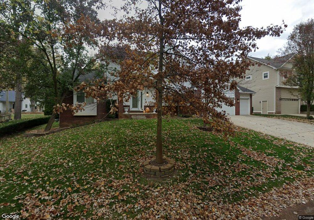
6692 Grassland Ave West Bloomfield, MI 48324
Estimated Value: $419,782 - $461,000
3
Beds
3
Baths
1,830
Sq Ft
$239/Sq Ft
Est. Value
About This Home
This home is located at 6692 Grassland Ave, West Bloomfield, MI 48324 and is currently estimated at $437,696, approximately $239 per square foot. 6692 Grassland Ave is a home located in Oakland County with nearby schools including Our Lady Of Refuge School and St Mary's Preparatory School.
Ownership History
Date
Name
Owned For
Owner Type
Purchase Details
Closed on
Apr 27, 2007
Sold by
Tobia Manhal W
Bought by
Rousseau John D
Current Estimated Value
Home Financials for this Owner
Home Financials are based on the most recent Mortgage that was taken out on this home.
Original Mortgage
$187,500
Interest Rate
6.26%
Mortgage Type
Purchase Money Mortgage
Purchase Details
Closed on
Jun 29, 2000
Sold by
Sunrise Homeinc
Bought by
Tobia Manhal W
Home Financials for this Owner
Home Financials are based on the most recent Mortgage that was taken out on this home.
Original Mortgage
$36,200
Interest Rate
8.24%
Create a Home Valuation Report for This Property
The Home Valuation Report is an in-depth analysis detailing your home's value as well as a comparison with similar homes in the area
Home Values in the Area
Average Home Value in this Area
Purchase History
| Date | Buyer | Sale Price | Title Company |
|---|---|---|---|
| Rousseau John D | $250,000 | Alpha Title Agency Inc | |
| Tobia Manhal W | $50,000 | -- |
Source: Public Records
Mortgage History
| Date | Status | Borrower | Loan Amount |
|---|---|---|---|
| Previous Owner | Rousseau John D | $187,500 | |
| Previous Owner | Tobia Manhal W | $36,200 |
Source: Public Records
Tax History Compared to Growth
Tax History
| Year | Tax Paid | Tax Assessment Tax Assessment Total Assessment is a certain percentage of the fair market value that is determined by local assessors to be the total taxable value of land and additions on the property. | Land | Improvement |
|---|---|---|---|---|
| 2024 | $2,912 | $190,720 | $0 | $0 |
| 2022 | $3,006 | $176,600 | $36,070 | $140,530 |
| 2021 | $4,237 | $168,230 | $0 | $0 |
| 2020 | $2,732 | $160,000 | $36,070 | $123,930 |
| 2018 | $4,085 | $137,650 | $36,070 | $101,580 |
| 2015 | -- | $116,170 | $0 | $0 |
| 2014 | -- | $107,790 | $0 | $0 |
| 2011 | -- | $93,700 | $0 | $0 |
Source: Public Records
Map
Nearby Homes
- 6768 Buckland Ave
- 3950 Bradmore Ave
- 3965 Carrick Ave
- 3991 Fieldview Ave
- 6903 Dandison Blvd
- 3632 Fieldview Ave
- 3641 Green Lake Rd
- 4066 Green Lake Rd
- 0000 Langtoft
- 6675 Langtoft St
- 6978 Colony Dr
- 6707 Heatherwood Dr
- 3701 Northwood
- 7146 Arrowood Dr
- 4442 Borland St
- 6420 Commerce Rd
- 4245 Bunker Ave
- 4335 Crestdale Ave
- 7369 Sweetbriar
- 4540 Rolling Pine Ct
- 6670 Grassland Ave
- 0000 Grassland Ave
- VAC Grassland Ave
- 6724 Grassland Ave
- 6675 Buckland Ave
- 6657 Buckland Ave
- 6711 Buckland Ave
- 6655 Grassland Ave
- 6715 Grassland Ave
- 6748 Grassland Ave
- 6650 Grassland Ave
- 6639 Buckland Ave
- 6723 Buckland Ave
- 6707 Grassland Ave
- 6670 Buckland Ave
- 6623 Buckland Ave
- 6645 Grassland Ave
- 6731 Buckland Ave
- 6752 Grassland Ave
- 6716 Dandison Blvd