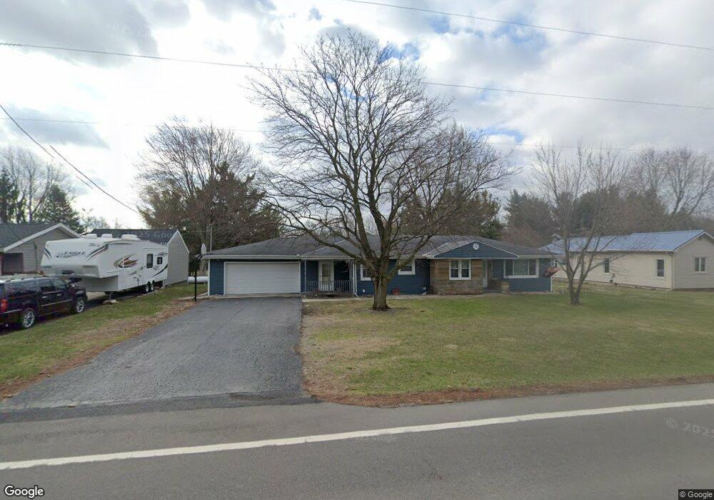
6693 W State Route 12 Findlay, OH 45840
Estimated Value: $247,644 - $304,000
2
Beds
2
Baths
1,688
Sq Ft
$159/Sq Ft
Est. Value
About This Home
This home is located at 6693 W State Route 12, Findlay, OH 45840 and is currently estimated at $267,911, approximately $158 per square foot. 6693 W State Route 12 is a home located in Hancock County with nearby schools including Liberty-Benton Elementary School, Liberty-Benton Middle School, and Liberty-Benton High School.
Ownership History
Date
Name
Owned For
Owner Type
Purchase Details
Closed on
Aug 28, 2017
Sold by
Crist Daniel
Bought by
Jett Catherine and Crist Catherien
Current Estimated Value
Purchase Details
Closed on
Oct 28, 2009
Sold by
Mckitrick Samuel K and Mckitrick Darlene E
Bought by
Wells Fargo Bank Na
Purchase Details
Closed on
Oct 4, 1989
Bought by
Thornton Thornton C and Thornton Tonia K
Create a Home Valuation Report for This Property
The Home Valuation Report is an in-depth analysis detailing your home's value as well as a comparison with similar homes in the area
Home Values in the Area
Average Home Value in this Area
Purchase History
| Date | Buyer | Sale Price | Title Company |
|---|---|---|---|
| Jett Catherine | -- | None Available | |
| Wells Fargo Bank Na | $56,667 | Attorney | |
| Thornton Thornton C | $63,500 | -- |
Source: Public Records
Tax History Compared to Growth
Tax History
| Year | Tax Paid | Tax Assessment Tax Assessment Total Assessment is a certain percentage of the fair market value that is determined by local assessors to be the total taxable value of land and additions on the property. | Land | Improvement |
|---|---|---|---|---|
| 2024 | $2,197 | $59,110 | $11,240 | $47,870 |
| 2023 | $2,145 | $59,110 | $11,240 | $47,870 |
| 2022 | $2,124 | $59,110 | $11,240 | $47,870 |
| 2021 | $1,984 | $48,720 | $11,510 | $37,210 |
| 2020 | $2,000 | $48,720 | $11,510 | $37,210 |
| 2019 | $1,921 | $48,720 | $11,510 | $37,210 |
| 2018 | $1,512 | $42,370 | $10,010 | $32,360 |
| 2017 | $1,560 | $42,370 | $10,010 | $32,360 |
| 2016 | $3,323 | $42,370 | $10,010 | $32,360 |
| 2015 | $1,558 | $42,430 | $8,890 | $33,540 |
| 2014 | $1,572 | $42,430 | $8,890 | $33,540 |
| 2012 | $1,638 | $42,430 | $8,890 | $33,540 |
Source: Public Records
Map
Nearby Homes
- 11741 Township Road 10
- 9984 State Route 235
- 7780 Township Road 89
- 12159 County Road 12
- 10601 County Road 9
- 9307 W State Route 12
- 9653 Early Dr
- 9307 Hiegel Dr
- 4516 W US Route 224
- 3833 Bearcat Way
- 13666 County Road 12
- 2201 W Main Cross St
- 0 Bushwillow Dr Unit Lot 154
- 0 Bushwillow Dr Lot 156 Unit 6079046
- 0 Rock Candy Rd Lot 162 Unit 6079070
- 0 Bushwillow Dr Unit Lot 156
- 0 Bearcat Way Or 0 Rock Candy Rd Lot 167 Unit 6079083
- 0 Bushwillow Dr Lot 154 Unit 6079043
- 0 Rock Candy Rd Lot 171 Unit 6079088
- 0 County Road 99 Lot 2 Unit 6081480
- 6693 Ohio 12
- 6693 State Route
- 6711 W State Route 12
- 6681 W State Route 12
- 6721 W State Route 12
- 6663 W State Route 12
- 6686 Ohio 12
- 6686 W State Route 12
- 6656 Ohio 12
- 6722 Ohio 12
- 6656 W State Route 12
- 6645 W State Route 12
- 6722 W State Route 12
- 6749 W State Route 12
- 6634 Ohio 12
- 6637 W State Route 12
- 10343 Township Road 128
- 10393 Township Road 128
- 6639 W State Route 12
- 6638 W State Route 12