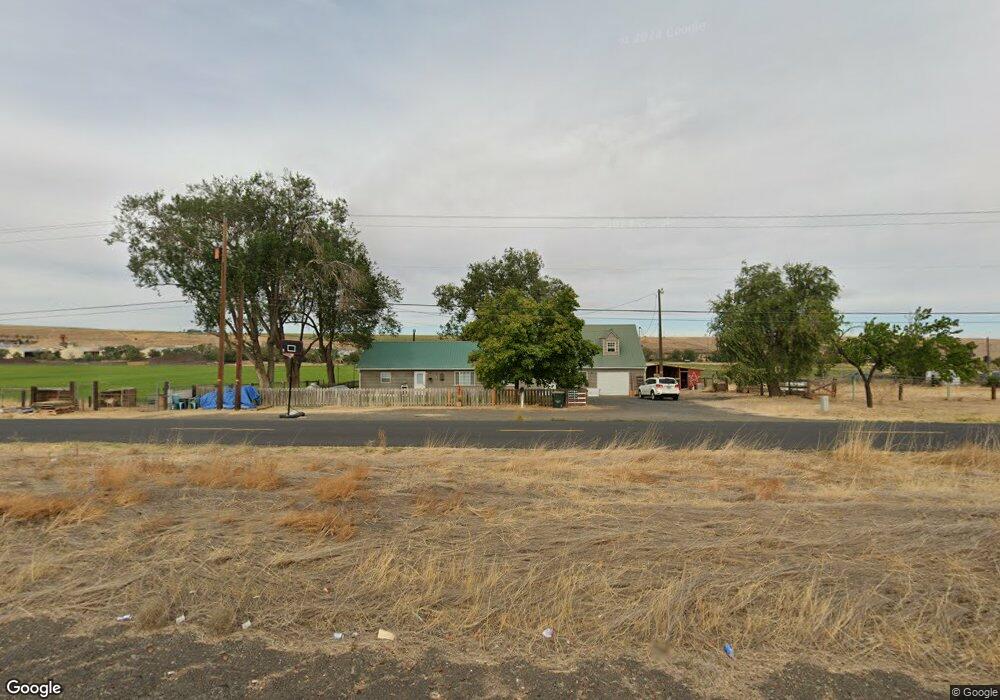
66952 Highway 395 S Pendleton, OR 97801
Estimated Value: $322,334 - $481,000
3
Beds
2
Baths
1,968
Sq Ft
$191/Sq Ft
Est. Value
About This Home
This home is located at 66952 Highway 395 S, Pendleton, OR 97801 and is currently estimated at $376,111, approximately $191 per square foot. 66952 Highway 395 S is a home located in Umatilla County with nearby schools including McKay Creek Elementary School, Sunridge Middle School, and Pendleton High School.
Ownership History
Date
Name
Owned For
Owner Type
Purchase Details
Closed on
Oct 20, 2022
Sold by
Klimek Matt
Bought by
Bertha Klimek 2022 Trust
Current Estimated Value
Purchase Details
Closed on
Aug 29, 2016
Sold by
Bronson Elizabeth L and Bronson Bryson G
Bought by
Klimek Matt
Home Financials for this Owner
Home Financials are based on the most recent Mortgage that was taken out on this home.
Original Mortgage
$185,089
Interest Rate
3.45%
Mortgage Type
New Conventional
Purchase Details
Closed on
Mar 23, 2006
Sold by
Lien Denis L and Lien Tamera L
Bought by
Bronson Elizabeth L and Bronson Bryson G
Home Financials for this Owner
Home Financials are based on the most recent Mortgage that was taken out on this home.
Original Mortgage
$132,776
Interest Rate
6.18%
Mortgage Type
FHA
Create a Home Valuation Report for This Property
The Home Valuation Report is an in-depth analysis detailing your home's value as well as a comparison with similar homes in the area
Home Values in the Area
Average Home Value in this Area
Purchase History
| Date | Buyer | Sale Price | Title Company |
|---|---|---|---|
| Bertha Klimek 2022 Trust | -- | -- | |
| Klimek Matt | $180,000 | Pioneer Title Co | |
| Bronson Elizabeth L | $135,000 | Pioneer Title Co |
Source: Public Records
Mortgage History
| Date | Status | Borrower | Loan Amount |
|---|---|---|---|
| Previous Owner | Klimek Matt | $185,089 | |
| Previous Owner | Bronson Elizabeth L | $132,776 |
Source: Public Records
Tax History Compared to Growth
Tax History
| Year | Tax Paid | Tax Assessment Tax Assessment Total Assessment is a certain percentage of the fair market value that is determined by local assessors to be the total taxable value of land and additions on the property. | Land | Improvement |
|---|---|---|---|---|
| 2024 | $2,364 | $164,550 | $78,550 | $86,000 |
| 2023 | $2,320 | $159,760 | $76,260 | $83,500 |
| 2022 | $2,207 | $155,110 | $0 | $0 |
| 2021 | $2,215 | $150,600 | $71,880 | $78,720 |
| 2020 | $1,990 | $146,220 | $69,790 | $76,430 |
| 2018 | $1,879 | $137,840 | $65,780 | $72,060 |
| 2017 | $1,829 | $133,830 | $63,860 | $69,970 |
| 2016 | $1,645 | $129,940 | $62,000 | $67,940 |
| 2015 | $1,673 | $120,310 | $31,860 | $88,450 |
| 2014 | $1,610 | $120,310 | $31,860 | $88,450 |
Source: Public Records
Map
Nearby Homes
- 70349 Lakeside Rd
- 71539 SW Bridle Dr
- 0000 County 1031 Rd
- 1914 SW 2nd Dr
- 0 SW 2nd St Unit 263926795
- 1703 SW 2nd St
- 1209 SW Zeta Ct
- 1901 SW Runnion Ln
- 1109 SW Nye Ave
- 0 SW Quinney Ln Unit 24414661
- 000 Motanic Rd
- 44786 Mission Rd
- 413 SW Nye Ave
- 27 SE Kirk Place
- 922 S Main St
- 940 SE 9th St
- 1206 SW 24th St
- 941 SE 9th St
- 4207 SW Sheridan Ave
- 606 SW 3rd St