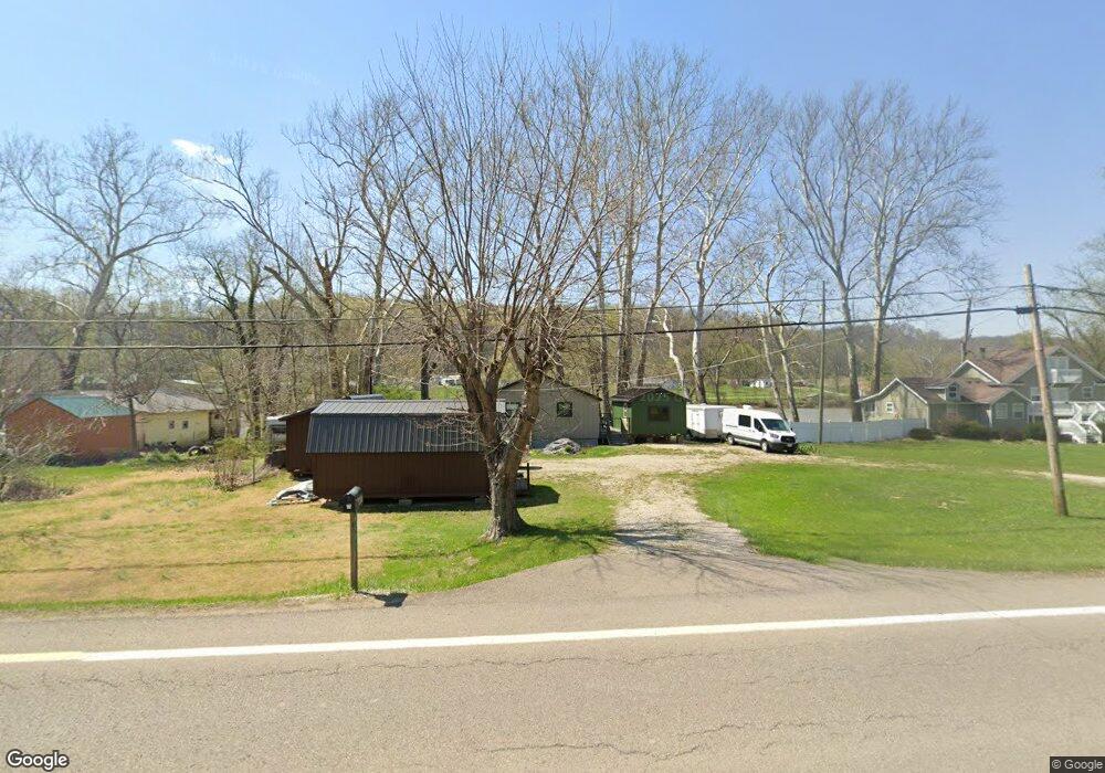
6697 N State Route 60 NW McConnelsville, OH 43756
Estimated Value: $100,000 - $154,000
2
Beds
1
Bath
936
Sq Ft
$133/Sq Ft
Est. Value
About This Home
This home is located at 6697 N State Route 60 NW, McConnelsville, OH 43756 and is currently estimated at $124,341, approximately $132 per square foot. 6697 N State Route 60 NW is a home located in Morgan County with nearby schools including Morgan High School.
Ownership History
Date
Name
Owned For
Owner Type
Purchase Details
Closed on
Jul 27, 2005
Sold by
Sayre Paul L and Sayre Ellen
Bought by
Stine Larry M and Stine Deborah R
Current Estimated Value
Home Financials for this Owner
Home Financials are based on the most recent Mortgage that was taken out on this home.
Original Mortgage
$45,063
Interest Rate
5.74%
Purchase Details
Closed on
Jul 15, 2005
Sold by
Sayre Paul L and Sayre Ellen
Bought by
Stine Larry M and Stine Deborah R
Home Financials for this Owner
Home Financials are based on the most recent Mortgage that was taken out on this home.
Original Mortgage
$45,063
Interest Rate
5.74%
Purchase Details
Closed on
Dec 16, 1998
Sold by
Radcliff Oscar
Bought by
Sayre Paul L and Sayre Ellen
Create a Home Valuation Report for This Property
The Home Valuation Report is an in-depth analysis detailing your home's value as well as a comparison with similar homes in the area
Home Values in the Area
Average Home Value in this Area
Purchase History
| Date | Buyer | Sale Price | Title Company |
|---|---|---|---|
| Stine Larry M | $50,000 | -- | |
| Stine Larry M | -- | Curtis B Nichols, Attorney | |
| Sayre Paul L | $28,000 | -- |
Source: Public Records
Mortgage History
| Date | Status | Borrower | Loan Amount |
|---|---|---|---|
| Previous Owner | Stine Larry M | $45,063 | |
| Previous Owner | Stine Larry M | $45,063 |
Source: Public Records
Tax History Compared to Growth
Tax History
| Year | Tax Paid | Tax Assessment Tax Assessment Total Assessment is a certain percentage of the fair market value that is determined by local assessors to be the total taxable value of land and additions on the property. | Land | Improvement |
|---|---|---|---|---|
| 2024 | $967 | $30,560 | $7,320 | $23,240 |
| 2023 | $696 | $21,740 | $6,240 | $15,500 |
| 2022 | $699 | $21,740 | $6,240 | $15,500 |
| 2021 | $707 | $21,740 | $6,240 | $15,500 |
| 2019 | $643 | $18,910 | $5,430 | $13,480 |
| 2018 | $619 | $18,910 | $5,430 | $13,480 |
| 2017 | $473 | $14,088 | $4,067 | $10,021 |
| 2016 | $475 | $14,088 | $4,067 | $10,021 |
| 2015 | $475 | $14,088 | $4,067 | $10,021 |
| 2014 | $489 | $14,088 | $4,067 | $10,021 |
| 2013 | $487 | $14,088 | $4,067 | $10,021 |
Source: Public Records
Map
Nearby Homes
- 5975 Helaman Ln
- 3630 Leisure Dr NW
- 0 Leisure Dr NW Unit Lot 2
- 0 Leisure Dr NW Unit Lot 4
- Lot #2 Leisure Dr
- 8627 N State Route 376 NW
- 8752 N Rokeby Dr NW
- 95 Sunset Dr
- 774 N Kennebec Ave
- 0 Echo Hill Rd
- 9371 Mautz Dr
- 284 N Kennebec Ave
- 262 N 5th St
- 9911 N River Rd NW
- 160 S Main St
- 10185 Ohio 376
- 10112 S River Rd NW
- 10115 Old River Rd
- 1747 E Airport Rd NE
- 8700 Rural Dale Rd
- 6691 N State Route 60 NW
- 6655 N State Route 60 NW
- 6655 St Rt 60
- 6760 N State Route 60 NW
- 6660 N State Route 60 NW
- 6621 N State Route 60 NW
- 6621 N State Route 60 NW
- 6767 N State Route 60 NW
- 6762 N State Route 60 NW
- 6621 Ohio 60
- 6615 N State Route 60 NW
- 6573 N State Route 60 NW
- 6611 Ohio 60
- 6785 N State Route 60 NW
- 6571 N State Route 60 NW
- 6772 Ohio 60
- 6571 Ohio 60
- 6580 N State Route 60 NW
- 6625 Ohio 669
- 6645 N State Route 669 NW