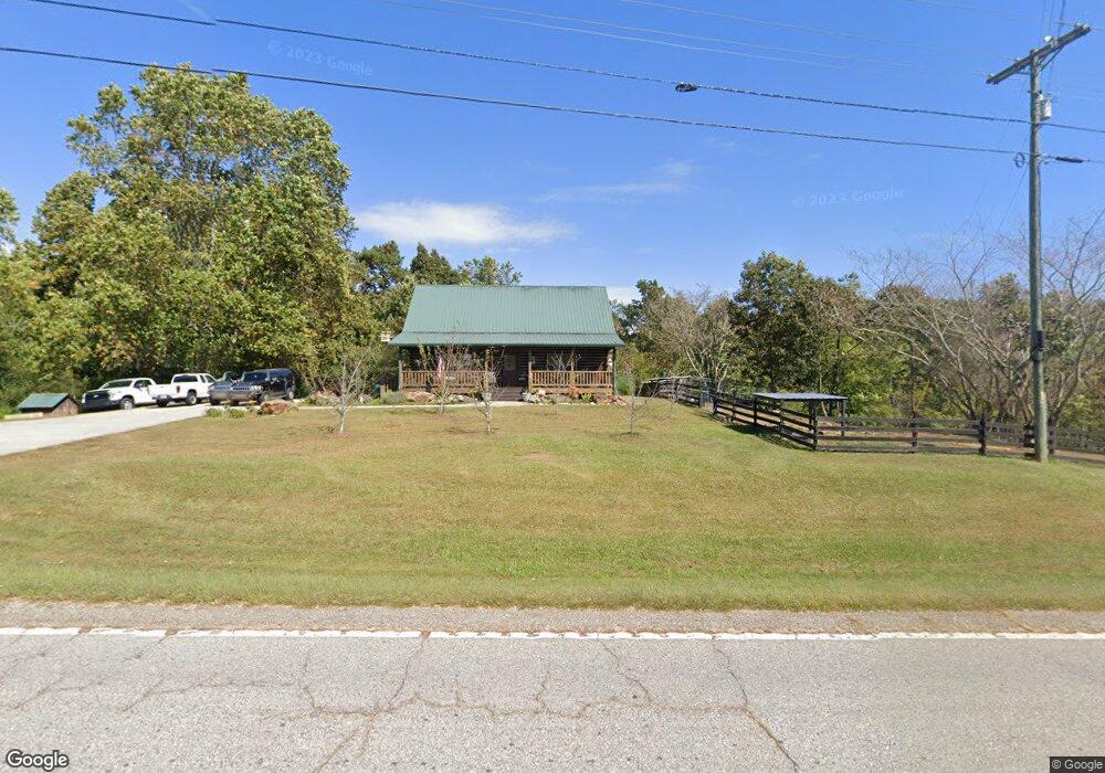
6699 Duncan Bridge Rd Cleveland, GA 30528
Estimated Value: $359,000 - $415,000
3
Beds
2
Baths
1,840
Sq Ft
$212/Sq Ft
Est. Value
About This Home
This home is located at 6699 Duncan Bridge Rd, Cleveland, GA 30528 and is currently estimated at $389,256, approximately $211 per square foot. 6699 Duncan Bridge Rd is a home located in White County with nearby schools including Mount Yonah Elementary School, White County 9th Grade Academy, and White County Middle School.
Ownership History
Date
Name
Owned For
Owner Type
Purchase Details
Closed on
Jun 22, 2016
Sold by
Mcclellon Danny
Bought by
Wooten Toddy
Current Estimated Value
Home Financials for this Owner
Home Financials are based on the most recent Mortgage that was taken out on this home.
Original Mortgage
$152,000
Outstanding Balance
$121,250
Interest Rate
3.64%
Mortgage Type
New Conventional
Estimated Equity
$268,006
Create a Home Valuation Report for This Property
The Home Valuation Report is an in-depth analysis detailing your home's value as well as a comparison with similar homes in the area
Home Values in the Area
Average Home Value in this Area
Purchase History
| Date | Buyer | Sale Price | Title Company |
|---|---|---|---|
| Wooten Toddy | $160,000 | -- |
Source: Public Records
Mortgage History
| Date | Status | Borrower | Loan Amount |
|---|---|---|---|
| Open | Wooten Toddy | $152,000 |
Source: Public Records
Tax History Compared to Growth
Tax History
| Year | Tax Paid | Tax Assessment Tax Assessment Total Assessment is a certain percentage of the fair market value that is determined by local assessors to be the total taxable value of land and additions on the property. | Land | Improvement |
|---|---|---|---|---|
| 2024 | $2,094 | $130,120 | $13,184 | $116,936 |
| 2023 | $1,660 | $112,896 | $11,720 | $101,176 |
| 2022 | $1,970 | $97,800 | $10,256 | $87,544 |
| 2021 | $1,910 | $78,188 | $7,980 | $70,208 |
| 2020 | $1,889 | $71,120 | $7,412 | $63,708 |
| 2019 | $1,895 | $71,120 | $7,412 | $63,708 |
| 2018 | $1,895 | $71,120 | $7,412 | $63,708 |
| 2017 | $1,735 | $64,000 | $7,200 | $56,800 |
| 2016 | $1,751 | $62,564 | $7,412 | $55,152 |
| 2015 | $1,670 | $156,410 | $7,412 | $55,152 |
| 2014 | $1,539 | $143,850 | $0 | $0 |
Source: Public Records
Map
Nearby Homes
- 0 Freeman Rd Unit LOT 4
- 0 Freeman Rd Unit LOT 3 10539998
- 0 Freeman Rd Unit LOT 2 10539989
- 00 Freeman Rd
- 675 Washboard Rd
- LOT 16 Morris Trail
- 0 Douglas Fir Dr Unit 10450306
- 179 Pine Brook Dr
- 294 Cedar Hollow Rd
- 61 Berry Patch Ln
- 811 Merck Rd
- 164 Leatherford Rd
- 95 Cedar Hollow Rd
- 0 Holiness Campground Rd Unit 10609890
- 915 Holiness Campground Rd
- 69 Blue Creek Cove
- 518 Riverside Dr
- 552 LOT 47 Riverside Dr
- 618 Riverside Dr
- 0 Waterside Trail Unit 7556513
- 6699 Duncan Bridge Rd
- 104 Freeborn Ave
- 6658 Duncan Bridge Rd
- 6601 Duncan Bridge Rd
- 0 Freeborn Ave
- 101 Freeborn Ave
- 6170 Duncan Bridge Rd
- 72 Dean Mountain Rd
- 99 Freeborn Ave
- 1018 Gerrells Rd
- 6905 Duncan Bridge Rd
- 54 Dean Mountain Rd
- 130 Dean Mountain Rd
- 32 Dean Mountain Rd
- 0 Dean Mtn Rd Unit 2905731
- 0 Dean Mtn Rd Unit 13.3A 8001060
- 0 Dean Mtn Rd Unit 8476120
- 0 Dean Mtn Rd Unit 8560262
- 0 Ivy Hills Dr Unit 5964167
- 0 Ivy Hills Dr Unit 8324381