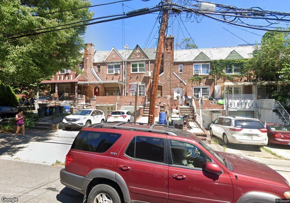
67-05 Burns St Forest Hills, NY 11375
Rego Park NeighborhoodEstimated Value: $1,044,000 - $1,129,000
3
Beds
4
Baths
1,782
Sq Ft
$601/Sq Ft
Est. Value
About This Home
This home is located at 67-05 Burns St, Forest Hills, NY 11375 and is currently estimated at $1,070,663, approximately $600 per square foot. 67-05 Burns St is a home located in Queens County with nearby schools including P.S. 174 - William Sidney Mount, J.H.S. 190 Russell Sage, and Queens Metropolitan High School.
Ownership History
Date
Name
Owned For
Owner Type
Purchase Details
Closed on
Jun 9, 2021
Sold by
Gelfand Fred
Bought by
Lam Jason and Wu Sylvia
Current Estimated Value
Home Financials for this Owner
Home Financials are based on the most recent Mortgage that was taken out on this home.
Original Mortgage
$733,500
Outstanding Balance
$664,093
Interest Rate
2.9%
Mortgage Type
Purchase Money Mortgage
Estimated Equity
$406,570
Create a Home Valuation Report for This Property
The Home Valuation Report is an in-depth analysis detailing your home's value as well as a comparison with similar homes in the area
Home Values in the Area
Average Home Value in this Area
Purchase History
| Date | Buyer | Sale Price | Title Company |
|---|---|---|---|
| Lam Jason | $978,000 | -- |
Source: Public Records
Mortgage History
| Date | Status | Borrower | Loan Amount |
|---|---|---|---|
| Open | Lam Jason | $733,500 |
Source: Public Records
Tax History Compared to Growth
Tax History
| Year | Tax Paid | Tax Assessment Tax Assessment Total Assessment is a certain percentage of the fair market value that is determined by local assessors to be the total taxable value of land and additions on the property. | Land | Improvement |
|---|---|---|---|---|
| 2025 | $10,044 | $50,388 | $8,257 | $42,131 |
| 2024 | $10,044 | $50,008 | $8,982 | $41,026 |
| 2023 | $9,476 | $47,178 | $8,297 | $38,881 |
| 2022 | $6,664 | $62,340 | $11,100 | $51,240 |
| 2021 | $8,837 | $60,420 | $11,100 | $49,320 |
| 2020 | $8,888 | $64,860 | $11,100 | $53,760 |
| 2019 | $8,718 | $64,920 | $11,100 | $53,820 |
| 2018 | $8,014 | $39,315 | $7,014 | $32,301 |
| 2017 | $7,561 | $37,090 | $7,649 | $29,441 |
| 2016 | $6,995 | $37,090 | $7,649 | $29,441 |
| 2015 | $4,220 | $34,992 | $8,888 | $26,104 |
| 2014 | $4,220 | $34,728 | $10,090 | $24,638 |
Source: Public Records
Map
Nearby Homes
- 97-07 67th Ave Unit 1A
- 96-09 67th Ave Unit 1 D
- 67-25 Clyde St Unit 3R
- 67-25 Clyde St Unit 7H
- 67-25 Clyde St Unit 5G
- 67-25 Clyde St Unit 5
- 67-25 Clyde St Unit 2L
- 67-25 Clyde St Unit 1G
- 67-41 Burns St Unit 212
- 67-36 Austin St
- 67-30 Clyde St Unit 3W
- 67-30 Clyde St Unit 5T
- 67-30 Clyde St Unit 3L
- 67-30 Clyde St Unit 5R
- 67-30 Clyde St Unit 6W
- 67-30 Clyde St Unit 5C
- 67-30 Clyde St Unit 7S
- 67-30 Clyde St Unit 3J
- 6730 Clyde St Unit 5T
- 6730 Clyde St Unit 4F
- 67-05 Burns St Unit DUPLEX
- 67-05 Burns St Unit 1
- 67-05 Burns St Unit 2 Flr
- 6701 Burns St
- 67-09 Burns St Unit 2
- 67-03 Burns St Unit 3
- 67-03 Burns St
- 6703 Burns St
- 6705 Burns St
- 6707 Burns St
- 67-07 Burns St
- 97-22 67th Ave
- 6709 Burns St
- 97-07 67th Ave Unit 6H
- 97-07 67th Ave Unit 1G
- 97-07 67th Ave Unit 4G
- 97-07 67th Ave Unit 1C
- 97-07 67th Ave Unit 6F
- 97-07 67th Ave Unit 2D
- 97-07 67th Ave Unit 4H