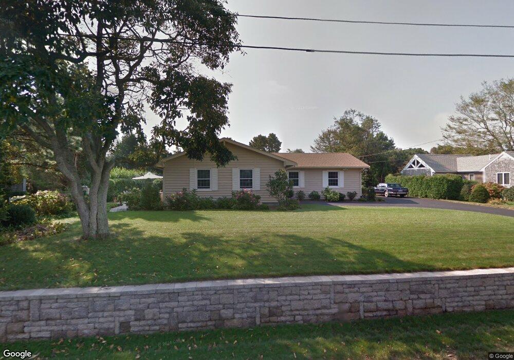
67 Anchorage Rd North Falmouth, MA 02556
Estimated Value: $1,013,972 - $1,409,000
3
Beds
2
Baths
1,332
Sq Ft
$857/Sq Ft
Est. Value
About This Home
This home is located at 67 Anchorage Rd, North Falmouth, MA 02556 and is currently estimated at $1,141,743, approximately $857 per square foot. 67 Anchorage Rd is a home located in Barnstable County with nearby schools including North Falmouth Elementary School, Morse Pond School, and Lawrence School.
Ownership History
Date
Name
Owned For
Owner Type
Purchase Details
Closed on
Oct 11, 2024
Sold by
Morini Mario and Morini Sandra
Bought by
Morini Rt and Morini
Current Estimated Value
Purchase Details
Closed on
Sep 27, 1979
Bought by
Morini Mario and Morini Sandra
Create a Home Valuation Report for This Property
The Home Valuation Report is an in-depth analysis detailing your home's value as well as a comparison with similar homes in the area
Home Values in the Area
Average Home Value in this Area
Purchase History
| Date | Buyer | Sale Price | Title Company |
|---|---|---|---|
| Morini Rt | -- | None Available | |
| Morini Rt | -- | None Available | |
| Morini Mario | $22,000 | -- |
Source: Public Records
Mortgage History
| Date | Status | Borrower | Loan Amount |
|---|---|---|---|
| Previous Owner | Morini Mario | $40,000 |
Source: Public Records
Tax History Compared to Growth
Tax History
| Year | Tax Paid | Tax Assessment Tax Assessment Total Assessment is a certain percentage of the fair market value that is determined by local assessors to be the total taxable value of land and additions on the property. | Land | Improvement |
|---|---|---|---|---|
| 2025 | $5,715 | $973,600 | $633,400 | $340,200 |
| 2024 | $5,386 | $857,600 | $548,500 | $309,100 |
| 2023 | $4,869 | $703,600 | $437,200 | $266,400 |
| 2022 | $5,369 | $666,900 | $437,500 | $229,400 |
| 2021 | $4,823 | $567,400 | $374,600 | $192,800 |
| 2020 | $4,581 | $533,300 | $340,500 | $192,800 |
| 2019 | $4,478 | $523,100 | $340,500 | $182,600 |
| 2018 | $4,404 | $512,100 | $340,500 | $171,600 |
| 2017 | $4,310 | $505,300 | $340,500 | $164,800 |
| 2016 | $4,225 | $504,800 | $340,500 | $164,300 |
| 2015 | $4,134 | $504,800 | $340,500 | $164,300 |
| 2014 | $4,080 | $500,600 | $340,600 | $160,000 |
Source: Public Records
Map
Nearby Homes
- 63 Anchorage Rd
- 73 Anchorage Rd
- 303 Wild Harbor Rd
- 1 Seascape Ln
- 309 Wild Harbor Rd
- 299 Wild Harbor Rd
- 57 Anchorage Rd
- 2 Seascape Ln
- 79 Anchorage Rd
- 315 Wild Harbor Rd
- 54 Anchorage Rd
- 9 Waterside Dr
- 9 Waterside Dr Unit 3
- 9 Waterside Dr Unit 2
- 78 Anchorage Rd
- 78 Anchorage Rd
- 306 Wild Harbor Rd
- 310 Wild Harbor Rd
- 208 Waterside Dr
- 300 Wild Harbor Rd