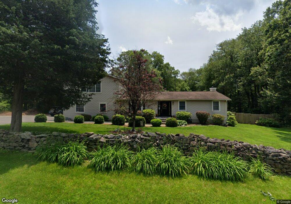
67 Armstrong Rd Shelton, CT 06484
Estimated Value: $506,000 - $646,000
4
Beds
3
Baths
1,952
Sq Ft
$295/Sq Ft
Est. Value
About This Home
This home is located at 67 Armstrong Rd, Shelton, CT 06484 and is currently estimated at $576,770, approximately $295 per square foot. 67 Armstrong Rd is a home located in Fairfield County with nearby schools including Perry Hill School, Shelton Intermediate School, and Shelton High School.
Ownership History
Date
Name
Owned For
Owner Type
Purchase Details
Closed on
Nov 22, 2002
Sold by
Pereira Jorge and Pereira Jennifer M
Bought by
Bishop Bryan J and Bishop Michelle
Current Estimated Value
Purchase Details
Closed on
Apr 18, 1997
Sold by
Spinelli Roger and Sorrentino Virginia
Bought by
Pereira Jorge A and Pereira Jennifer M
Purchase Details
Closed on
Jan 31, 1996
Sold by
United Illuminating Co
Bought by
Spinelli Roger
Create a Home Valuation Report for This Property
The Home Valuation Report is an in-depth analysis detailing your home's value as well as a comparison with similar homes in the area
Home Values in the Area
Average Home Value in this Area
Purchase History
| Date | Buyer | Sale Price | Title Company |
|---|---|---|---|
| Bishop Bryan J | $285,000 | -- | |
| Bishop Bryan J | $285,000 | -- | |
| Pereira Jorge A | $133,400 | -- | |
| Pereira Jorge A | $133,400 | -- | |
| Spinelli Roger | $16,000 | -- |
Source: Public Records
Mortgage History
| Date | Status | Borrower | Loan Amount |
|---|---|---|---|
| Open | Spinelli Roger | $196,000 | |
| Closed | Spinelli Roger | $248,100 |
Source: Public Records
Tax History Compared to Growth
Tax History
| Year | Tax Paid | Tax Assessment Tax Assessment Total Assessment is a certain percentage of the fair market value that is determined by local assessors to be the total taxable value of land and additions on the property. | Land | Improvement |
|---|---|---|---|---|
| 2025 | $5,408 | $287,350 | $110,810 | $176,540 |
| 2024 | $5,511 | $287,350 | $110,810 | $176,540 |
| 2023 | $5,020 | $287,350 | $110,810 | $176,540 |
| 2022 | $5,020 | $287,350 | $110,810 | $176,540 |
| 2021 | $12,829 | $190,470 | $75,810 | $114,660 |
| 2020 | $12,463 | $190,470 | $75,810 | $114,660 |
| 2019 | $12,547 | $190,470 | $75,810 | $114,660 |
| 2017 | $4,230 | $190,470 | $75,810 | $114,660 |
| 2015 | $4,423 | $198,250 | $81,410 | $116,840 |
| 2014 | $4,423 | $198,250 | $81,410 | $116,840 |
Source: Public Records
Map
Nearby Homes
- 44 Hemlock Dr
- 14 Horseshoe Dr
- 12 Horseshoe Dr
- 6 Daybreak Ln
- 79 River Bend Rd Unit B
- 33 Happy Hollow Cir Unit C
- 37 Heather Ridge
- 350 Maple Oak Dr
- 543 North Trail Unit B
- 664 Osage Ln Unit A
- 522 Iroquois Ln Unit B
- 815 James Farm Rd
- 82 Kanungum Trail
- 516 Opa Ln Unit A
- 736 Quinnipiac Ln Unit B
- 766 Nyack Ln Unit B
- 35 Mustang Dr
- 170 Oronoque Ln Unit 85
- 170 Oronoque Ln Unit 95
- 35 Saginaw Trail
- 57 Armstrong Rd
- 56 Armstrong Rd
- 61 Armstrong Rd
- 54 Armstrong Rd
- 53 Armstrong Rd
- 5 James Farm Rd
- 82 Armstrong Rd
- 51 Armstrong Rd
- 51A Armstrong Rd
- 50 Armstrong Rd
- 6 James Farm Rd
- 2 James Farm Rd
- 48 Armstrong Rd
- 1 James Farm Rd
- 47 Armstrong Rd
- 62 Armstrong Rd Unit C
- 62 Armstrong Rd Unit D
- 62 Armstrong Rd Unit B
- 62 Armstrong Rd Unit A
- 62 Armstrong Rd