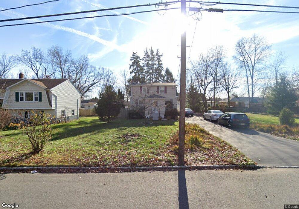
67 Ball Ave Parsippany, NJ 07054
Estimated Value: $534,000 - $644,000
--
Bed
--
Bath
1,598
Sq Ft
$364/Sq Ft
Est. Value
About This Home
This home is located at 67 Ball Ave, Parsippany, NJ 07054 and is currently estimated at $581,196, approximately $363 per square foot. 67 Ball Ave is a home located in Morris County with nearby schools including Lake Hiawatha Elementary School, Central Middle School, and Parsippany High School.
Ownership History
Date
Name
Owned For
Owner Type
Purchase Details
Closed on
Aug 15, 1997
Sold by
Cairelli Vincent A and Cairelli Rosalia
Bought by
Maglione Edward and Maglione Beth
Current Estimated Value
Home Financials for this Owner
Home Financials are based on the most recent Mortgage that was taken out on this home.
Original Mortgage
$105,000
Outstanding Balance
$15,490
Interest Rate
7.36%
Estimated Equity
$565,706
Create a Home Valuation Report for This Property
The Home Valuation Report is an in-depth analysis detailing your home's value as well as a comparison with similar homes in the area
Home Values in the Area
Average Home Value in this Area
Purchase History
| Date | Buyer | Sale Price | Title Company |
|---|---|---|---|
| Maglione Edward | $150,000 | -- |
Source: Public Records
Mortgage History
| Date | Status | Borrower | Loan Amount |
|---|---|---|---|
| Open | Maglione Edward | $105,000 |
Source: Public Records
Tax History Compared to Growth
Tax History
| Year | Tax Paid | Tax Assessment Tax Assessment Total Assessment is a certain percentage of the fair market value that is determined by local assessors to be the total taxable value of land and additions on the property. | Land | Improvement |
|---|---|---|---|---|
| 2025 | $8,744 | $248,000 | $168,200 | $79,800 |
| 2024 | $8,581 | $248,000 | $168,200 | $79,800 |
| 2023 | $8,581 | $248,000 | $168,200 | $79,800 |
| 2022 | $8,005 | $248,000 | $168,200 | $79,800 |
| 2021 | $8,005 | $248,000 | $168,200 | $79,800 |
| 2020 | $7,834 | $248,000 | $168,200 | $79,800 |
| 2019 | $7,616 | $248,000 | $168,200 | $79,800 |
| 2018 | $7,447 | $248,000 | $168,200 | $79,800 |
| 2017 | $7,271 | $248,000 | $168,200 | $79,800 |
| 2016 | $7,140 | $248,000 | $168,200 | $79,800 |
| 2015 | $6,959 | $248,000 | $168,200 | $79,800 |
| 2014 | $6,862 | $248,000 | $168,200 | $79,800 |
Source: Public Records
Map
Nearby Homes
- 159 Ball Ave
- 123 Cardigan Ct Unit 123
- 53 Gordon Cir Unit 53
- 5 Twin Oaks Ct
- 3 Woodhaven Rd
- 20 Sandra Dr
- 20 Druid Hill Dr
- 2 Colony Ct
- 209 Raymound Blvd
- 21 Nokomis Ave
- 188 Edwards Rd
- 2 Buckingham Rd
- 17 Madison Ave
- 255 Knoll Rd
- 30 Madison Ave
- 4 New Hampshire Ct
- 12 Cherokee Ave
- 122 Lake Shore Dr
- 42 Minnehaha Blvd
- 31.5 Roosevelt Ave