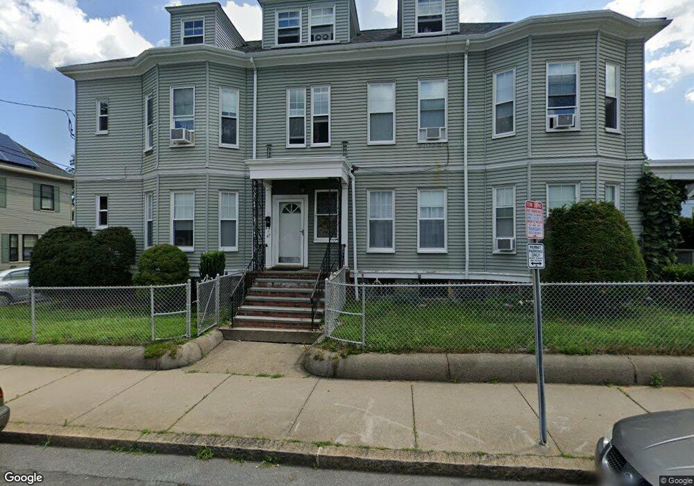
67 Benton Rd Somerville, MA 02143
Spring Hill NeighborhoodEstimated Value: $1,536,000 - $2,020,000
5
Beds
7
Baths
5,514
Sq Ft
$337/Sq Ft
Est. Value
About This Home
This home is located at 67 Benton Rd, Somerville, MA 02143 and is currently estimated at $1,859,671, approximately $337 per square foot. 67 Benton Rd is a home located in Middlesex County with nearby schools including Somerville High School and Saint Theresa School.
Ownership History
Date
Name
Owned For
Owner Type
Purchase Details
Closed on
Dec 3, 2012
Sold by
Int Cpg
Bought by
Cicalis Charles J
Current Estimated Value
Home Financials for this Owner
Home Financials are based on the most recent Mortgage that was taken out on this home.
Original Mortgage
$575,000
Outstanding Balance
$391,373
Interest Rate
3%
Mortgage Type
Adjustable Rate Mortgage/ARM
Estimated Equity
$1,468,298
Purchase Details
Closed on
May 4, 2011
Sold by
Grillone Caesar P and Grillone Donna
Bought by
Somerville City Of
Create a Home Valuation Report for This Property
The Home Valuation Report is an in-depth analysis detailing your home's value as well as a comparison with similar homes in the area
Home Values in the Area
Average Home Value in this Area
Purchase History
| Date | Buyer | Sale Price | Title Company |
|---|---|---|---|
| Cicalis Charles J | $850,000 | -- | |
| Somerville City Of | -- | -- |
Source: Public Records
Mortgage History
| Date | Status | Borrower | Loan Amount |
|---|---|---|---|
| Open | Cicalis Charles J | $575,000 |
Source: Public Records
Tax History
| Year | Tax Paid | Tax Assessment Tax Assessment Total Assessment is a certain percentage of the fair market value that is determined by local assessors to be the total taxable value of land and additions on the property. | Land | Improvement |
|---|---|---|---|---|
| 2025 | $18,441 | $1,690,300 | $550,300 | $1,140,000 |
| 2024 | $17,094 | $1,624,900 | $550,300 | $1,074,600 |
| 2023 | $16,608 | $1,606,200 | $550,300 | $1,055,900 |
| 2022 | $15,513 | $1,523,900 | $524,100 | $999,800 |
| 2021 | $14,512 | $1,424,100 | $499,100 | $925,000 |
| 2020 | $13,659 | $1,353,700 | $480,000 | $873,700 |
| 2019 | $13,137 | $1,220,900 | $417,300 | $803,600 |
| 2018 | $11,454 | $1,012,700 | $379,400 | $633,300 |
| 2017 | $10,960 | $939,200 | $357,900 | $581,300 |
| 2016 | $11,114 | $887,000 | $327,400 | $559,600 |
| 2015 | $11,107 | $880,800 | $325,600 | $555,200 |
Source: Public Records
Map
Nearby Homes
- 111 Belmont St
- 80 Hudson St
- 89 Central St
- 1-3 Woodbine St
- 7 Woodbine St
- 15 Spring Hill Terrace
- 161 Lowell St Unit 1
- 144 Highland Ave Unit 1
- 221 Highland Ave Unit 1
- 227 Highland Ave Unit 2
- 227 Highland Ave Unit 3
- 227 Highland Ave Unit 1
- 148 Lowell St Unit 3
- 125 Lowell St Unit 603
- 125 Lowell St Unit 3B
- 125 Lowell St Unit 202
- 125 Lowell St Unit 701
- 125 Lowell St Unit 5C
- 8 Albion Terrace
- 17 Monmouth St
- 67 Benton Rd Unit 1
- 67 Benton Rd
- 67 Benton Rd Unit 3
- 67 Benton Rd Unit 2
- 173 Highland Ave
- 173 Highland Ave
- 173 Highland Ave Unit 1
- 169 Highland Ave
- 75 Benton Rd
- 79 Benton Rd
- 79 Benton Rd Unit 2
- 79 Benton Rd Unit 1
- 79 Benton Rd Unit 3
- 78 Benton Rd Unit 2
- 78 Benton Rd
- 78 Benton Rd Unit 3
- 174 Highland Ave
- 174 Highland Ave Unit 3
- 170 Highland Ave Unit 3
- 170 Highland Ave Unit 2
Your Personal Tour Guide
Ask me questions while you tour the home.