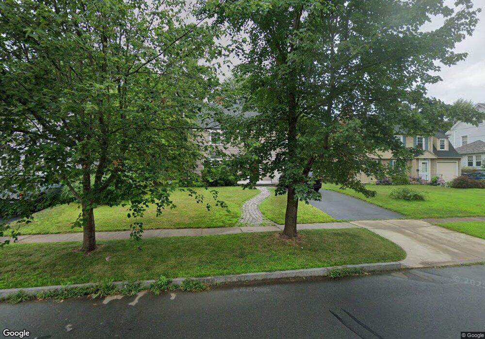
67 Beverly Rd West Hartford, CT 06119
Estimated Value: $441,000 - $519,000
4
Beds
2
Baths
1,786
Sq Ft
$269/Sq Ft
Est. Value
About This Home
This home is located at 67 Beverly Rd, West Hartford, CT 06119 and is currently estimated at $480,174, approximately $268 per square foot. 67 Beverly Rd is a home located in Hartford County with nearby schools including Whiting Lane School, Adams Elementary School, and King Philip Middle School.
Ownership History
Date
Name
Owned For
Owner Type
Purchase Details
Closed on
Jan 20, 2006
Sold by
Barnard Earl C and Barnard Lucinda B
Bought by
Dipoi Alfredo and Dopoi Andrea N
Current Estimated Value
Home Financials for this Owner
Home Financials are based on the most recent Mortgage that was taken out on this home.
Original Mortgage
$213,200
Interest Rate
6.33%
Purchase Details
Closed on
Apr 30, 1999
Sold by
Williams Paul L
Bought by
Barnard Earl C and Barnard Lucinda B
Purchase Details
Closed on
Sep 30, 1996
Sold by
Cohen Eric
Bought by
Williams Paul
Purchase Details
Closed on
Mar 6, 1992
Sold by
Giovannucci Susan
Bought by
Cohen Eric
Purchase Details
Closed on
Jan 31, 1989
Sold by
Schmidt Richard
Bought by
Giovannucci John P
Create a Home Valuation Report for This Property
The Home Valuation Report is an in-depth analysis detailing your home's value as well as a comparison with similar homes in the area
Home Values in the Area
Average Home Value in this Area
Purchase History
| Date | Buyer | Sale Price | Title Company |
|---|---|---|---|
| Dipoi Alfredo | $266,500 | -- | |
| Barnard Earl C | $135,900 | -- | |
| Williams Paul | $142,000 | -- | |
| Cohen Eric | $185,000 | -- | |
| Giovannucci John P | $203,000 | -- |
Source: Public Records
Mortgage History
| Date | Status | Borrower | Loan Amount |
|---|---|---|---|
| Open | Giovannucci John P | $224,000 | |
| Closed | Giovannucci John P | $22,500 | |
| Closed | Giovannucci John P | $213,200 |
Source: Public Records
Tax History Compared to Growth
Tax History
| Year | Tax Paid | Tax Assessment Tax Assessment Total Assessment is a certain percentage of the fair market value that is determined by local assessors to be the total taxable value of land and additions on the property. | Land | Improvement |
|---|---|---|---|---|
| 2025 | $9,796 | $218,750 | $91,490 | $127,260 |
| 2024 | $9,264 | $218,750 | $91,490 | $127,260 |
| 2023 | $8,951 | $218,750 | $91,490 | $127,260 |
| 2022 | $8,682 | $213,430 | $91,490 | $121,940 |
| 2021 | $8,332 | $196,420 | $91,490 | $104,930 |
| 2020 | $7,760 | $185,640 | $86,590 | $99,050 |
| 2019 | $7,760 | $185,640 | $86,590 | $99,050 |
| 2018 | $7,611 | $185,640 | $86,590 | $99,050 |
| 2017 | $7,619 | $185,640 | $86,590 | $99,050 |
| 2016 | $7,404 | $187,390 | $86,870 | $100,520 |
| 2015 | $7,093 | $185,150 | $86,870 | $98,280 |
| 2014 | $6,919 | $185,150 | $86,870 | $98,280 |
Source: Public Records
Map
Nearby Homes
- 39 Fairlawn St
- 16 Lockwood Terrace
- 478 Prospect Ave
- 518 Prospect Ave
- 11 Crosby St
- 16 Lilley Rd
- 48 Walkley Rd
- 102 Oakwood Ave Unit B5
- 102 Rowe Ave
- 90-92 Rowe Ave
- 89 Price Blvd
- 54 James St Unit 56
- 237 Fern St Unit 314
- 126 Heath St
- 2 Rodney St
- 59 Milton St
- 45 Warrenton Ave Unit 47
- 136 Kane St Unit B10
- 869 Farmington Ave Unit 305
- 82 S Whitney St