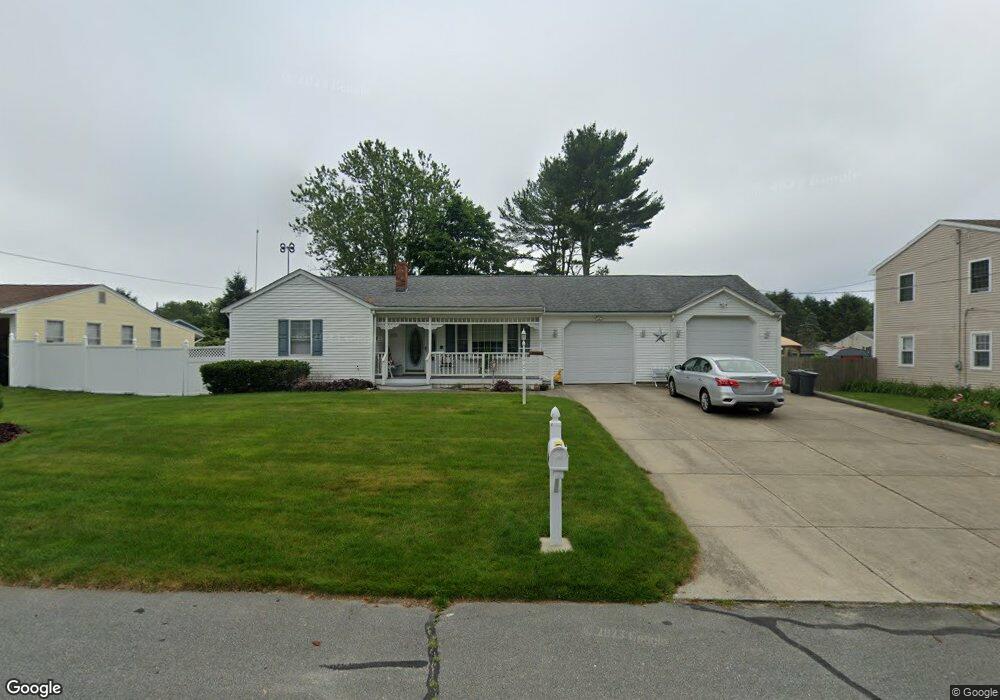
67 Blaze Rd New Bedford, MA 02745
Estimated Value: $492,000 - $568,000
2
Beds
2
Baths
1,703
Sq Ft
$307/Sq Ft
Est. Value
About This Home
This home is located at 67 Blaze Rd, New Bedford, MA 02745 and is currently estimated at $522,172, approximately $306 per square foot. 67 Blaze Rd is a home located in Bristol County with nearby schools including Casimir Pulaski Elementary School, Normandin Middle School, and New Bedford High School.
Create a Home Valuation Report for This Property
The Home Valuation Report is an in-depth analysis detailing your home's value as well as a comparison with similar homes in the area
Home Values in the Area
Average Home Value in this Area
Tax History Compared to Growth
Tax History
| Year | Tax Paid | Tax Assessment Tax Assessment Total Assessment is a certain percentage of the fair market value that is determined by local assessors to be the total taxable value of land and additions on the property. | Land | Improvement |
|---|---|---|---|---|
| 2025 | $6,178 | $546,200 | $132,600 | $413,600 |
| 2024 | $6,390 | $532,500 | $144,200 | $388,300 |
| 2023 | $6,501 | $454,900 | $116,000 | $338,900 |
| 2022 | $6,033 | $388,200 | $107,700 | $280,500 |
| 2021 | $5,912 | $379,200 | $107,700 | $271,500 |
| 2020 | $5,711 | $353,400 | $107,700 | $245,700 |
| 2019 | $5,572 | $338,300 | $103,600 | $234,700 |
| 2018 | $5,122 | $308,000 | $103,600 | $204,400 |
| 2017 | $4,822 | $288,900 | $101,500 | $187,400 |
| 2016 | $4,492 | $272,400 | $99,400 | $173,000 |
| 2015 | $4,168 | $265,000 | $95,300 | $169,700 |
| 2014 | $4,002 | $264,000 | $93,200 | $170,800 |
Source: Public Records
Map
Nearby Homes
- 64 Blaze Rd
- 34 Poplar Rd
- 210 Heritage Dr
- 145 Heritage Dr
- 1063 Westgate St
- 1069 Cherokee St
- 16 Swallow St
- 13 Luscomb Ln
- SS Charbonneau Ln
- 26 Blueberry Dr
- 62 Longview Rd
- ES Phillips Rd
- 1573 Braley Rd Unit 39
- 2 Woodland Rd
- 8 Holly Tree Ln
- 1599 Braley Rd Unit 68
- 700 Pine Hill Dr
- 3 Elaine Ave
- 888 Hillcrest Rd
- 4597 Acushnet Ave