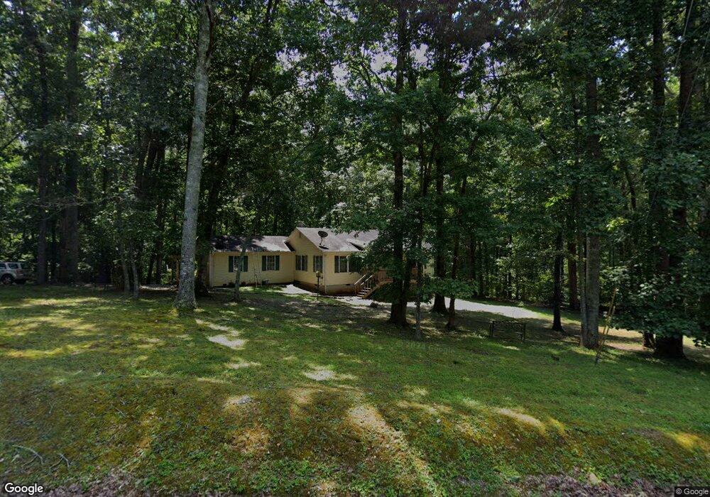
67 Bob Rd Talking Rock, GA 30175
Estimated Value: $298,141 - $362,000
Studio
2
Baths
1,680
Sq Ft
$199/Sq Ft
Est. Value
About This Home
This home is located at 67 Bob Rd, Talking Rock, GA 30175 and is currently estimated at $334,285, approximately $198 per square foot. 67 Bob Rd is a home located in Pickens County with nearby schools including Hill City Elementary School, Pickens County Middle School, and Pickens County High School.
Ownership History
Date
Name
Owned For
Owner Type
Purchase Details
Closed on
Nov 3, 2008
Sold by
Kerr James M
Bought by
Arrendale Susan Michelle
Current Estimated Value
Home Financials for this Owner
Home Financials are based on the most recent Mortgage that was taken out on this home.
Original Mortgage
$137,795
Interest Rate
6.11%
Mortgage Type
New Conventional
Purchase Details
Closed on
Mar 27, 1998
Bought by
Kerr James M
Purchase Details
Closed on
Feb 3, 1994
Bought by
Benton Vernon E and Benton Barbara
Purchase Details
Closed on
Jan 1, 1986
Bought by
Wigington Properties Inc
Create a Home Valuation Report for This Property
The Home Valuation Report is an in-depth analysis detailing your home's value as well as a comparison with similar homes in the area
Home Values in the Area
Average Home Value in this Area
Purchase History
| Date | Buyer | Sale Price | Title Company |
|---|---|---|---|
| Arrendale Susan Michelle | $135,000 | -- | |
| Kerr James M | $18,500 | -- | |
| Benton Vernon E | $11,600 | -- | |
| Wigington Properties Inc | -- | -- |
Source: Public Records
Mortgage History
| Date | Status | Borrower | Loan Amount |
|---|---|---|---|
| Closed | Arrendale Susan Michelle | $137,795 |
Source: Public Records
Tax History
| Year | Tax Paid | Tax Assessment Tax Assessment Total Assessment is a certain percentage of the fair market value that is determined by local assessors to be the total taxable value of land and additions on the property. | Land | Improvement |
|---|---|---|---|---|
| 2025 | $904 | $110,640 | $14,448 | $96,192 |
| 2024 | $988 | $54,899 | $7,224 | $47,675 |
| 2023 | $1,015 | $54,899 | $7,224 | $47,675 |
| 2022 | $1,015 | $54,899 | $7,224 | $47,675 |
| 2021 | $1,087 | $54,899 | $7,224 | $47,675 |
| 2020 | $1,120 | $54,899 | $7,224 | $47,675 |
| 2019 | $1,146 | $54,899 | $7,224 | $47,675 |
| 2018 | $1,156 | $54,899 | $7,224 | $47,675 |
| 2017 | $1,175 | $54,899 | $7,224 | $47,675 |
| 2016 | $1,194 | $54,899 | $7,224 | $47,675 |
| 2015 | $1,166 | $54,899 | $7,224 | $47,675 |
| 2014 | $1,169 | $54,899 | $7,224 | $47,675 |
| 2013 | -- | $54,899 | $7,224 | $47,675 |
Source: Public Records
Map
Nearby Homes
- 200 Willow Ln
- 110 Jerusalem Farms Dr
- 310 Comet Ln
- 126 Jerusalem Farms Dr
- 0 Carver Mill Rd Unit 7670227
- 0 Carver Mill Rd Unit 7670211
- 11 Bradley Rd
- 6472 Highway 53
- 1497 Harris Rd
- Lot 1 Thompson Ln
- 369 Thompson Ln
- 373 Thompson Ln
- 69 Blakes Ln
- 681 Mullinax Rd
- 0 Swan Bridge Rd Unit 7701634
- 0 Swan Bridge Rd Unit 10670001
- 711 Carver Mill Rd
- 701 Tatum Rd
- 616 Gibson Trail
- 755 Harris Rd
- 5 Ruth Rd
- 50 Bob Rd
- 55 Chuck Rd
- 51 Chuck Rd
- 124 Thomason Farm Dr
- 15 Chuck Rd
- 124 Thomason Farms Dr
- 104 Thomason Farm Dr
- 107 Bob Rd
- 80 Thomason Farm Dr
- 50 Thomason Farm Dr
- 11 Chuck Rd
- 141 Chuck Rd
- 14 Thomason Farm Dr
- 103 Thomason Farm Dr
- 117 Ruth Rd
- 134 Thomason Farm Dr
- 79 Thomason Farm Dr
- 49 Thomason Farm Dr
- 133 Thomason Farm Dr
Your Personal Tour Guide
Ask me questions while you tour the home.