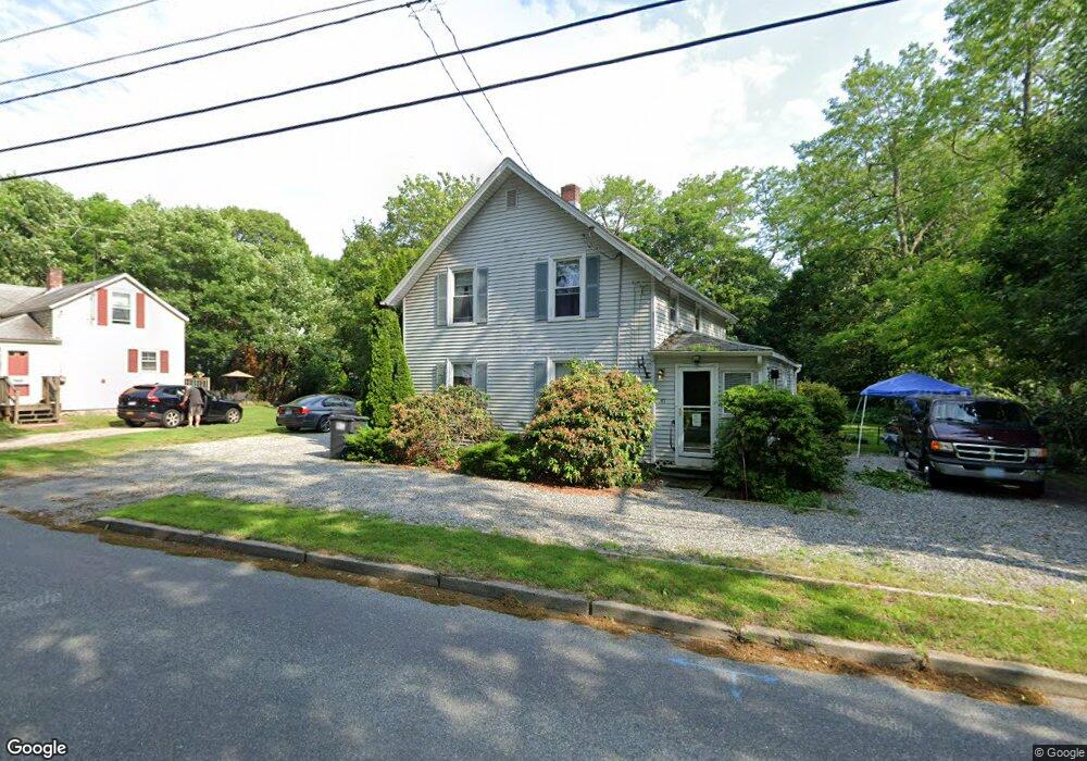
67 Broad Rock Rd Wakefield, RI 02879
Estimated Value: $568,000 - $735,000
3
Beds
3
Baths
2,190
Sq Ft
$282/Sq Ft
Est. Value
About This Home
This home is located at 67 Broad Rock Rd, Wakefield, RI 02879 and is currently estimated at $617,144, approximately $281 per square foot. 67 Broad Rock Rd is a home located in Washington County with nearby schools including South Kingstown High School, Monsignor Matthew Clarke Catholic Regional School, and Bradley School-South.
Ownership History
Date
Name
Owned For
Owner Type
Purchase Details
Closed on
Jun 29, 1993
Sold by
Mccusker Robin D
Bought by
Porter Daniel L and Porter Karin G
Current Estimated Value
Create a Home Valuation Report for This Property
The Home Valuation Report is an in-depth analysis detailing your home's value as well as a comparison with similar homes in the area
Home Values in the Area
Average Home Value in this Area
Purchase History
| Date | Buyer | Sale Price | Title Company |
|---|---|---|---|
| Porter Daniel L | $62,000 | -- |
Source: Public Records
Mortgage History
| Date | Status | Borrower | Loan Amount |
|---|---|---|---|
| Open | Porter Daniel L | $206,000 | |
| Closed | Porter Daniel L | $173,000 | |
| Closed | Porter Daniel L | $24,000 | |
| Closed | Porter Daniel L | $130,000 |
Source: Public Records
Tax History Compared to Growth
Tax History
| Year | Tax Paid | Tax Assessment Tax Assessment Total Assessment is a certain percentage of the fair market value that is determined by local assessors to be the total taxable value of land and additions on the property. | Land | Improvement |
|---|---|---|---|---|
| 2025 | $4,002 | $447,700 | $168,000 | $279,700 |
| 2024 | $4,216 | $381,500 | $129,200 | $252,300 |
| 2023 | $4,216 | $381,500 | $129,200 | $252,300 |
| 2022 | $4,177 | $381,500 | $129,200 | $252,300 |
| 2021 | $4,653 | $322,000 | $112,400 | $209,600 |
| 2020 | $4,653 | $322,000 | $112,400 | $209,600 |
| 2019 | $4,653 | $322,000 | $112,400 | $209,600 |
| 2018 | $4,350 | $277,400 | $104,500 | $172,900 |
| 2017 | $4,247 | $277,400 | $104,500 | $172,900 |
| 2016 | $4,186 | $277,400 | $104,500 | $172,900 |
| 2015 | $4,225 | $272,200 | $102,200 | $170,000 |
| 2014 | $4,214 | $272,200 | $102,200 | $170,000 |
Source: Public Records
Map
Nearby Homes
- 70 Broad Rock Rd
- 40 Amos St
- 3 Larkin St
- 156 River St Unit B
- 128 Camden Ct
- 73 Camden Ct
- 10 Hendricks St
- 45 Cherry Ln Unit C
- 37 Columbia St
- 128 North Rd
- 39 Hazard Ave
- 48 Stone Bridge Dr
- 38 Eisenhower Place
- 98 Meadow Ave
- 228 Rodman St
- 31 Winter St
- 128 Rodman St
- 53 Rocky Brook Way
- 918 Saugatucket Rd
- 17 Celestial Heights Dr
- 77 Broad Rock Rd
- 61 Broad Rock Rd
- 53 Broad Rock Rd
- 83 Broad Rock Rd
- 68 Old Mountain Rd
- 49 Broad Rock Rd
- 54 Broad Rock Rd
- 60 Broad Rock Rd
- 24 Jessica Ln
- 48 Broad Rock Rd
- 46 Old Mountain Rd
- 41 Broad Rock Rd
- 20 Jessica Ln
- 95 Broad Rock Rd
- 40 Broad Rock Rd
- 80 Old Mountain Rd
- 35 Broad Rock Rd
- 36 Old Mountain Rd
- 0 Old Mountain Rd
- 34 Broad Rock Rd