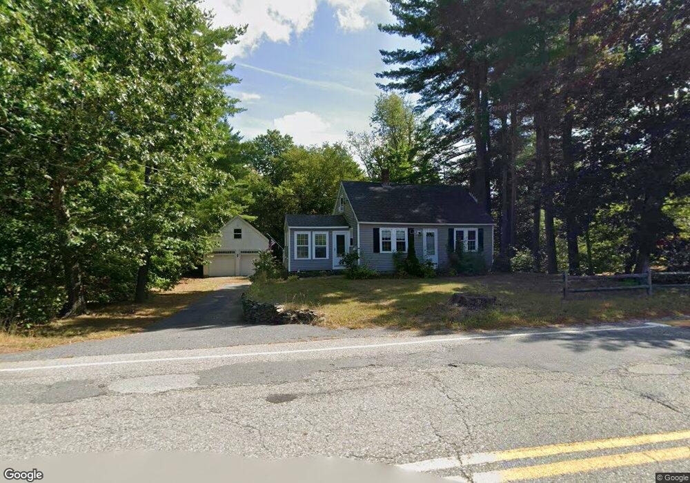
67 Brookline St Unit A Townsend, MA 01469
Estimated Value: $425,000 - $508,000
3
Beds
1
Bath
1,827
Sq Ft
$256/Sq Ft
Est. Value
About This Home
This home is located at 67 Brookline St Unit A, Townsend, MA 01469 and is currently estimated at $467,577, approximately $255 per square foot. 67 Brookline St Unit A is a home located in Middlesex County with nearby schools including North Middlesex Regional High School.
Ownership History
Date
Name
Owned For
Owner Type
Purchase Details
Closed on
Mar 31, 1998
Sold by
Gnerre Pamela H
Bought by
Cain Philip J and Cain Margaret
Current Estimated Value
Purchase Details
Closed on
Feb 18, 1994
Sold by
Sheldon Stephen P and Sheldon Gwenna L
Bought by
Gnerre Pamela H
Create a Home Valuation Report for This Property
The Home Valuation Report is an in-depth analysis detailing your home's value as well as a comparison with similar homes in the area
Home Values in the Area
Average Home Value in this Area
Purchase History
| Date | Buyer | Sale Price | Title Company |
|---|---|---|---|
| Cain Philip J | $135,000 | -- | |
| Cain Philip J | $135,000 | -- | |
| Gnerre Pamela H | $132,500 | -- | |
| Gnerre Pamela H | $132,500 | -- |
Source: Public Records
Mortgage History
| Date | Status | Borrower | Loan Amount |
|---|---|---|---|
| Open | Gnerre Pamela H | $209,400 | |
| Closed | Gnerre Pamela H | $17,460 |
Source: Public Records
Tax History
| Year | Tax Paid | Tax Assessment Tax Assessment Total Assessment is a certain percentage of the fair market value that is determined by local assessors to be the total taxable value of land and additions on the property. | Land | Improvement |
|---|---|---|---|---|
| 2025 | $5,886 | $405,400 | $91,000 | $314,400 |
| 2024 | $5,768 | $400,300 | $91,000 | $309,300 |
| 2023 | $5,283 | $346,200 | $82,800 | $263,400 |
| 2022 | $5,371 | $305,000 | $72,000 | $233,000 |
| 2021 | $5,479 | $298,900 | $71,200 | $227,700 |
| 2020 | $5,251 | $269,000 | $63,300 | $205,700 |
| 2019 | $5,167 | $267,300 | $63,300 | $204,000 |
| 2018 | $4,907 | $242,200 | $63,300 | $178,900 |
| 2017 | $4,628 | $235,300 | $67,500 | $167,800 |
| 2016 | $4,243 | $214,300 | $67,500 | $146,800 |
| 2015 | $4,216 | $220,600 | $70,300 | $150,300 |
| 2014 | $3,830 | $195,700 | $63,300 | $132,400 |
Source: Public Records
Map
Nearby Homes
- 5 Turnpike Rd Unit 213 TWO
- 0 Brookline St
- 1 Depot Street Extension Unit 5
- 1 Depot Street Extension Unit 2
- 1 Depot Street Extension Unit 4
- 16 Worcester Rd
- 359 Main St
- 144 Main St
- 9 Kaneohe Ct
- 15 N End Rd
- 364 Townsend Hill Rd
- 102 Wheeler St
- 198 N End Rd
- 86 W Elm Lunenburg Rd Blood Rd
- 18 Beech St
- 1235 Townsend Rd
- 64 Maplewood Dr
- 0 Tyler Rd Unit 72560808
- 00 Tyler Rd
- 2 Blueberry Hill Rd
- 67 Brookline St
- 67A Brookline St
- 69 Brookline St
- 8 Meadow Rd
- 65 Brookline St
- 10 Meadow Rd
- 63 Brookline St
- 12 Meadow Rd
- 14 Meadow Rd
- 3 Meadow Rd
- 3 Meadow Rd
- 3 Meadow Rd
- 75 Brookline St
- 74 Brookline St
- 27 Meadow Rd Unit 27
- 27 Meadow Rd Unit 22-8
- 59 Brookline St
- 12A Meadow Rd
- 32 Meadow Rd Unit 32
- 16 Meadow Rd
Your Personal Tour Guide
Ask me questions while you tour the home.