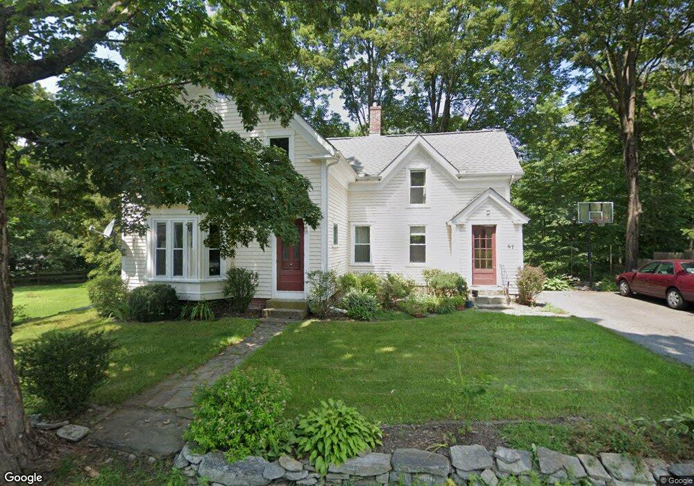
67 Carter St Berlin, MA 01503
Estimated Value: $648,574
3
Beds
1
Bath
1,548
Sq Ft
$419/Sq Ft
Est. Value
About This Home
This home is located at 67 Carter St, Berlin, MA 01503 and is currently estimated at $648,574, approximately $418 per square foot. 67 Carter St is a home located in Worcester County with nearby schools including Tahanto Regional High School, First Steps Children's Center, and Darnell School For Educational & Behavioral Service.
Ownership History
Date
Name
Owned For
Owner Type
Purchase Details
Closed on
Feb 20, 1997
Sold by
Donnelly Warren P and Donnelly Ilee W
Bought by
Regan Sean
Current Estimated Value
Purchase Details
Closed on
Dec 10, 1990
Sold by
Kent Louise P
Bought by
Donnelly Warren P
Create a Home Valuation Report for This Property
The Home Valuation Report is an in-depth analysis detailing your home's value as well as a comparison with similar homes in the area
Home Values in the Area
Average Home Value in this Area
Purchase History
| Date | Buyer | Sale Price | Title Company |
|---|---|---|---|
| Regan Sean | $147,000 | -- | |
| Regan Sean | $147,000 | -- | |
| Donnelly Warren P | $65,000 | -- | |
| Donnelly Warren P | $65,000 | -- |
Source: Public Records
Mortgage History
| Date | Status | Borrower | Loan Amount |
|---|---|---|---|
| Open | Donnelly Warren P | $112,000 | |
| Closed | Donnelly Warren P | $50,000 |
Source: Public Records
Tax History Compared to Growth
Tax History
| Year | Tax Paid | Tax Assessment Tax Assessment Total Assessment is a certain percentage of the fair market value that is determined by local assessors to be the total taxable value of land and additions on the property. | Land | Improvement |
|---|---|---|---|---|
| 2025 | $0 | $437,600 | $215,600 | $222,000 |
| 2024 | -- | $437,600 | $215,600 | $222,000 |
| 2023 | $0 | $393,500 | $187,400 | $206,100 |
| 2022 | $0 | $320,800 | $156,100 | $164,700 |
| 2021 | $0 | $313,400 | $148,700 | $164,700 |
| 2020 | $4,203 | $302,300 | $137,600 | $164,700 |
| 2019 | $4,026 | $289,600 | $137,600 | $152,000 |
| 2018 | $0 | $265,400 | $121,900 | $143,500 |
| 2017 | $0 | $265,400 | $121,900 | $143,500 |
| 2016 | -- | $219,800 | $110,800 | $109,000 |
| 2015 | -- | $206,700 | $105,400 | $101,300 |
| 2014 | -- | $206,700 | $105,400 | $101,300 |
Source: Public Records
Map
Nearby Homes
- 46 West St
- 68 Pleasant St
- 3 Randall Rd
- 52 Village Ct
- 98 Coburn Rd
- 152 Coburn Rd
- 11 Estabrook Ln
- 16 Priest Rd
- 24 Priest Rd
- 339 Old Central St
- 11 Bigelow Dr Unit 11
- 508 Linwood Ct
- 165 Lyman Rd
- 611 Devenwood Way Unit 611
- 343 Newton St
- 915 Crestwood Ln
- 414 Fernwood Ln Unit 414
- 445 Berlin St Unit 1
- 843 Ledgewood Way
- 72 Brook Ln