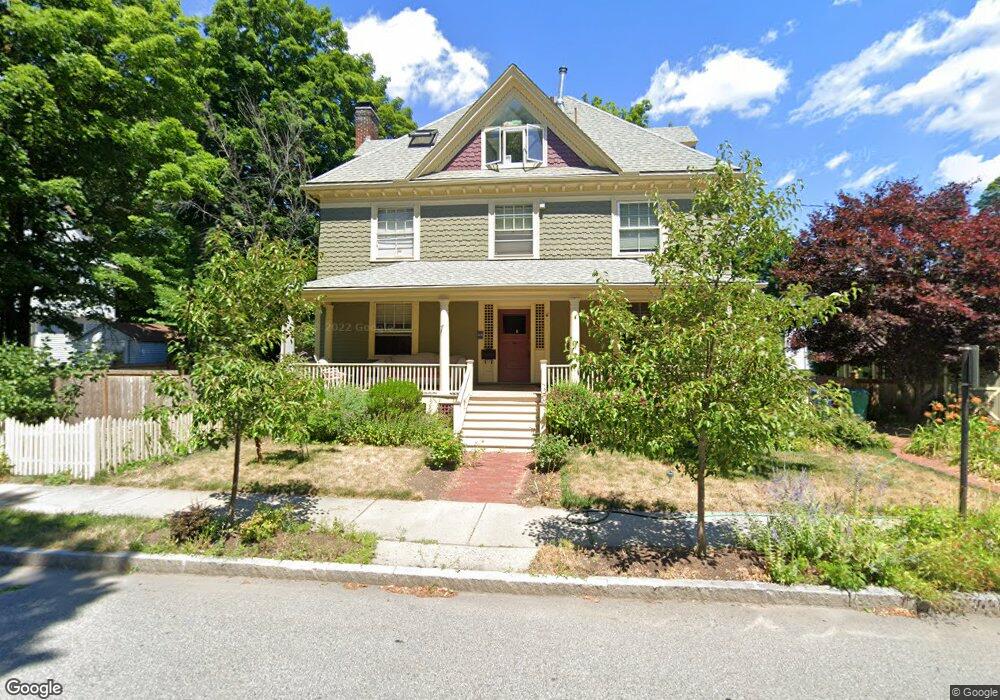
67 Clyde St Newtonville, MA 02460
Newtonville NeighborhoodEstimated Value: $1,770,568 - $2,175,000
5
Beds
3
Baths
3,323
Sq Ft
$602/Sq Ft
Est. Value
About This Home
This home is located at 67 Clyde St, Newtonville, MA 02460 and is currently estimated at $1,999,892, approximately $601 per square foot. 67 Clyde St is a home located in Middlesex County with nearby schools including Cabot Elementary School, F.A. Day Middle School, and Newton North High School.
Ownership History
Date
Name
Owned For
Owner Type
Purchase Details
Closed on
Jul 14, 2005
Sold by
Howe Edith C and Howe Edward H
Bought by
Minsky Henry and Minsky Milan
Current Estimated Value
Home Financials for this Owner
Home Financials are based on the most recent Mortgage that was taken out on this home.
Original Mortgage
$515,000
Outstanding Balance
$269,010
Interest Rate
5.67%
Mortgage Type
Purchase Money Mortgage
Estimated Equity
$1,730,882
Create a Home Valuation Report for This Property
The Home Valuation Report is an in-depth analysis detailing your home's value as well as a comparison with similar homes in the area
Home Values in the Area
Average Home Value in this Area
Purchase History
| Date | Buyer | Sale Price | Title Company |
|---|---|---|---|
| Minsky Henry | $970,000 | -- |
Source: Public Records
Mortgage History
| Date | Status | Borrower | Loan Amount |
|---|---|---|---|
| Open | Minsky Henry | $515,000 |
Source: Public Records
Tax History Compared to Growth
Tax History
| Year | Tax Paid | Tax Assessment Tax Assessment Total Assessment is a certain percentage of the fair market value that is determined by local assessors to be the total taxable value of land and additions on the property. | Land | Improvement |
|---|---|---|---|---|
| 2025 | $14,872 | $1,517,600 | $992,700 | $524,900 |
| 2024 | $14,380 | $1,473,400 | $963,800 | $509,600 |
| 2023 | $13,728 | $1,348,500 | $734,000 | $614,500 |
| 2022 | $13,135 | $1,248,600 | $679,600 | $569,000 |
| 2021 | $12,674 | $1,177,900 | $641,100 | $536,800 |
| 2020 | $12,297 | $1,177,900 | $641,100 | $536,800 |
| 2019 | $11,951 | $1,143,600 | $622,400 | $521,200 |
| 2018 | $11,488 | $1,061,700 | $562,400 | $499,300 |
| 2017 | $11,138 | $1,001,600 | $530,600 | $471,000 |
| 2016 | $10,653 | $936,100 | $495,900 | $440,200 |
Source: Public Records
Map
Nearby Homes
- 300 Cabot St
- 22 Walnut Place Unit 1
- 10 Washington Park
- 10 Washington Park Unit 2
- 10 Washington Park Unit 1
- 110 Harvard St Unit A
- 127-129 Withington Rd Unit 1
- 44 Blake St Unit 2
- 48 Harvard St Unit 1
- 911 Washington St
- 935 Washington St Unit 8
- 957 Washington St Unit 1
- 34 Morton Rd
- 3 Cedar St
- 123-125 Mount Vernon St
- 123 Mount Vernon St Unit 2
- 61 Lakeview Ave
- 887 Commonwealth Ave
- 168 Walnut St
- 43 Walker St
- 35 Pulsifer St
- 72 Clyde St Unit 1
- 66 Clyde St
- 70 Clyde St Unit 72
- 70 Clyde St Unit 2
- 60 Clyde St
- 31 Pulsifer St
- 454 Walnut St
- 454 Walnut St Unit 454
- 454 Walnut St Unit house
- 49 Clyde St
- 7 Gibson Rd
- 52 Clyde St
- 27 Pulsifer St
- 424 Walnut St
- 15 Trowbridge Ave
- 462 Walnut St
- 462 Walnut St
- 462 Walnut St Unit 2B
- 462 Walnut St Unit 1B