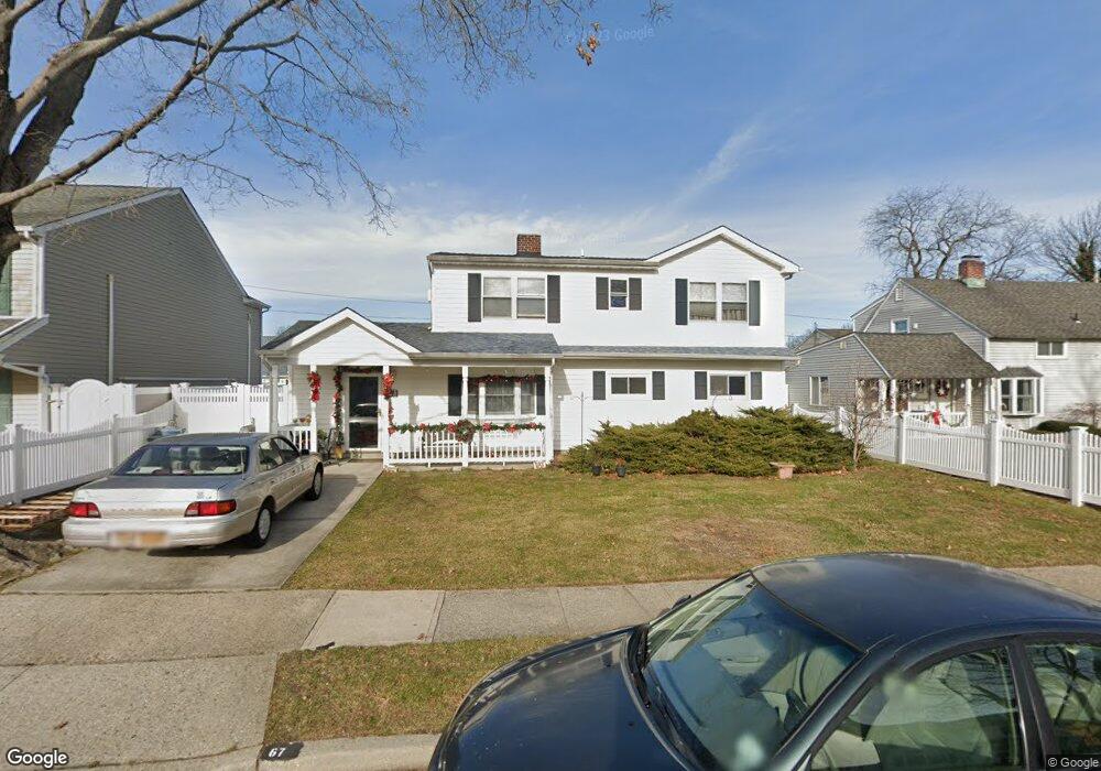
67 Constellation Rd Levittown, NY 11756
Estimated Value: $628,408 - $770,000
Studio
2
Baths
1,788
Sq Ft
$391/Sq Ft
Est. Value
About This Home
This home is located at 67 Constellation Rd, Levittown, NY 11756 and is currently estimated at $699,204, approximately $391 per square foot. 67 Constellation Rd is a home located in Nassau County with nearby schools including J Fred Sparke Elementary School, Michael F. Stokes Elementary School, and Island Trees Middle School.
Create a Home Valuation Report for This Property
The Home Valuation Report is an in-depth analysis detailing your home's value as well as a comparison with similar homes in the area
Home Values in the Area
Average Home Value in this Area
Tax History
| Year | Tax Paid | Tax Assessment Tax Assessment Total Assessment is a certain percentage of the fair market value that is determined by local assessors to be the total taxable value of land and additions on the property. | Land | Improvement |
|---|---|---|---|---|
| 2025 | $10,479 | $460 | $213 | $247 |
| 2024 | $3,930 | $460 | $213 | $247 |
Source: Public Records
Map
Nearby Homes
- 101 Constellation Rd
- 48 Bloomingdale Rd
- 56 Jester Ln
- 12 Meridian Rd
- 33 Prentice Rd
- 140 Jerusalem Ave
- 94 Mallard Rd
- 68 Coppersmith Rd
- 38 Heather Ln
- 143 Blacksmith Rd E
- 7 Lowland Rd
- 2 Jupiter Ln
- 35 Lowland Rd
- 111 Blacksmith Rd E
- 17 Windmill Ln
- 70 Corncrib Ln
- 51 Shepherd Ln
- 59 Corncrib Ln
- 43 Farmedge Rd
- 41 Coachman Ln
- 65 Constellation Rd
- 71 Constellation Rd
- 72 Polaris Dr
- 68 Polaris Dr
- 63 Constellation Rd
- 73 Constellation Rd
- 74 Polaris Dr
- 66 Polaris Dr
- 78 Polaris Dr
- 68 Constellation Rd
- 72 Constellation Rd
- 59 Constellation Rd
- 77 Constellation Rd
- 74 Constellation Rd
- 62 Constellation Rd
- 80 Polaris Dr
- 60 Constellation Rd
- 60 Polaris Dr
- 80 Constellation Rd
- 84 Polaris Dr