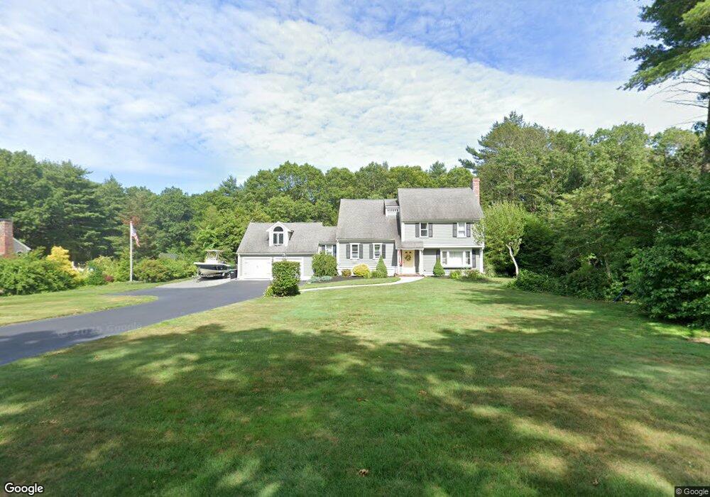
67 Cranberry Dr Halifax, MA 02338
Estimated Value: $694,000 - $752,000
4
Beds
3
Baths
2,356
Sq Ft
$306/Sq Ft
Est. Value
About This Home
This home is located at 67 Cranberry Dr, Halifax, MA 02338 and is currently estimated at $720,782, approximately $305 per square foot. 67 Cranberry Dr is a home located in Plymouth County with nearby schools including Silver Lake Regional High School, Halifax Elementary School, and Silver Lake Regional Middle School.
Ownership History
Date
Name
Owned For
Owner Type
Purchase Details
Closed on
Dec 17, 2013
Sold by
Benner Bruce P and Benner Maryann N
Bought by
Benner Theodore J and Benner Tara M
Current Estimated Value
Home Financials for this Owner
Home Financials are based on the most recent Mortgage that was taken out on this home.
Original Mortgage
$330,000
Outstanding Balance
$245,970
Interest Rate
4.14%
Mortgage Type
New Conventional
Estimated Equity
$474,812
Purchase Details
Closed on
Sep 1, 1989
Sold by
Hms Paul F Williams
Bought by
Benner Bruce P
Home Financials for this Owner
Home Financials are based on the most recent Mortgage that was taken out on this home.
Original Mortgage
$138,000
Interest Rate
9.7%
Mortgage Type
Purchase Money Mortgage
Create a Home Valuation Report for This Property
The Home Valuation Report is an in-depth analysis detailing your home's value as well as a comparison with similar homes in the area
Home Values in the Area
Average Home Value in this Area
Purchase History
| Date | Buyer | Sale Price | Title Company |
|---|---|---|---|
| Benner Theodore J | $330,000 | -- | |
| Benner Bruce P | $238,000 | -- |
Source: Public Records
Mortgage History
| Date | Status | Borrower | Loan Amount |
|---|---|---|---|
| Open | Benner Theodore J | $330,000 | |
| Previous Owner | Benner Bruce P | $250,000 | |
| Previous Owner | Benner Bruce P | $50,000 | |
| Previous Owner | Benner Bruce P | $65,000 | |
| Previous Owner | Benner Bruce P | $138,000 |
Source: Public Records
Tax History Compared to Growth
Tax History
| Year | Tax Paid | Tax Assessment Tax Assessment Total Assessment is a certain percentage of the fair market value that is determined by local assessors to be the total taxable value of land and additions on the property. | Land | Improvement |
|---|---|---|---|---|
| 2025 | $9,131 | $639,900 | $200,300 | $439,600 |
| 2024 | $8,870 | $616,000 | $192,600 | $423,400 |
| 2023 | $8,557 | $575,100 | $187,000 | $388,100 |
| 2022 | $8,255 | $515,600 | $167,000 | $348,600 |
| 2021 | $8,032 | $461,900 | $160,500 | $301,400 |
| 2020 | $7,661 | $439,300 | $160,500 | $278,800 |
| 2019 | $7,519 | $430,400 | $155,900 | $274,500 |
| 2018 | $7,247 | $410,600 | $147,100 | $263,500 |
| 2017 | $7,251 | $391,300 | $147,100 | $244,200 |
| 2016 | $7,294 | $378,900 | $137,500 | $241,400 |
| 2015 | $7,104 | $374,100 | $137,500 | $236,600 |
Source: Public Records
Map
Nearby Homes
- 780 Old Plymouth St
- 0 Morse St Unit 73387111
- 118 Lingan St
- 8 10th Ave
- 148 Lot 1a Elm St
- 40 3rd Ave
- 139 Fairway Dr
- 2 Lydon Ln Unit A1
- 343 Monponsett St
- 266 Monponsett St Unit 1105
- 266 Monponsett St Unit 202
- 266 Monponsett St Unit 307
- 266 Monponsett St Unit 1208
- 266 Monponsett St Unit 103
- 266 Monponsett St Unit 309
- 266 Monponsett St Unit 305
- 266 Monponsett St Unit 1101
- 266 Monponsett St Unit 302
- 266 Monponsett St Unit 303
- 266 Monponsett St Unit 1210
- 75 Cranberry Dr
- 61 Cranberry Dr
- 53 Cranberry Dr
- 58 Cranberry Dr
- 78 Stoney Weir Rd
- 86 Stoney Weir Rd
- 70 Stoney Weir Rd
- 76 Cranberry Dr
- 52 Cranberry Dr
- 81 Cranberry Dr
- 47 Cranberry Dr
- 46 Cranberry Dr
- 84 Cranberry Dr
- 94 Stoney Weir Rd
- 178 Cranberry Dr
- 186 Cranberry Dr
- 54 Stoney Weir Rd
- 102 Stoney Weir Rd
- 39 Cranberry Dr
- 172 Cranberry Dr