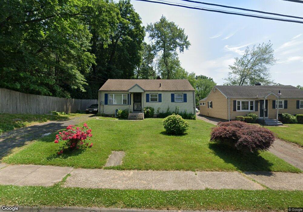
67 Dart St Hartford, CT 06106
Behind the Rocks NeighborhoodEstimated Value: $223,449 - $267,000
3
Beds
1
Bath
900
Sq Ft
$270/Sq Ft
Est. Value
About This Home
This home is located at 67 Dart St, Hartford, CT 06106 and is currently estimated at $243,362, approximately $270 per square foot. 67 Dart St is a home located in Hartford County with nearby schools including Environmental Sciences Magnet School at Mary Hooker, Kennelly School, and Parkville Community School.
Ownership History
Date
Name
Owned For
Owner Type
Purchase Details
Closed on
Aug 11, 2015
Sold by
Ortega Yolanda
Bought by
Villegas Nelson
Current Estimated Value
Purchase Details
Closed on
Nov 16, 1988
Sold by
Caballero Victor M
Bought by
Villegas Nelson
Home Financials for this Owner
Home Financials are based on the most recent Mortgage that was taken out on this home.
Original Mortgage
$98,300
Interest Rate
10.28%
Create a Home Valuation Report for This Property
The Home Valuation Report is an in-depth analysis detailing your home's value as well as a comparison with similar homes in the area
Home Values in the Area
Average Home Value in this Area
Purchase History
| Date | Buyer | Sale Price | Title Company |
|---|---|---|---|
| Villegas Nelson | -- | -- | |
| Villegas Nelson | $103,000 | -- |
Source: Public Records
Mortgage History
| Date | Status | Borrower | Loan Amount |
|---|---|---|---|
| Previous Owner | Villegas Nelson | $98,300 |
Source: Public Records
Tax History Compared to Growth
Tax History
| Year | Tax Paid | Tax Assessment Tax Assessment Total Assessment is a certain percentage of the fair market value that is determined by local assessors to be the total taxable value of land and additions on the property. | Land | Improvement |
|---|---|---|---|---|
| 2025 | $4,024 | $58,359 | $6,652 | $51,707 |
| 2024 | $4,024 | $58,359 | $6,652 | $51,707 |
| 2023 | $4,024 | $58,359 | $6,652 | $51,707 |
| 2022 | $4,024 | $58,359 | $6,652 | $51,707 |
| 2021 | $3,146 | $42,350 | $9,205 | $33,145 |
| 2020 | $3,146 | $42,350 | $9,205 | $33,145 |
| 2019 | $3,146 | $42,350 | $9,205 | $33,145 |
| 2018 | $3,040 | $40,922 | $8,894 | $32,028 |
| 2016 | $3,034 | $40,842 | $8,471 | $32,371 |
| 2015 | $2,890 | $38,902 | $8,069 | $30,833 |
| 2014 | $2,819 | $37,951 | $7,871 | $30,080 |
Source: Public Records
Map
Nearby Homes
- 89 Sequin St
- 111 Coolidge St
- 647 Broadview Terrace
- 634 New Britain Ave
- 120 Nilan St
- 474 Hillside Ave
- 40 Forster St
- 729 Broadview Terrace
- 389 Hillside Ave
- 25 Cumberland St
- 263 Linnmoore St
- 343 Hillside Ave
- 17 Giddings St
- 61 Wilbur St
- 185 Grandview Terrace Unit 187
- 148 Princeton St
- 11 Nepaug St
- 218 Grandview Terrace Unit 220
- 147 Newbury St Unit 149
- 49 Newbury St Unit 51
- 71 Dart St
- 75 Dart St
- 588 Broadview Terrace
- 592 Broadview Terrace
- 584 Broadview Terrace
- 79 Dart St
- 596 Broadview Terrace
- 214 Chandler St
- 600 Broadview Terrace
- 580 Broadview Terrace
- 604 Broadview Terrace
- 76 Dart St
- 72 Dart St
- 68 Dart St
- 64 Dart St
- 608 Broadview Terrace
- 60 Dart St
- 87 Dart St
- 222 Chandler St
- 56 Dart St