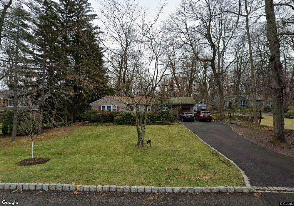
67 Debbie Place Berkeley Heights, NJ 07922
Estimated Value: $837,848 - $1,125,000
--
Bed
--
Bath
2,161
Sq Ft
$458/Sq Ft
Est. Value
About This Home
This home is located at 67 Debbie Place, Berkeley Heights, NJ 07922 and is currently estimated at $990,462, approximately $458 per square foot. 67 Debbie Place is a home located in Union County with nearby schools including Columbia Middle School, Governor Livingston High School, and The Academy of Our Lady of Peace.
Ownership History
Date
Name
Owned For
Owner Type
Purchase Details
Closed on
Jan 23, 2024
Sold by
Bails Douglas
Bought by
Bails Pauline
Current Estimated Value
Purchase Details
Closed on
Aug 27, 1998
Sold by
Miller Andrew and Miller Cathy
Bought by
Bails Douglas
Home Financials for this Owner
Home Financials are based on the most recent Mortgage that was taken out on this home.
Original Mortgage
$239,200
Interest Rate
6.75%
Create a Home Valuation Report for This Property
The Home Valuation Report is an in-depth analysis detailing your home's value as well as a comparison with similar homes in the area
Home Values in the Area
Average Home Value in this Area
Purchase History
| Date | Buyer | Sale Price | Title Company |
|---|---|---|---|
| Bails Pauline | -- | None Listed On Document | |
| Bails Pauline | -- | None Listed On Document | |
| Bails Douglas | $299,000 | Stewart Title Guaranty Compa |
Source: Public Records
Mortgage History
| Date | Status | Borrower | Loan Amount |
|---|---|---|---|
| Previous Owner | Bails Douglas | $239,200 |
Source: Public Records
Tax History Compared to Growth
Tax History
| Year | Tax Paid | Tax Assessment Tax Assessment Total Assessment is a certain percentage of the fair market value that is determined by local assessors to be the total taxable value of land and additions on the property. | Land | Improvement |
|---|---|---|---|---|
| 2025 | $12,938 | $301,800 | $184,000 | $117,800 |
| 2024 | $12,751 | $301,800 | $184,000 | $117,800 |
| 2023 | $12,751 | $301,800 | $184,000 | $117,800 |
| 2022 | $12,673 | $301,800 | $184,000 | $117,800 |
| 2021 | $12,603 | $301,800 | $184,000 | $117,800 |
| 2020 | $12,670 | $301,800 | $184,000 | $117,800 |
| 2019 | $12,606 | $301,800 | $184,000 | $117,800 |
| 2018 | $12,344 | $301,800 | $184,000 | $117,800 |
| 2017 | $12,193 | $301,800 | $184,000 | $117,800 |
| 2016 | $13,542 | $341,200 | $184,000 | $157,200 |
| 2015 | $13,467 | $341,200 | $184,000 | $157,200 |
| 2014 | $13,054 | $339,600 | $184,000 | $155,600 |
Source: Public Records
Map
Nearby Homes
- 25 Oechsner Ct
- 33 Bristol Ct
- 5 Berkeley Square Unit 5
- 86 Orion Rd
- 62 Springholm Dr Unit 62
- 78 Twin Falls Rd
- 45 Wilson Dr
- 41 Meadowview Ln
- 28 Peacock Ln Unit 28
- 132 Fairview Ave
- 34 Meadowview Ln
- 56 Valley Rd
- 30 Robbins Ave
- 19 Guenevere Way Ondo
- 78 Spring Ridge Dr
- 37 Oak Ridge Rd
- 12 Park Edge
- 126 Snyder Ave
- 93 Park Edge Unit 3H
- 27 Angela Way Unit 727
- 77 Debbie Place
- 57 Debbie Place
- 68 Debbie Place
- 60 Debbie Place
- 49 Debbie Place
- 78 Debbie Place
- 56 Debbie Place
- 23 Barnstable Rd
- 19 Barnstable Rd
- 46 Debbie Place
- 22 Barnstable Rd
- 81 Hillside Ave
- 89 Hillside Ave
- 75 Hillside Ave
- 57 Martins Ln
- 33 Debbie Place
- 53 Martins Ln
- 73 Hillside Ave
- 95 Hillside Ave
- 63 Martins Ln