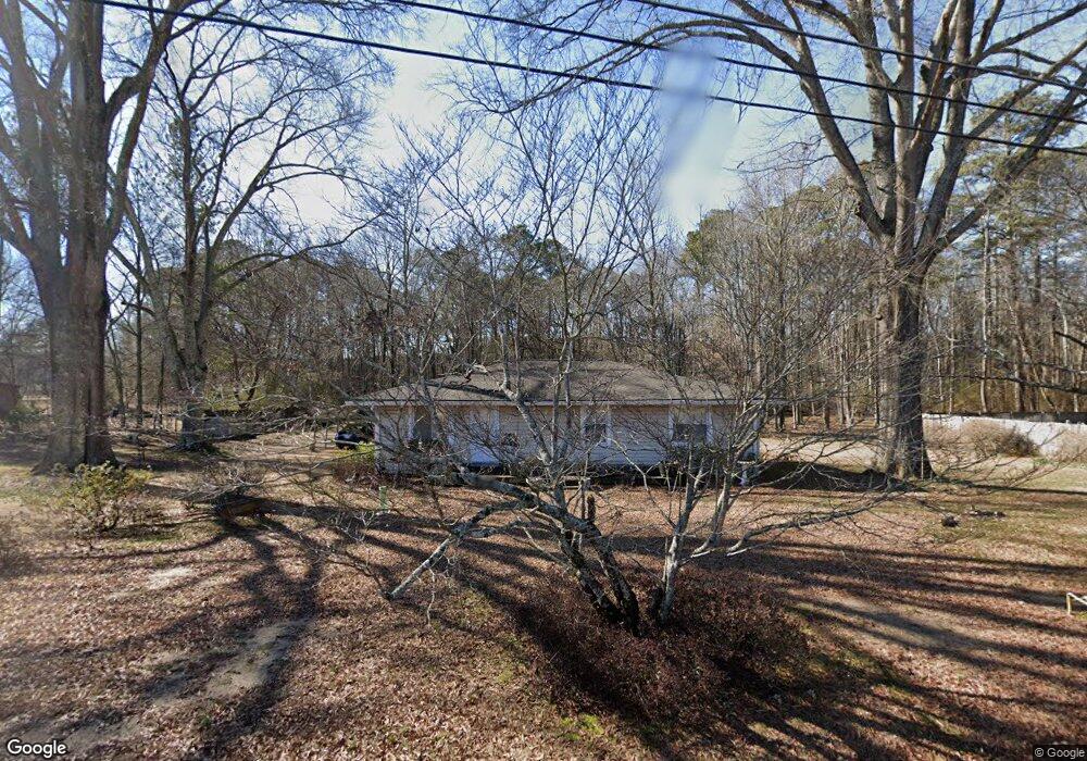
67 Deland Rd Kingston, GA 30145
Estimated Value: $174,536 - $241,000
--
Bed
1
Bath
1,260
Sq Ft
$170/Sq Ft
Est. Value
About This Home
This home is located at 67 Deland Rd, Kingston, GA 30145 and is currently estimated at $213,884, approximately $169 per square foot. 67 Deland Rd is a home located in Floyd County with nearby schools including Model Middle School and Model High School.
Ownership History
Date
Name
Owned For
Owner Type
Purchase Details
Closed on
Aug 2, 2002
Bought by
P and R
Current Estimated Value
Purchase Details
Closed on
Jun 8, 1990
Sold by
Dixon Larry Ray and Allyson Hyde Dixon
Bought by
Turner Sandy Ross and Kelley Renee Sh
Purchase Details
Closed on
Mar 19, 1985
Sold by
Dew Danny A
Bought by
Dixon Larry Ray and Allyson Hyde Dixo
Purchase Details
Closed on
Jun 5, 1978
Sold by
Floyd Spencer D and Floyd Brenda E
Bought by
Dew Danny A
Purchase Details
Closed on
Sep 30, 1975
Bought by
P and R
Purchase Details
Closed on
Mar 16, 1964
Sold by
Barker Al
Bought by
Barker Harold Eugene
Purchase Details
Closed on
Jan 1, 1953
Bought by
Barker Al
Create a Home Valuation Report for This Property
The Home Valuation Report is an in-depth analysis detailing your home's value as well as a comparison with similar homes in the area
Home Values in the Area
Average Home Value in this Area
Purchase History
| Date | Buyer | Sale Price | Title Company |
|---|---|---|---|
| P | -- | -- | |
| Turner Sandy Ross | $42,900 | -- | |
| Dixon Larry Ray | $27,500 | -- | |
| Dew Danny A | $17,500 | -- | |
| P | -- | -- | |
| Floyd Spencer D | $14,000 | -- | |
| Barker Harold Eugene | -- | -- | |
| Barker Al | -- | -- |
Source: Public Records
Tax History Compared to Growth
Tax History
| Year | Tax Paid | Tax Assessment Tax Assessment Total Assessment is a certain percentage of the fair market value that is determined by local assessors to be the total taxable value of land and additions on the property. | Land | Improvement |
|---|---|---|---|---|
| 2024 | $1,323 | $62,944 | $14,212 | $48,732 |
| 2023 | $680 | $54,727 | $12,920 | $41,807 |
| 2022 | $1,057 | $45,176 | $10,744 | $34,432 |
| 2021 | $852 | $34,703 | $9,799 | $24,904 |
| 2020 | $782 | $30,511 | $8,520 | $21,991 |
| 2019 | $758 | $29,600 | $8,520 | $21,080 |
| 2018 | $737 | $28,308 | $8,115 | $20,193 |
| 2017 | $719 | $27,186 | $7,514 | $19,672 |
| 2016 | $722 | $26,873 | $7,480 | $19,393 |
| 2015 | $708 | $26,873 | $7,480 | $19,393 |
| 2014 | $708 | $26,873 | $7,480 | $19,393 |
Source: Public Records
Map
Nearby Homes
- 127 Branson Rd SE
- 158 Sproull Rd SE
- 0 Mountain Creek Dr SE Unit 10436191
- 8 Trimble Way SE
- 96 Collins Rd NE
- 818 Morrison Camp Ground Rd NE
- 38 Parkwood Cir NE
- 567 Fred Kelley Rd NE
- 139 Shoals Ferry Rd SE
- 291 Youngs Mill Rd
- 406 Fred Kelly Rd NE
- 9 Everwood Ct SE
- 11 Everwood Ct SE
- 21 Everwood Ct SE
- 87 Ward Mountain Rd
- 13 Broken Arrow Trail SE
- 370 Youngs Mill Rd
- 25 Everwood Ct SE
- 0 Fallen Branch Cir SE Unit 10311756
- 0 Fallen Branch Cir SE Unit 10172755
- 3601 Kingston Hwy NE
- 343 Acorn Rd SE
- 363 Acorn Rd SE
- 3575 Kingston Hwy NE
- 321 Acorn Rd SE
- 64 Deland Rd
- 107 Deland Rd
- 0 Reynolds Bend Unit 10361195
- 364 Acorn Rd SE
- 3661 Kingston Hwy
- 344 Acorn Rd SE
- 3558 Kingston Hwy SE
- 330 Acorn Rd SE
- 330 Acorn Rd SE
- 100 Deland Rd
- 312 Acorn Rd SE
- 0 Branson Rd - Tract 1
- 0 Branson Rd -Tract 2
- 0 Branson Rd SE Unit 6009501
- 0 Branson Rd SE Unit 8330921