Estimated Value: $1,025,723 - $1,166,000
Studio
--
Bath
3,690
Sq Ft
$293/Sq Ft
Est. Value
About This Home
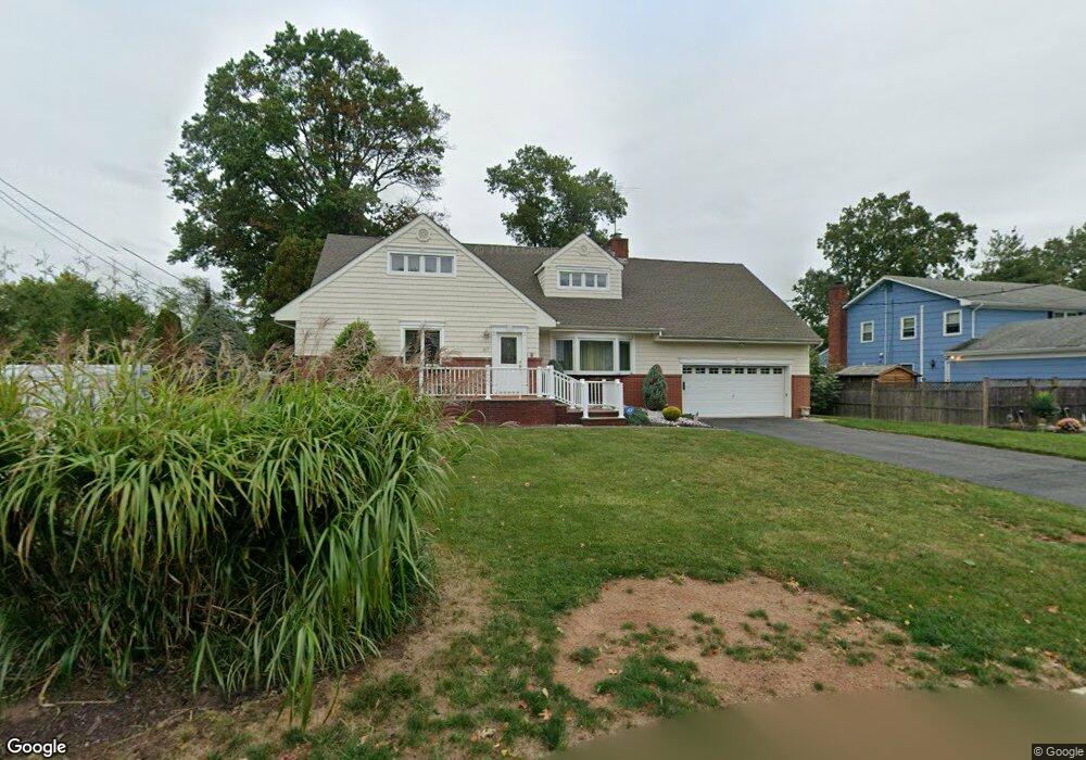
This home is located at 67 Doris Way, Clark, NJ 07066 and is currently estimated at $1,081,181, approximately $293 per square foot. 67 Doris Way is a home located in Union County with nearby schools including Frank K. Hehnly Elementary School, Carl H. Kumpf Middle School, and Arthur L. Johnson High School.
Ownership History
Date
Name
Owned For
Owner Type
Purchase Details
Closed on
Dec 30, 1999
Sold by
Fresco Maryann
Bought by
Fresco Family Trust and Rosato Arcangelo C
Current Estimated Value
Purchase Details
Closed on
Oct 1, 1993
Sold by
Torrisi Jospeh
Bought by
Fresco John B and Fresco Maryann
Home Financials for this Owner
Home Financials are based on the most recent Mortgage that was taken out on this home.
Original Mortgage
$250,000
Interest Rate
6.87%
Create a Home Valuation Report for This Property
The Home Valuation Report is an in-depth analysis detailing your home's value as well as a comparison with similar homes in the area
Home Values in the Area
Average Home Value in this Area
Purchase History
| Date | Buyer | Sale Price | Title Company |
|---|---|---|---|
| Fresco Family Trust | $400,000 | -- | |
| Fresco John B | $360,000 | -- |
Source: Public Records
Mortgage History
| Date | Status | Borrower | Loan Amount |
|---|---|---|---|
| Closed | Fresco John B | $250,000 |
Source: Public Records
Tax History
| Year | Tax Paid | Tax Assessment Tax Assessment Total Assessment is a certain percentage of the fair market value that is determined by local assessors to be the total taxable value of land and additions on the property. | Land | Improvement |
|---|---|---|---|---|
| 2025 | $17,763 | $802,300 | $338,600 | $463,700 |
| 2024 | $17,498 | $802,300 | $338,600 | $463,700 |
| 2023 | $17,498 | $802,300 | $338,600 | $463,700 |
| 2022 | $16,993 | $802,300 | $338,600 | $463,700 |
| 2021 | $16,162 | $181,800 | $51,000 | $130,800 |
| 2020 | $15,898 | $181,800 | $51,000 | $130,800 |
| 2019 | $15,738 | $181,800 | $51,000 | $130,800 |
| 2018 | $15,549 | $181,800 | $51,000 | $130,800 |
| 2017 | $15,300 | $181,800 | $51,000 | $130,800 |
| 2016 | $14,737 | $181,800 | $51,000 | $130,800 |
| 2015 | $14,588 | $181,800 | $51,000 | $130,800 |
| 2014 | $14,280 | $181,800 | $51,000 | $130,800 |
Source: Public Records
Map
Nearby Homes
- 17 Rolling Hill Way
- 814 Falesky St
- 1044 Madison Hill Rd
- 793 Garden St
- 157 Westfield Ave
- 22 Washington St
- 272 Westfield Ave
- 1138 William V Young Dr
- 52 Broadway
- 1206 Westfield Ave
- 45 Lexington Blvd
- 44 Joseph St
- 26 Linda Ave
- 20 Joanna Place
- 85 Fulton St
- 66 Lincoln Blvd
- 24 Frederick Ave
- 78 Patricia Ave
- 116 Arthur Ave
- 726 W Milton Ave
Your Personal Tour Guide
Ask me questions while you tour the home.