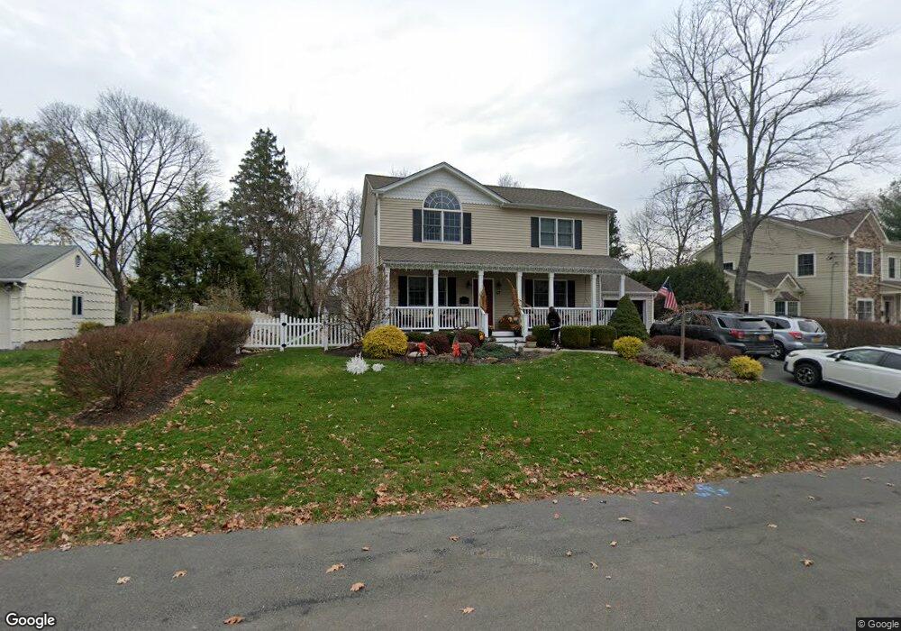
67 Douglas Ct Pearl River, NY 10965
Estimated Value: $702,000 - $779,000
3
Beds
3
Baths
2,033
Sq Ft
$367/Sq Ft
Est. Value
About This Home
This home is located at 67 Douglas Ct, Pearl River, NY 10965 and is currently estimated at $746,847, approximately $367 per square foot. 67 Douglas Ct is a home located in Rockland County with nearby schools including Pearl River High School and St Margaret School.
Ownership History
Date
Name
Owned For
Owner Type
Purchase Details
Closed on
Mar 26, 1999
Sold by
Mcgill Fergus and Mcgill Margaret
Bought by
Massaro Vincent and Massaro Jane
Current Estimated Value
Home Financials for this Owner
Home Financials are based on the most recent Mortgage that was taken out on this home.
Original Mortgage
$192,000
Outstanding Balance
$47,769
Interest Rate
6.83%
Mortgage Type
Purchase Money Mortgage
Estimated Equity
$699,078
Purchase Details
Closed on
Jun 6, 1996
Sold by
Allison William J and Allison Madeline
Bought by
Mcgill Fergus and Mcgill Margaret
Home Financials for this Owner
Home Financials are based on the most recent Mortgage that was taken out on this home.
Original Mortgage
$154,800
Interest Rate
7.97%
Mortgage Type
Construction
Create a Home Valuation Report for This Property
The Home Valuation Report is an in-depth analysis detailing your home's value as well as a comparison with similar homes in the area
Home Values in the Area
Average Home Value in this Area
Purchase History
| Date | Buyer | Sale Price | Title Company |
|---|---|---|---|
| Massaro Vincent | $240,000 | Chicago Title Insurance Co | |
| Mcgill Fergus | $193,500 | -- |
Source: Public Records
Mortgage History
| Date | Status | Borrower | Loan Amount |
|---|---|---|---|
| Open | Massaro Vincent | $192,000 | |
| Previous Owner | Mcgill Fergus | $154,800 |
Source: Public Records
Tax History Compared to Growth
Tax History
| Year | Tax Paid | Tax Assessment Tax Assessment Total Assessment is a certain percentage of the fair market value that is determined by local assessors to be the total taxable value of land and additions on the property. | Land | Improvement |
|---|---|---|---|---|
| 2024 | $15,029 | $190,400 | $46,600 | $143,800 |
| 2023 | $15,029 | $190,400 | $46,600 | $143,800 |
| 2022 | $12,752 | $190,400 | $46,600 | $143,800 |
| 2021 | $12,752 | $190,400 | $46,600 | $143,800 |
| 2020 | $12,100 | $190,400 | $46,600 | $143,800 |
| 2019 | $4,405 | $190,400 | $46,600 | $143,800 |
| 2018 | $11,461 | $190,400 | $46,600 | $143,800 |
| 2017 | $11,063 | $190,400 | $46,600 | $143,800 |
| 2016 | $10,716 | $190,400 | $46,600 | $143,800 |
| 2015 | -- | $190,400 | $46,600 | $143,800 |
| 2014 | -- | $190,400 | $46,600 | $143,800 |
Source: Public Records
Map
Nearby Homes
- 250 Blauvelt Rd
- 352 Holt Dr
- 165 Forest Ave
- 14 Staubitz Ave
- 221 N Middletown Rd Unit F
- 4 Brown Dr
- 118 & 114 Standish Dr
- 110 Orchid Dr
- 854 E Crooked Hill Rd Unit 854
- 87 Pinto Rd
- 359 Orangeburg Rd
- 86 Braunsdorf Rd
- 432 Somerset Dr Unit M
- 99 E Washington Ave
- 26 E George Ave
- 5 Hillaire Place
- 71 E Washington Ave
- 159 Martin Place
- 210 Rockland Rd
- 74 Oldert Dr