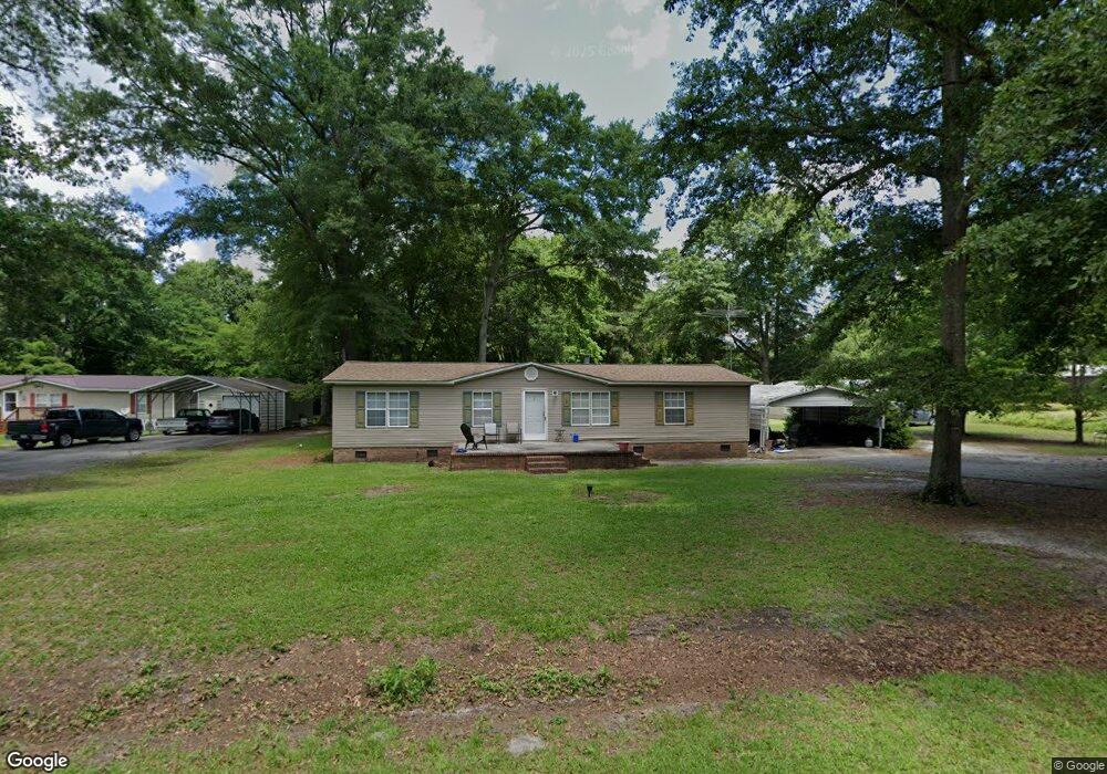
67 E Cedar Ave Mc Bee, SC 29101
Estimated Value: $115,971 - $212,000
Studio
--
Bath
1,568
Sq Ft
$96/Sq Ft
Est. Value
About This Home
This home is located at 67 E Cedar Ave, Mc Bee, SC 29101 and is currently estimated at $149,993, approximately $95 per square foot. 67 E Cedar Ave is a home with nearby schools including McBee Elementary School, McBee High School, and New Heights Middle School.
Create a Home Valuation Report for This Property
The Home Valuation Report is an in-depth analysis detailing your home's value as well as a comparison with similar homes in the area
Tax History
| Year | Tax Paid | Tax Assessment Tax Assessment Total Assessment is a certain percentage of the fair market value that is determined by local assessors to be the total taxable value of land and additions on the property. | Land | Improvement |
|---|---|---|---|---|
| 2025 | $1,519 | $4,290 | $410 | $3,880 |
| 2024 | $324 | $2,490 | $240 | $2,250 |
| 2023 | $312 | $2,490 | $240 | $2,250 |
| 2022 | $329 | $2,490 | $240 | $2,250 |
| 2021 | $292 | $2,490 | $240 | $2,250 |
| 2020 | $324 | $2,490 | $240 | $2,250 |
| 2019 | $1,032 | $2,490 | $240 | $2,250 |
| 2018 | $1,012 | $2,490 | $240 | $2,250 |
| 2015 | $1,228 | $3,730 | $360 | $3,370 |
| 2014 | $1,232 | $3,730 | $360 | $3,370 |
| 2010 | -- | $3,780 | $510 | $3,270 |
Source: Public Records
Map
Nearby Homes
- Lot 9-14 Maple Ave
- 0 Route 1 Unit Lot 92
- 151 E Pine Ave
- Lot 30 Norwood Farms
- Lot 25 Norwood Farms
- Lot 32 Norwood Farms
- Lot 34 Norwood Farms
- Lot 28 Norwood Farm
- Lot 38 Norwood Farms
- Lot 36 Norwood Farms
- Lot 26 Norwood Farms
- 0 Us Highway 1 South Seventh St Unit 20223111
- Overflow Rd
- 000 Overflow Rd
- 21 Rolling Hills Rd
- 2117 & 2109 Togetherness Way
- 3048 Timrod Rd
- 400 Pickens St
- 401 Inwood St
- 1652 Ashland Rd
- 51 E Cedar Ave
- 58 E Cedar Ave
- 23 E Cedar Ave
- 34 E Cedar Ave
- 112 E Cedar Ave
- 130 E Cypress Ave
- 15 W Cedar Ave
- 323 S Seventh St
- 157 S Seventh St
- 258 S Seventh St
- 21 W Cedar Ave
- 73 E Cypress Ave
- 158 E Cypress Ave
- 25 E Cypress Ave
- 144 S Seventh St
- 41 W Cypress Ave
- 342 S Seventh St
- 379 S Seventh St
- 160 S 9th St
- 57 W Cypress Ave
Your Personal Tour Guide
Ask me questions while you tour the home.