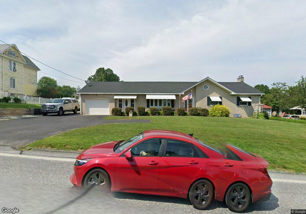
67 E Main St Fawn Grove, PA 17321
Estimated Value: $267,000 - $324,000
3
Beds
2
Baths
1,569
Sq Ft
$189/Sq Ft
Est. Value
About This Home
This home is located at 67 E Main St, Fawn Grove, PA 17321 and is currently estimated at $295,819, approximately $188 per square foot. 67 E Main St is a home located in York County with nearby schools including South Eastern Intermediate School, South Eastern Middle School, and Kennard-Dale High School.
Ownership History
Date
Name
Owned For
Owner Type
Purchase Details
Closed on
Nov 3, 2021
Sold by
Morris Sara C
Bought by
Agustin Patricia A San and Agustin Jerry F
Current Estimated Value
Purchase Details
Closed on
Oct 7, 2019
Sold by
Morris Sara C and Morris Roger F
Bought by
Morris Sara C
Purchase Details
Closed on
Jun 18, 1998
Sold by
Morris Roger F and Morris Sara C
Bought by
Roger F Morris & Sara C Morris Revocable
Create a Home Valuation Report for This Property
The Home Valuation Report is an in-depth analysis detailing your home's value as well as a comparison with similar homes in the area
Home Values in the Area
Average Home Value in this Area
Purchase History
| Date | Buyer | Sale Price | Title Company |
|---|---|---|---|
| Agustin Patricia A San | -- | None Available | |
| Morris Sara C | -- | None Available | |
| Roger F Morris & Sara C Morris Revocable | -- | -- |
Source: Public Records
Tax History Compared to Growth
Tax History
| Year | Tax Paid | Tax Assessment Tax Assessment Total Assessment is a certain percentage of the fair market value that is determined by local assessors to be the total taxable value of land and additions on the property. | Land | Improvement |
|---|---|---|---|---|
| 2025 | $4,366 | $140,150 | $23,160 | $116,990 |
| 2024 | $4,366 | $140,150 | $23,160 | $116,990 |
| 2023 | $4,366 | $140,150 | $23,160 | $116,990 |
| 2022 | $4,366 | $140,150 | $23,160 | $116,990 |
| 2021 | $4,226 | $140,150 | $23,160 | $116,990 |
| 2020 | $4,226 | $140,150 | $23,160 | $116,990 |
| 2019 | $4,212 | $140,150 | $23,160 | $116,990 |
| 2018 | $4,212 | $140,150 | $23,160 | $116,990 |
| 2017 | $4,212 | $140,150 | $23,160 | $116,990 |
| 2016 | $0 | $140,150 | $23,160 | $116,990 |
| 2015 | -- | $140,150 | $23,160 | $116,990 |
| 2014 | -- | $140,150 | $23,160 | $116,990 |
Source: Public Records
Map
Nearby Homes
- 31 N Market St
- 1701 Scott Rd
- 387 Garvine Mill Rd
- 54 Mitchell Rd
- 2131 Channel Rd
- 194 Cook Rd
- 2913 Whiteford Rd
- 257 Wiley Mill Rd
- 20 Carea Rd
- 267 Cook Rd
- 101 Saint Marys Rd
- 415 Saint Marys Rd
- 1038 Woodshire Ln
- 4816 Amos Rd
- 216 Meadow Trail
- Lot C Bryansville Rd
- Parcel 859 Neill Run Rd
- 46 Corn Tassel Rd
- 397 Marsteller Rd
- Lot 4 Ridge Rd