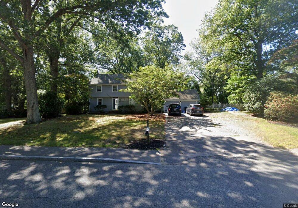
67 Edith Holmes Dr Scituate, MA 02066
Estimated Value: $816,180 - $902,000
3
Beds
2
Baths
1,580
Sq Ft
$539/Sq Ft
Est. Value
About This Home
This home is located at 67 Edith Holmes Dr, Scituate, MA 02066 and is currently estimated at $851,295, approximately $538 per square foot. 67 Edith Holmes Dr is a home located in Plymouth County with nearby schools including Wampatuck Elementary School, Lester J. Gates Middle School, and Scituate High School.
Ownership History
Date
Name
Owned For
Owner Type
Purchase Details
Closed on
Dec 7, 2018
Sold by
Nisbet Neil T
Bought by
Nisbet Carolyn J
Current Estimated Value
Home Financials for this Owner
Home Financials are based on the most recent Mortgage that was taken out on this home.
Original Mortgage
$335,000
Interest Rate
4.4%
Mortgage Type
New Conventional
Purchase Details
Closed on
Jul 14, 2000
Sold by
Yuknins Ward L and Yuknis Barbara E
Bought by
Nisbet Neil T and Nisbet Carolyn J
Home Financials for this Owner
Home Financials are based on the most recent Mortgage that was taken out on this home.
Original Mortgage
$300,000
Interest Rate
8.5%
Mortgage Type
Purchase Money Mortgage
Purchase Details
Closed on
Jul 1, 1991
Sold by
Hall James R and Hall Laurie J
Bought by
Yuknis Ward L and Yuknis Barbara E
Create a Home Valuation Report for This Property
The Home Valuation Report is an in-depth analysis detailing your home's value as well as a comparison with similar homes in the area
Home Values in the Area
Average Home Value in this Area
Purchase History
| Date | Buyer | Sale Price | Title Company |
|---|---|---|---|
| Nisbet Carolyn J | -- | -- | |
| Nisbet Neil T | $335,000 | -- | |
| Yuknis Ward L | $197,000 | -- | |
| Yuknis Ward L | $197,000 | -- |
Source: Public Records
Mortgage History
| Date | Status | Borrower | Loan Amount |
|---|---|---|---|
| Previous Owner | Nisbet Carolyn J | $335,000 | |
| Previous Owner | Yuknis Ward L | $313,000 | |
| Previous Owner | Yuknis Ward L | $300,000 | |
| Previous Owner | Yuknis Ward L | $120,000 |
Source: Public Records
Tax History
| Year | Tax Paid | Tax Assessment Tax Assessment Total Assessment is a certain percentage of the fair market value that is determined by local assessors to be the total taxable value of land and additions on the property. | Land | Improvement |
|---|---|---|---|---|
| 2025 | $6,786 | $679,300 | $375,400 | $303,900 |
| 2024 | $6,622 | $639,200 | $341,200 | $298,000 |
| 2023 | $6,701 | $607,300 | $327,500 | $279,800 |
| 2022 | $6,701 | $531,000 | $296,400 | $234,600 |
| 2021 | $6,508 | $488,200 | $282,300 | $205,900 |
| 2020 | $6,348 | $470,200 | $271,400 | $198,800 |
| 2019 | $6,234 | $453,700 | $266,100 | $187,600 |
| 2018 | $6,219 | $445,800 | $277,200 | $168,600 |
| 2017 | $6,035 | $428,300 | $266,100 | $162,200 |
| 2016 | $5,742 | $406,100 | $243,900 | $162,200 |
| 2015 | $5,176 | $395,100 | $232,900 | $162,200 |
Source: Public Records
Map
Nearby Homes
- 54 Woodland Rd
- 49 Jackson Rd
- 74 Branch St Unit 15
- 20 Lawson Rd
- 59 Captain Peirce Rd
- 20 Lee Ave
- 1 Washington Ln
- 38 Lauren Ln
- 86 Hatherly Rd
- 92 Marion Rd
- 49 Whittier Dr
- 33 Oceanside Dr
- 34 Cudworth Rd
- 23 Oceanside Dr
- 327 Country Way
- 20 Grace Way Unit 20
- 6 Grace Way Unit 6
- 27 Grace Way
- 111 Elm St
- 115 Elm St
- 150 Woodland Rd
- 162 Woodland Rd
- 63 Strawberry Ln
- 155 Woodland Rd
- 59 Strawberry Ln
- 52 Edith Holmes Dr
- 161 Woodland Rd
- 144 Woodland Rd
- 55 Strawberry Ln
- 147 Woodland Rd
- 2 Cairo Cir
- 6 Delta Ln
- 62 Strawberry Ln
- 46 Edith Holmes Dr
- 7 Delta Ln
- 58 Strawberry Ln
- 7 Pyramid Ln
- 140 Woodland Rd
- 51 Strawberry Ln
- 3 Cairo Cir
Your Personal Tour Guide
Ask me questions while you tour the home.