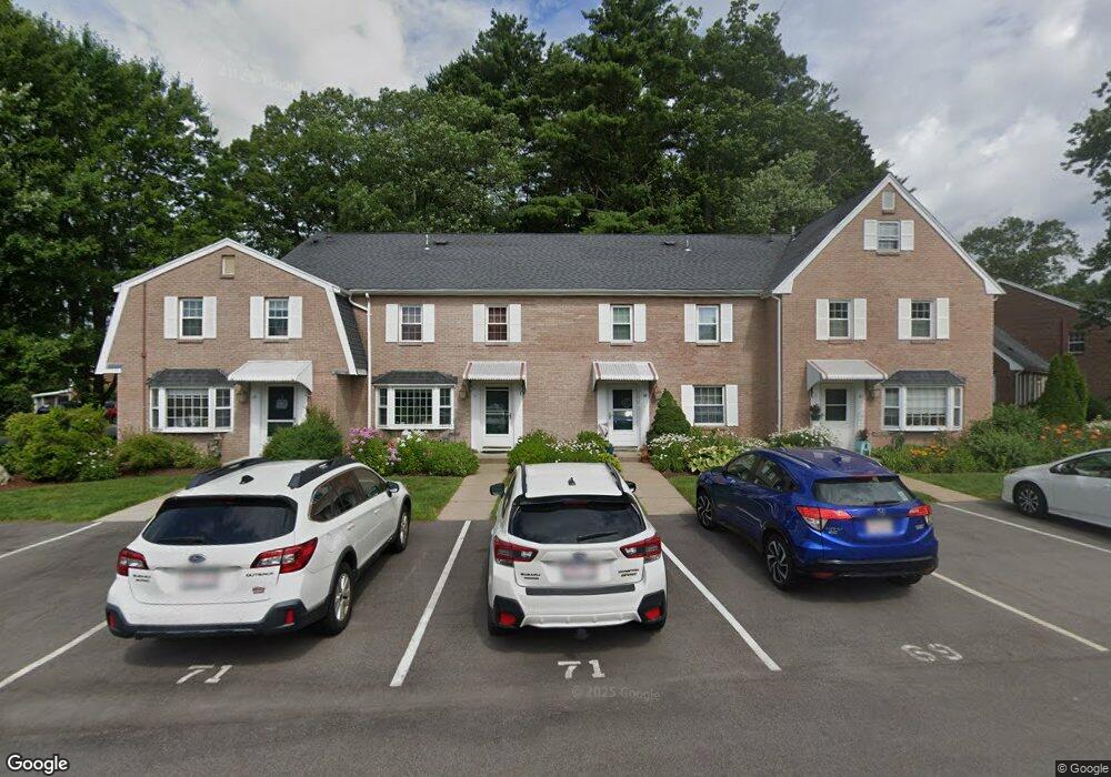
67 Edward Dr Stoughton, MA 02072
Estimated Value: $421,000 - $460,000
2
Beds
3
Baths
1,440
Sq Ft
$300/Sq Ft
Est. Value
About This Home
This home is located at 67 Edward Dr, Stoughton, MA 02072 and is currently estimated at $432,089, approximately $300 per square foot. 67 Edward Dr is a home located in Norfolk County with nearby schools including Helen Hansen Elementary School, O'Donnell Middle School, and Stoughton High School.
Ownership History
Date
Name
Owned For
Owner Type
Purchase Details
Closed on
Dec 18, 2009
Sold by
Kellman Gustave and Kellman Gloria
Bought by
Garland Timothy P and Garland Hermione K
Current Estimated Value
Home Financials for this Owner
Home Financials are based on the most recent Mortgage that was taken out on this home.
Original Mortgage
$134,900
Outstanding Balance
$88,440
Interest Rate
5%
Mortgage Type
Purchase Money Mortgage
Estimated Equity
$343,649
Purchase Details
Closed on
Mar 14, 2001
Sold by
Natalie Resnick T
Bought by
Kellman Gustave and Kellman Gloria
Purchase Details
Closed on
Oct 3, 1991
Sold by
Kaufman Alfred and Kaufman Roslyn A
Bought by
Resnick Natalie and Resnick Max L
Purchase Details
Closed on
Sep 12, 1991
Sold by
Kaufman Alfred and Kaufman Roslyn A
Bought by
Resnick Natalie and Resnick Max L
Create a Home Valuation Report for This Property
The Home Valuation Report is an in-depth analysis detailing your home's value as well as a comparison with similar homes in the area
Home Values in the Area
Average Home Value in this Area
Purchase History
| Date | Buyer | Sale Price | Title Company |
|---|---|---|---|
| Garland Timothy P | $194,900 | -- | |
| Kellman Gustave | $192,000 | -- | |
| Resnick Natalie | $122,000 | -- | |
| Resnick Natalie | $122,000 | -- |
Source: Public Records
Mortgage History
| Date | Status | Borrower | Loan Amount |
|---|---|---|---|
| Open | Garland Timothy P | $134,900 |
Source: Public Records
Tax History Compared to Growth
Tax History
| Year | Tax Paid | Tax Assessment Tax Assessment Total Assessment is a certain percentage of the fair market value that is determined by local assessors to be the total taxable value of land and additions on the property. | Land | Improvement |
|---|---|---|---|---|
| 2025 | $4,855 | $392,200 | $0 | $392,200 |
| 2024 | $4,779 | $375,400 | $0 | $375,400 |
| 2023 | $4,516 | $333,300 | $0 | $333,300 |
| 2022 | $4,262 | $295,800 | $0 | $295,800 |
| 2021 | $4,349 | $288,000 | $0 | $288,000 |
| 2020 | $4,150 | $278,700 | $0 | $278,700 |
| 2019 | $3,965 | $258,500 | $0 | $258,500 |
| 2018 | $3,643 | $246,000 | $0 | $246,000 |
| 2017 | $3,449 | $238,000 | $0 | $238,000 |
| 2016 | $3,479 | $232,400 | $0 | $232,400 |
| 2015 | $3,392 | $224,200 | $0 | $224,200 |
| 2014 | $3,107 | $197,400 | $0 | $197,400 |
Source: Public Records
Map
Nearby Homes
- 82 Frances Dr
- 16 Jessica Dr Unit E
- 18 Cherrywood Dr Unit 18
- 109 Greenbrook Dr Unit 109
- 72 Kim Terrace Unit C
- 40 Elderwood Dr
- 8 Patricia Dr
- 17 Patricia Dr
- 23 Millfarm Rd
- 398 Erin Rd Unit 398
- 103 Kim Terrace Unit A
- 74 Ethyl Way
- 2040 Central St
- 111 Ethyl Way Unit E
- 54 Laurelwood Dr
- 230 Greenbrook Dr
- 56 Laurelwood Dr
- 11 Springwood Ave
- 3 Donald Rd
- 16 Meadowood Dr
- 71 Edward Dr
- 69 Edward Dr
- 73 Edward Dr
- 53 Edward Dr
- 53 Edward Dr Unit 53
- 7 Claire Dr
- 9 Claire Dr
- 5 Claire Dr
- 5 Claire Dr Unit 5
- 5 Claire Dr Unit C5,5
- 11 Claire Dr Unit 19
- 11 Claire Dr Unit 19
- 7 Claire Dr Unit 21
- 51 Edward Dr
- 51 Edward Dr Unit 51
- 11 Claire Dr
- 57 Edward Dr
- 55 Edward Dr
- 57 Edward Dr Unit 57
- 57 Edward Dr Unit 57,1