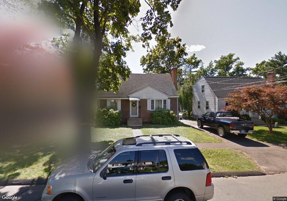
67 Frederick St Newington, CT 06111
Estimated Value: $341,000 - $375,000
2
Beds
2
Baths
1,267
Sq Ft
$284/Sq Ft
Est. Value
About This Home
This home is located at 67 Frederick St, Newington, CT 06111 and is currently estimated at $359,362, approximately $283 per square foot. 67 Frederick St is a home located in Hartford County with nearby schools including John Paterson School, John Wallace Middle School, and Newington High School.
Ownership History
Date
Name
Owned For
Owner Type
Purchase Details
Closed on
Sep 17, 2001
Sold by
Quinn James F
Bought by
Prestia Joseph S and Sadlasky Sarah R
Current Estimated Value
Home Financials for this Owner
Home Financials are based on the most recent Mortgage that was taken out on this home.
Original Mortgage
$115,000
Interest Rate
6.05%
Create a Home Valuation Report for This Property
The Home Valuation Report is an in-depth analysis detailing your home's value as well as a comparison with similar homes in the area
Home Values in the Area
Average Home Value in this Area
Purchase History
| Date | Buyer | Sale Price | Title Company |
|---|---|---|---|
| Prestia Joseph S | $135,000 | -- |
Source: Public Records
Mortgage History
| Date | Status | Borrower | Loan Amount |
|---|---|---|---|
| Closed | Prestia Joseph S | $110,000 | |
| Closed | Prestia Joseph S | $115,000 |
Source: Public Records
Tax History
| Year | Tax Paid | Tax Assessment Tax Assessment Total Assessment is a certain percentage of the fair market value that is determined by local assessors to be the total taxable value of land and additions on the property. | Land | Improvement |
|---|---|---|---|---|
| 2025 | $5,111 | $127,830 | $51,330 | $76,500 |
| 2024 | $5,071 | $127,830 | $51,330 | $76,500 |
| 2023 | $4,904 | $127,830 | $51,330 | $76,500 |
| 2022 | $4,920 | $127,830 | $51,330 | $76,500 |
| 2021 | $4,961 | $127,830 | $51,330 | $76,500 |
| 2020 | $4,986 | $126,930 | $49,350 | $77,580 |
| 2019 | $5,007 | $126,930 | $49,350 | $77,580 |
| 2018 | $4,887 | $126,930 | $49,350 | $77,580 |
| 2017 | $4,644 | $126,930 | $49,350 | $77,580 |
| 2016 | $4,538 | $126,930 | $49,350 | $77,580 |
| 2014 | $4,272 | $122,870 | $50,010 | $72,860 |
Source: Public Records
Map
Nearby Homes
- 55 Coles Ave
- 22 Mohawk Cir
- 129 Glenview Dr
- 1471 Willard Ave Unit C
- 1473 Willard Ave Unit B
- 235 Lucille St
- 144 Churchill Dr
- 3 Steeplechase Dr
- 32 Flagler St
- 417 Churchill Dr Unit 417
- 1 Old Farm Dr
- 7 Old Farm Dr
- 9 Old Farm Dr
- 77 Thorniley St
- 116 Sunrise Ave
- 192 Market St
- 38 Northwood Rd
- 172 Eddy Ln
- 236 Old Farm Dr
- 2950 Berlin Turnpike
Your Personal Tour Guide
Ask me questions while you tour the home.