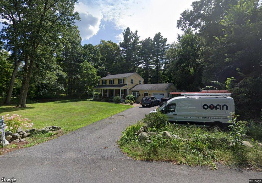
67 Fruit St Norfolk, MA 02056
Estimated Value: $685,990 - $908,000
4
Beds
2
Baths
2,012
Sq Ft
$385/Sq Ft
Est. Value
About This Home
This home is located at 67 Fruit St, Norfolk, MA 02056 and is currently estimated at $774,248, approximately $384 per square foot. 67 Fruit St is a home located in Norfolk County with nearby schools including H. Olive Day School, Freeman-Kennedy School, and Woodside Montessori Academy.
Ownership History
Date
Name
Owned For
Owner Type
Purchase Details
Closed on
Aug 15, 1995
Sold by
Obrien Mark W and Obrien Susan J
Bought by
Keenan Thomas D and Keenan Marie C
Current Estimated Value
Home Financials for this Owner
Home Financials are based on the most recent Mortgage that was taken out on this home.
Original Mortgage
$169,000
Interest Rate
7.48%
Mortgage Type
Purchase Money Mortgage
Purchase Details
Closed on
Dec 31, 1991
Sold by
Hudson John W and Hudson Priscilla A
Bought by
Obrien Mark W and Obrien Susan J
Create a Home Valuation Report for This Property
The Home Valuation Report is an in-depth analysis detailing your home's value as well as a comparison with similar homes in the area
Home Values in the Area
Average Home Value in this Area
Purchase History
| Date | Buyer | Sale Price | Title Company |
|---|---|---|---|
| Keenan Thomas D | $212,000 | -- | |
| Obrien Mark W | $140,000 | -- |
Source: Public Records
Mortgage History
| Date | Status | Borrower | Loan Amount |
|---|---|---|---|
| Open | Obrien Mark W | $169,000 | |
| Closed | Obrien Mark W | $169,000 | |
| Previous Owner | Obrien Mark W | $127,000 |
Source: Public Records
Tax History Compared to Growth
Tax History
| Year | Tax Paid | Tax Assessment Tax Assessment Total Assessment is a certain percentage of the fair market value that is determined by local assessors to be the total taxable value of land and additions on the property. | Land | Improvement |
|---|---|---|---|---|
| 2025 | $8,793 | $550,600 | $216,000 | $334,600 |
| 2024 | $8,324 | $534,600 | $216,000 | $318,600 |
| 2023 | $8,085 | $492,700 | $216,000 | $276,700 |
| 2022 | $7,662 | $421,000 | $202,300 | $218,700 |
| 2021 | $7,396 | $411,100 | $196,400 | $214,700 |
| 2020 | $6,858 | $367,900 | $178,400 | $189,500 |
| 2019 | $6,626 | $362,300 | $178,400 | $183,900 |
| 2018 | $6,433 | $345,500 | $178,400 | $167,100 |
| 2017 | $6,341 | $348,000 | $178,400 | $169,600 |
| 2016 | $6,095 | $337,100 | $178,400 | $158,700 |
| 2015 | $5,845 | $331,000 | $169,900 | $161,100 |
| 2014 | $5,745 | $329,600 | $169,900 | $159,700 |
Source: Public Records
Map
Nearby Homes
- 26 Noon Hill Ave
- 14 Onondaga Ln
- 33 Whichita Rd
- 1 Pueblo Rd
- 14 Willow Place
- 14 Cleary Cir
- 14 Cleary Cir Unit 14
- 10 Stop River Rd
- 13 Stop River Rd
- 53 Thomas Mann Cir Unit 31
- 55 Thomas Mann Cir Unit 32
- 51 Thomas Mann Unit 30
- The Georgetown Grand R Plan at Lakeland Hills
- The Georgetown Grand L Plan at Lakeland Hills
- The Georgetown L Plan at Lakeland Hills
- The Georgetown R Plan at Lakeland Hills
- 54 Thomas Mann Unit Lot 42
- 43 Thomas Mann Cir Unit Lot 26
- 42 Thomas Mann Unit 39
- 37 Thomas Mann Cir Unit 23