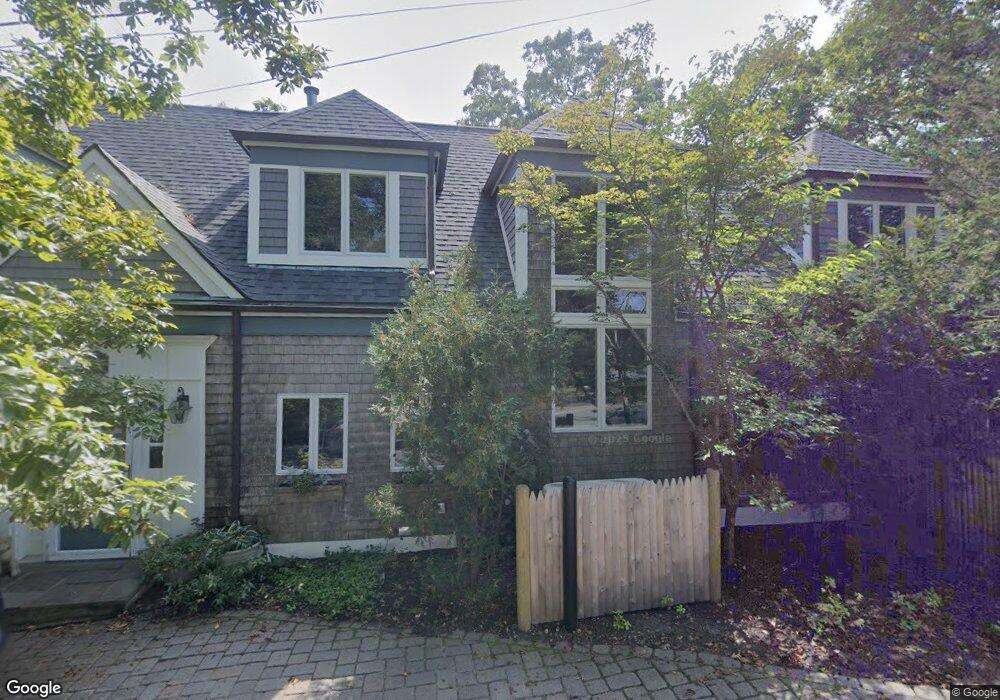
67 Gammons Rd Cohasset, MA 02025
Estimated Value: $2,413,000 - $2,777,000
3
Beds
4
Baths
3,552
Sq Ft
$735/Sq Ft
Est. Value
About This Home
This home is located at 67 Gammons Rd, Cohasset, MA 02025 and is currently estimated at $2,611,444, approximately $735 per square foot. 67 Gammons Rd is a home located in Norfolk County with nearby schools including Joseph Osgood School, Deer Hill School, and Cohasset Middle School.
Ownership History
Date
Name
Owned For
Owner Type
Purchase Details
Closed on
Dec 13, 2013
Sold by
Kornet Diana D
Bought by
Earon William A
Current Estimated Value
Purchase Details
Closed on
Apr 18, 2000
Sold by
Kornet John L
Bought by
Kornet Diana D
Purchase Details
Closed on
Sep 12, 1995
Sold by
Barry Edna W
Bought by
Kornet John L and Kornet Diana D
Home Financials for this Owner
Home Financials are based on the most recent Mortgage that was taken out on this home.
Original Mortgage
$344,000
Interest Rate
7.8%
Mortgage Type
Purchase Money Mortgage
Purchase Details
Closed on
Mar 24, 1995
Sold by
Weltman Tr David I
Bought by
Barry Edna W
Create a Home Valuation Report for This Property
The Home Valuation Report is an in-depth analysis detailing your home's value as well as a comparison with similar homes in the area
Home Values in the Area
Average Home Value in this Area
Purchase History
| Date | Buyer | Sale Price | Title Company |
|---|---|---|---|
| Earon William A | $700,000 | -- | |
| Earon William A | $700,000 | -- | |
| Earon William A | $700,000 | -- | |
| Kornet Diana D | $295,000 | -- | |
| Kornet John L | $430,000 | -- | |
| Kornet John L | $430,000 | -- | |
| Barry Edna W | $400,000 | -- | |
| Barry Edna W | $400,000 | -- |
Source: Public Records
Mortgage History
| Date | Status | Borrower | Loan Amount |
|---|---|---|---|
| Previous Owner | Barry Edna W | $75,000 | |
| Previous Owner | Kornet John L | $344,000 | |
| Previous Owner | Barry Edna W | $100,000 |
Source: Public Records
Tax History Compared to Growth
Tax History
| Year | Tax Paid | Tax Assessment Tax Assessment Total Assessment is a certain percentage of the fair market value that is determined by local assessors to be the total taxable value of land and additions on the property. | Land | Improvement |
|---|---|---|---|---|
| 2025 | $28,286 | $2,442,700 | $1,760,500 | $682,200 |
| 2024 | $28,692 | $2,357,600 | $1,676,200 | $681,400 |
| 2023 | $25,277 | $2,142,100 | $1,487,700 | $654,400 |
| 2022 | $26,238 | $2,089,000 | $1,487,700 | $601,300 |
| 2021 | $22,623 | $1,734,900 | $1,180,400 | $554,500 |
| 2020 | $22,502 | $1,734,900 | $1,180,400 | $554,500 |
| 2019 | $22,380 | $1,734,900 | $1,180,400 | $554,500 |
| 2018 | $22,189 | $1,734,900 | $1,180,400 | $554,500 |
| 2017 | $22,740 | $1,741,200 | $1,180,400 | $560,800 |
| 2016 | $21,271 | $1,651,500 | $1,090,700 | $560,800 |
| 2015 | $20,991 | $1,651,500 | $1,090,700 | $560,800 |
| 2014 | $21,788 | $1,737,500 | $1,176,700 | $560,800 |
Source: Public Records
Map
Nearby Homes
- 101 Nichols Rd
- 146 N Main St Unit 146
- 11 Beach St
- 135 Beach St
- 25 Ripley Rd
- 356 Atlantic Ave
- 17 Mohawk Way
- 25 Mohawk Way
- 89 Ripley Rd
- 15 Cushing Rd
- 128 Elm St Unit 211
- 296 N Main St
- 21-23 Elm Ct
- 29 Heather Dr
- 4 Margin St Unit A
- 87 Elm St Unit 215
- 119 Pleasant St
- 124 Elm St Unit 202
- 124 Elm St Unit 308
- 26 Ash St