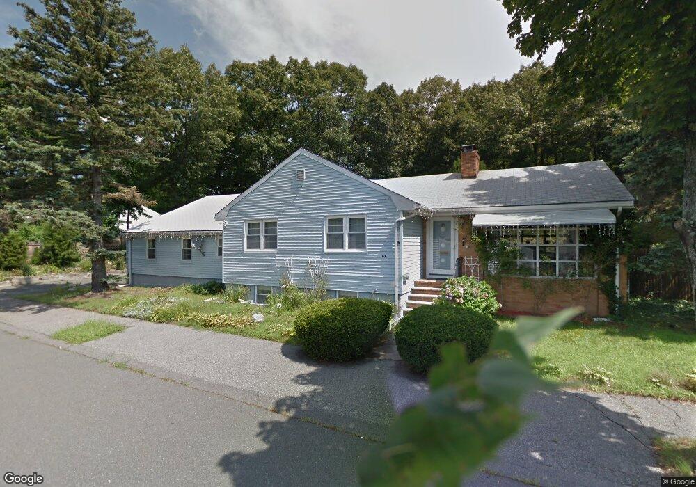
67 Gateway Ln Lynn, MA 01905
Upper Walnut Street NeighborhoodEstimated Value: $629,000 - $728,000
3
Beds
2
Baths
2,096
Sq Ft
$330/Sq Ft
Est. Value
About This Home
This home is located at 67 Gateway Ln, Lynn, MA 01905 and is currently estimated at $692,218, approximately $330 per square foot. 67 Gateway Ln is a home located in Essex County with nearby schools including Cromwell-Wright Elementary School, Julia F. Callahan Elementary School, and William R. Fallon School.
Ownership History
Date
Name
Owned For
Owner Type
Purchase Details
Closed on
Nov 30, 2001
Sold by
Helen T Connolly Ft
Bought by
Pirogov Iourii D and Pirogov Olga D
Current Estimated Value
Home Financials for this Owner
Home Financials are based on the most recent Mortgage that was taken out on this home.
Original Mortgage
$264,100
Outstanding Balance
$103,887
Interest Rate
6.66%
Mortgage Type
Purchase Money Mortgage
Estimated Equity
$588,331
Create a Home Valuation Report for This Property
The Home Valuation Report is an in-depth analysis detailing your home's value as well as a comparison with similar homes in the area
Home Values in the Area
Average Home Value in this Area
Purchase History
| Date | Buyer | Sale Price | Title Company |
|---|---|---|---|
| Pirogov Iourii D | $278,000 | -- |
Source: Public Records
Mortgage History
| Date | Status | Borrower | Loan Amount |
|---|---|---|---|
| Open | Pirogov Iourii D | $264,100 |
Source: Public Records
Tax History Compared to Growth
Tax History
| Year | Tax Paid | Tax Assessment Tax Assessment Total Assessment is a certain percentage of the fair market value that is determined by local assessors to be the total taxable value of land and additions on the property. | Land | Improvement |
|---|---|---|---|---|
| 2025 | $6,208 | $599,200 | $227,300 | $371,900 |
| 2024 | $5,933 | $563,400 | $225,900 | $337,500 |
| 2023 | $5,781 | $518,500 | $218,900 | $299,600 |
| 2022 | $5,493 | $441,900 | $187,600 | $254,300 |
| 2021 | $5,303 | $407,000 | $174,700 | $232,300 |
| 2020 | $5,097 | $380,400 | $155,400 | $225,000 |
| 2019 | $5,365 | $375,200 | $167,800 | $207,400 |
| 2018 | $5,121 | $338,000 | $156,900 | $181,100 |
| 2017 | $4,797 | $307,500 | $136,000 | $171,500 |
| 2016 | $4,613 | $285,100 | $128,700 | $156,400 |
| 2015 | $4,449 | $265,600 | $127,200 | $138,400 |
Source: Public Records
Map
Nearby Homes
- 32 Birch Brook Rd Unit 27
- 32 Birch Brook Rd Unit 16
- 32 Birch Brook Rd Unit 1
- 32 Birch Brook Rd Unit 25
- 32 Birch Brook Rd Unit 22
- 32 Birch Brook Rd Unit 28
- 268 Walnut St
- 110 Holyoke St
- 8 Newcomb Ave
- 27 Bradford Terrace
- 35 Curran Rd
- 14 Atkinson St
- 92-94 Newton Ave
- 15 Quebec Ct
- 20 Houston St
- 93 Robinson St
- 28 Wyman St
- 31 Fairchild Ave
- 725 Boston St
- 100 Ashland St