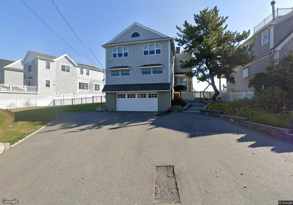
67 Gilson Rd Scituate, MA 02066
Estimated Value: $1,490,000 - $2,340,000
3
Beds
3
Baths
2,276
Sq Ft
$827/Sq Ft
Est. Value
About This Home
This home is located at 67 Gilson Rd, Scituate, MA 02066 and is currently estimated at $1,881,685, approximately $826 per square foot. 67 Gilson Rd is a home located in Plymouth County with nearby schools including Jenkins Elementary School, Lester J. Gates Middle School, and Scituate High School.
Ownership History
Date
Name
Owned For
Owner Type
Purchase Details
Closed on
Oct 19, 2016
Sold by
Downes Matthew J and Downes Tammy T
Bought by
Downes Matthew J and Downes Tammy T
Current Estimated Value
Purchase Details
Closed on
Mar 5, 2010
Sold by
Downes Matthew J and Sheehy Tammy
Bought by
Downes Matthew J and Downes Tammy T
Purchase Details
Closed on
Nov 30, 2005
Sold by
Reynolds Paul D and Reynolds Anne-Marie T L
Bought by
Downes Matthew J and Sheehan Tammy
Purchase Details
Closed on
Apr 2, 2003
Sold by
Reynolds Paul D and Reynolds Anne-Marie T L
Bought by
Reynolds Paul D and Reynolds Anne-Marie T L
Purchase Details
Closed on
Jun 12, 1997
Sold by
Murphy Philip A and Murphy Elizabeth M
Bought by
Reynolds Paul D and Reynolds Anne-Marie Tl
Purchase Details
Closed on
Sep 7, 1990
Sold by
Tibbetts Mary E
Bought by
Murphy Philip A
Create a Home Valuation Report for This Property
The Home Valuation Report is an in-depth analysis detailing your home's value as well as a comparison with similar homes in the area
Home Values in the Area
Average Home Value in this Area
Purchase History
| Date | Buyer | Sale Price | Title Company |
|---|---|---|---|
| Downes Matthew J | -- | -- | |
| Downes Matthew J | -- | -- | |
| Downes Matthew J | $788,000 | -- | |
| Reynolds Paul D | -- | -- | |
| Reynolds Paul D | $387,500 | -- | |
| Murphy Philip A | $267,500 | -- |
Source: Public Records
Mortgage History
| Date | Status | Borrower | Loan Amount |
|---|---|---|---|
| Previous Owner | Murphy Philip A | $523,750 | |
| Previous Owner | Murphy Philip A | $378,000 |
Source: Public Records
Tax History
| Year | Tax Paid | Tax Assessment Tax Assessment Total Assessment is a certain percentage of the fair market value that is determined by local assessors to be the total taxable value of land and additions on the property. | Land | Improvement |
|---|---|---|---|---|
| 2025 | $16,540 | $1,655,700 | $1,136,600 | $519,100 |
| 2024 | $16,542 | $1,596,700 | $1,087,600 | $509,100 |
| 2023 | $15,413 | $1,460,500 | $988,800 | $471,700 |
| 2022 | $15,413 | $1,221,300 | $830,600 | $390,700 |
| 2021 | $15,142 | $1,135,900 | $791,100 | $344,800 |
| 2020 | $14,706 | $1,089,300 | $760,600 | $328,700 |
| 2019 | $14,562 | $1,059,800 | $745,600 | $314,200 |
| 2018 | $12,662 | $907,700 | $618,300 | $289,400 |
| 2017 | $11,853 | $841,200 | $562,800 | $278,400 |
| 2016 | $11,460 | $810,500 | $532,100 | $278,400 |
| 2015 | $9,546 | $728,700 | $450,300 | $278,400 |
Source: Public Records
Map
Nearby Homes
- 59 Greenfield Ln
- 55 Crescent Ave
- 91 Front St Unit 106
- 50 First Parish Rd
- 25 Morton Place
- 23 Sunset Rd
- 34 Ladds Way
- 46 Tilden Rd
- 21 Jenkins Place
- 14 Old Country Way Unit C
- 14 Old Country Way Unit B
- 19 Ford Place Unit 1
- 19 Ford Place Unit 2
- 11 Brookline Rd
- 32 Barker Rd Unit 3
- 26 Damons Point Cir
- 38 Lauren Ln
- 17 Old Oaken Bucket Rd
- 48 Neal Gate St
- 86 Hatherly Rd
Your Personal Tour Guide
Ask me questions while you tour the home.