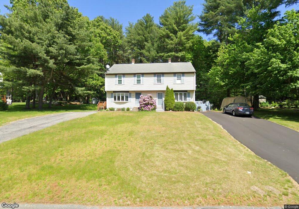
67 Harvest Rd Uxbridge, MA 01569
Estimated Value: $346,000 - $409,000
2
Beds
2
Baths
1,256
Sq Ft
$304/Sq Ft
Est. Value
About This Home
This home is located at 67 Harvest Rd, Uxbridge, MA 01569 and is currently estimated at $382,371, approximately $304 per square foot. 67 Harvest Rd is a home located in Worcester County with nearby schools including Uxbridge High School, Our Lady of the Valley Regional School, and Whitinsville Christian School.
Ownership History
Date
Name
Owned For
Owner Type
Purchase Details
Closed on
Dec 13, 1996
Sold by
Joanis Susan A
Bought by
Tzeremes Konstantinos
Current Estimated Value
Purchase Details
Closed on
Oct 12, 1994
Sold by
Mirabile Virginia
Bought by
Joanis Susan A
Purchase Details
Closed on
Nov 20, 1989
Sold by
Audet Bros Inc
Bought by
Mirabile Virginia
Create a Home Valuation Report for This Property
The Home Valuation Report is an in-depth analysis detailing your home's value as well as a comparison with similar homes in the area
Home Values in the Area
Average Home Value in this Area
Purchase History
| Date | Buyer | Sale Price | Title Company |
|---|---|---|---|
| Tzeremes Konstantinos | $92,000 | -- | |
| Joanis Susan A | $93,500 | -- | |
| Mirabile Virginia | $113,900 | -- |
Source: Public Records
Mortgage History
| Date | Status | Borrower | Loan Amount |
|---|---|---|---|
| Open | Mirabile Virginia | $133,000 | |
| Closed | Mirabile Virginia | $25,000 | |
| Closed | Mirabile Virginia | $88,000 |
Source: Public Records
Tax History Compared to Growth
Tax History
| Year | Tax Paid | Tax Assessment Tax Assessment Total Assessment is a certain percentage of the fair market value that is determined by local assessors to be the total taxable value of land and additions on the property. | Land | Improvement |
|---|---|---|---|---|
| 2025 | $45 | $346,200 | $0 | $346,200 |
| 2024 | $3,778 | $292,400 | $0 | $292,400 |
| 2023 | $3,335 | $239,100 | $0 | $239,100 |
| 2022 | $3,238 | $213,600 | $0 | $213,600 |
| 2021 | $3,036 | $191,900 | $0 | $191,900 |
| 2020 | $3,494 | $208,700 | $0 | $208,700 |
| 2019 | $3,621 | $208,700 | $0 | $208,700 |
| 2018 | $3,279 | $191,000 | $0 | $191,000 |
| 2017 | $2,736 | $161,300 | $0 | $161,300 |
| 2016 | $2,720 | $154,800 | $0 | $154,800 |
| 2015 | $2,636 | $151,500 | $0 | $151,500 |
Source: Public Records
Map
Nearby Homes
- 304 W River Rd
- 371 Hartford Ave E
- 390 Hartford Ave E
- 41 Pouts Ln
- 45 Nature View Dr
- 29 Pouts Ln Unit 29
- 38 William Ward St
- 46 Pouts Ln Unit 46
- 69 Pouts Ln
- 94 Carrington Ln Unit 94
- 50 Carrington Ln
- 46 Capron St
- 440 Quaker St
- 37 Elizabeth St
- 52 Homeward Ave
- 48 Homeward Ave
- 19 Harvard St
- 0 Louis St
- 7 Wall St
- 19 Snowling Rd
- 65 Harvest Rd
- 65 Harvest Rd Unit 65
- 67 Harvest Rd Unit 67
- 73 Harvest Rd
- 75 Harvest Rd
- 75 Harvest Rd Unit 1
- 64 Harvest Rd
- 57 Harvest Rd
- 59 Harvest Rd
- 57 Lake St
- 72 Harvest Rd
- 74 Harvest Rd
- 74 Harvest Rd Unit B
- 83 Harvest Rd
- 85 Harvest Rd
- 85 Harvest Rd Unit 85,36A
- 58 Harvest Rd
- 58 Harvest Rd Unit 58B
- 66 Harvest Rd
- 56 Harvest Rd