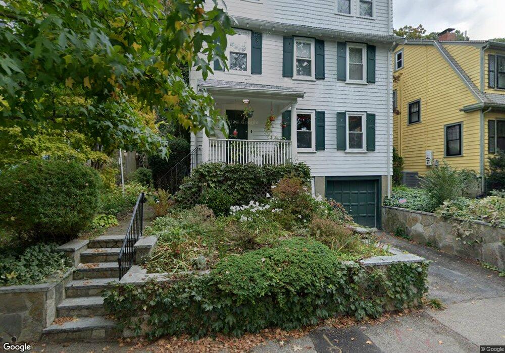
67 Highland Rd Brookline, MA 02445
Brookline Village NeighborhoodEstimated Value: $1,642,000 - $2,092,000
4
Beds
3
Baths
2,093
Sq Ft
$877/Sq Ft
Est. Value
About This Home
This home is located at 67 Highland Rd, Brookline, MA 02445 and is currently estimated at $1,835,403, approximately $876 per square foot. 67 Highland Rd is a home located in Norfolk County with nearby schools including William H. Lincoln School, St. Mary of the Assumption Elementary School, and Maimonides School.
Ownership History
Date
Name
Owned For
Owner Type
Purchase Details
Closed on
May 10, 1999
Sold by
Baker Tania A
Bought by
Wucherpfennig Kai and Wucherpfennig Anne
Current Estimated Value
Home Financials for this Owner
Home Financials are based on the most recent Mortgage that was taken out on this home.
Original Mortgage
$240,000
Outstanding Balance
$61,396
Interest Rate
6.92%
Mortgage Type
Purchase Money Mortgage
Estimated Equity
$1,774,007
Purchase Details
Closed on
Nov 30, 1993
Sold by
Kost Karen L
Bought by
Baker Tania A
Home Financials for this Owner
Home Financials are based on the most recent Mortgage that was taken out on this home.
Original Mortgage
$171,000
Interest Rate
6.72%
Mortgage Type
Purchase Money Mortgage
Create a Home Valuation Report for This Property
The Home Valuation Report is an in-depth analysis detailing your home's value as well as a comparison with similar homes in the area
Home Values in the Area
Average Home Value in this Area
Purchase History
| Date | Buyer | Sale Price | Title Company |
|---|---|---|---|
| Wucherpfennig Kai | $400,000 | -- | |
| Baker Tania A | $190,000 | -- |
Source: Public Records
Mortgage History
| Date | Status | Borrower | Loan Amount |
|---|---|---|---|
| Open | Baker Tania A | $150,000 | |
| Open | Baker Tania A | $240,000 | |
| Previous Owner | Baker Tania A | $171,000 |
Source: Public Records
Tax History Compared to Growth
Tax History
| Year | Tax Paid | Tax Assessment Tax Assessment Total Assessment is a certain percentage of the fair market value that is determined by local assessors to be the total taxable value of land and additions on the property. | Land | Improvement |
|---|---|---|---|---|
| 2025 | $16,469 | $1,668,600 | $963,600 | $705,000 |
| 2024 | $15,778 | $1,614,900 | $926,500 | $688,400 |
| 2023 | $14,711 | $1,475,500 | $801,400 | $674,100 |
| 2022 | $14,210 | $1,394,500 | $763,300 | $631,200 |
| 2021 | $13,140 | $1,340,800 | $733,900 | $606,900 |
| 2020 | $11,953 | $1,264,900 | $667,200 | $597,700 |
| 2019 | $11,287 | $1,204,600 | $635,400 | $569,200 |
| 2018 | $10,526 | $1,112,700 | $551,500 | $561,200 |
| 2017 | $10,370 | $1,049,600 | $520,100 | $529,500 |
| 2016 | $10,222 | $981,000 | $486,100 | $494,900 |
| 2015 | $9,791 | $916,800 | $454,300 | $462,500 |
| 2014 | $9,863 | $865,900 | $413,000 | $452,900 |
Source: Public Records
Map
Nearby Homes
- 81 Glen Rd Unit S2
- 60 Glen Rd Unit 101
- 105 Franklin St Unit 1
- 20 Rice St Unit 2
- 36 Allerton St
- 99 Pond Ave Unit 608
- 111 Perkins St Unit 108
- 111 Perkins St Unit 282
- 111 Perkins St Unit 121
- 111 Perkins St Unit 152
- 241 Perkins St Unit F301
- 241 Perkins St Unit J602
- 241 Perkins St Unit C306
- 241 Perkins St Unit C402
- 241 Perkins St Unit D405
- 77 Pond Ave Unit 1103
- 77 Pond Ave Unit 1506
- 33 Pond Ave Unit 422
- 33 Pond Ave Unit 709
- 33 Pond Ave Unit 523
- 69 Highland Rd
- 63 Highland Rd
- 61 Highland Rd Unit 61A
- 71 Highland Rd
- 73 Highland Rd
- 75 Highland Rd
- 77 Highland Rd
- 59 Highland Rd Unit 59
- 57 Highland Rd Unit 59
- 57 Highland Rd Unit 57
- 81 Highland Rd
- 53 Highland Rd Unit 55
- 53 Highland Rd Unit 1
- 53 Highland Rd Unit 1
- 82 Highland Rd Unit 3
- 82 Highland Rd Unit 2
- 82 Highland Rd Unit 1
- 66 Jamaica Rd
- 66 Jamaica Rd Unit 1
- 66 Jamaica Rd Unit 3