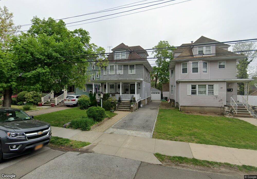
67 Howard Pkwy New Rochelle, NY 10801
Rochelle Heights NeighborhoodEstimated Value: $667,662 - $776,000
4
Beds
2
Baths
1,566
Sq Ft
$466/Sq Ft
Est. Value
About This Home
This home is located at 67 Howard Pkwy, New Rochelle, NY 10801 and is currently estimated at $729,416, approximately $465 per square foot. 67 Howard Pkwy is a home located in Westchester County with nearby schools including William B. Ward Elementary School, Albert Leonard Middle School, and New Rochelle High School.
Ownership History
Date
Name
Owned For
Owner Type
Purchase Details
Closed on
Oct 1, 2008
Sold by
Castelot Susan L
Bought by
Wheeler Daniel and Wheeler Erika
Current Estimated Value
Home Financials for this Owner
Home Financials are based on the most recent Mortgage that was taken out on this home.
Original Mortgage
$384,750
Outstanding Balance
$249,755
Interest Rate
5.94%
Mortgage Type
Purchase Money Mortgage
Estimated Equity
$479,661
Purchase Details
Closed on
Oct 20, 1997
Sold by
Santianna Frank E
Bought by
Castelot Susan L
Create a Home Valuation Report for This Property
The Home Valuation Report is an in-depth analysis detailing your home's value as well as a comparison with similar homes in the area
Home Values in the Area
Average Home Value in this Area
Purchase History
| Date | Buyer | Sale Price | Title Company |
|---|---|---|---|
| Wheeler Daniel | $427,500 | First Amer Title Ins Co Ny | |
| Castelot Susan L | $170,000 | Commonwealth Land Title Ins |
Source: Public Records
Mortgage History
| Date | Status | Borrower | Loan Amount |
|---|---|---|---|
| Open | Wheeler Daniel | $384,750 |
Source: Public Records
Tax History Compared to Growth
Tax History
| Year | Tax Paid | Tax Assessment Tax Assessment Total Assessment is a certain percentage of the fair market value that is determined by local assessors to be the total taxable value of land and additions on the property. | Land | Improvement |
|---|---|---|---|---|
| 2024 | $12,382 | $8,470 | $1,650 | $6,820 |
| 2023 | $9,520 | $8,470 | $1,650 | $6,820 |
| 2022 | $9,851 | $8,250 | $1,650 | $6,600 |
| 2021 | $9,768 | $8,250 | $1,650 | $6,600 |
| 2020 | $7,874 | $8,250 | $1,650 | $6,600 |
| 2019 | $8,556 | $8,250 | $1,650 | $6,600 |
| 2018 | $7,244 | $8,250 | $1,650 | $6,600 |
| 2017 | $2,328 | $8,250 | $1,650 | $6,600 |
| 2016 | $7,548 | $8,250 | $1,650 | $6,600 |
| 2015 | $6,257 | $8,250 | $1,650 | $6,600 |
| 2014 | $6,257 | $8,250 | $1,650 | $6,600 |
| 2013 | $6,257 | $8,250 | $1,650 | $6,600 |
Source: Public Records
Map
Nearby Homes
- 1 Slocum St
- 12 Congress St
- 43 Treno St
- 20 Treno St
- 308 5th Ave
- 72 Hamilton Ave
- 29 Brookdale Ave
- 34 Hilltop Ave
- 51 White Oak St Unit 2A
- 51 White Oak St Unit 2E
- 51 White Oak St Unit 1H
- 0 Hilltop Ave
- 14 Hamilton Ave
- 61 White Oak St Unit 4B
- 60 White Oak St Unit 2H
- 50 White Oak St Unit 4B
- 50 White Oak St Unit 3G
- 50 White Oak St Unit 1E
- 240 Beechmont Dr
- 43 Pinebrook Rd
- 63 Howard Pkwy
- 71 Howard Pkwy
- 57 Howard Pkwy
- 110 Brookside Place
- 106 Brookside Place
- 54 Halcyon Terrace
- 104 Brookside Place
- 55 Howard Pkwy
- 66 Howard Pkwy
- 102 Brookside Place
- 60 Howard Pkwy
- 33 Halcyon Terrace
- 56 Halcyon Terrace
- 98 Brookside Place
- 41 Halcyon Terrace
- 51 Howard Pkwy Unit 2
- 51 Howard Pkwy
- 56 Howard Pkwy
- 45 Halcyon Terrace
- 31 Halcyon Terrace