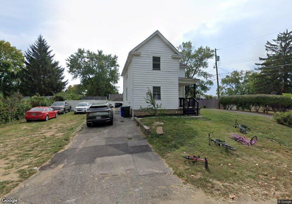
67 Kail Ave Columbus, OH 43207
Obetz-Lockbourne NeighborhoodEstimated Value: $199,678 - $443,000
3
Beds
2
Baths
5,400
Sq Ft
$52/Sq Ft
Est. Value
About This Home
This home is located at 67 Kail Ave, Columbus, OH 43207 and is currently estimated at $282,670, approximately $52 per square foot. 67 Kail Ave is a home located in Franklin County with nearby schools including Parsons Elementary School, Buckeye Middle School, and Marion-Franklin High School.
Ownership History
Date
Name
Owned For
Owner Type
Purchase Details
Closed on
Oct 5, 2021
Sold by
Deese Derrick
Bought by
Dw Capital Partners Ohio Llc
Current Estimated Value
Purchase Details
Closed on
Apr 14, 2021
Sold by
Gpv Ohio Llc
Bought by
Deese Derrick
Home Financials for this Owner
Home Financials are based on the most recent Mortgage that was taken out on this home.
Original Mortgage
$131,250
Interest Rate
2.9%
Mortgage Type
New Conventional
Purchase Details
Closed on
Apr 8, 2020
Sold by
Caliber Home Loans Inc
Bought by
Gpv Ohio Llc
Purchase Details
Closed on
Jun 24, 2019
Sold by
Siders Anna K and Franklin County
Bought by
Caliber Homes Loans Inc
Purchase Details
Closed on
Jun 16, 2014
Sold by
Maynard Barbara M
Bought by
Siders Anna K
Home Financials for this Owner
Home Financials are based on the most recent Mortgage that was taken out on this home.
Original Mortgage
$54,887
Interest Rate
4.37%
Mortgage Type
FHA
Purchase Details
Closed on
Aug 7, 1969
Bought by
Maynard Delmar E
Create a Home Valuation Report for This Property
The Home Valuation Report is an in-depth analysis detailing your home's value as well as a comparison with similar homes in the area
Home Values in the Area
Average Home Value in this Area
Purchase History
| Date | Buyer | Sale Price | Title Company |
|---|---|---|---|
| Dw Capital Partners Ohio Llc | -- | None Available | |
| Deese Derrick | -- | Ohio Real Title Agency Llc | |
| Gpv Ohio Llc | $27,500 | Omega Title Agency Llc | |
| Caliber Homes Loans Inc | $55,000 | Nova Title | |
| Siders Anna K | $55,900 | Land Sel Title | |
| Maynard Delmar E | -- | -- |
Source: Public Records
Mortgage History
| Date | Status | Borrower | Loan Amount |
|---|---|---|---|
| Previous Owner | Deese Derrick | $131,250 | |
| Previous Owner | Siders Anna K | $54,887 |
Source: Public Records
Tax History Compared to Growth
Tax History
| Year | Tax Paid | Tax Assessment Tax Assessment Total Assessment is a certain percentage of the fair market value that is determined by local assessors to be the total taxable value of land and additions on the property. | Land | Improvement |
|---|---|---|---|---|
| 2024 | $2,745 | $59,890 | $11,690 | $48,200 |
| 2023 | $3,023 | $59,890 | $11,690 | $48,200 |
| 2022 | $1,730 | $33,360 | $6,270 | $27,090 |
| 2021 | $1,776 | $33,360 | $6,270 | $27,090 |
| 2020 | $1,779 | $33,360 | $6,270 | $27,090 |
| 2019 | $1,796 | $28,320 | $5,460 | $22,860 |
| 2018 | $1,509 | $28,320 | $5,460 | $22,860 |
| 2017 | $1,576 | $28,320 | $5,460 | $22,860 |
| 2016 | $1,435 | $21,670 | $2,940 | $18,730 |
| 2015 | $1,303 | $21,670 | $2,940 | $18,730 |
| 2014 | $779 | $21,670 | $2,940 | $18,730 |
| 2013 | $417 | $22,785 | $3,080 | $19,705 |
Source: Public Records
Map
Nearby Homes
- 19 E Castle Rd
- 202 Calahan Rd
- 84 Betz Rd
- 2808 Dolby Dr
- 115 W Castle Rd
- 82 Delray Rd
- 300 Loxley Dr
- 2763 Parsons Ave
- 2769 Shelly Dr
- 162 Phelps Rd
- 0 Parsons Ave
- 228 Currier Dr
- 1633-1635 E Greenway Ave
- 574 Koebel Ave
- 256 Rumsey Rd Unit 258
- 611 Lock Ave
- 445 Basswood Rd
- 3380 Parsons Ave
- 3414 Parsons Ave
- 546 Stambaugh Ave
- 81 Kail Ave
- 2694 Thorndale Ave
- 2684 Thorndale Ave
- 2706 Thorndale Ave
- 85 Kail Ave
- 74 E Alcott Rd
- 86 E Alcott Rd
- 72 Kail Ave
- 72 Kail Ave
- 0 Kail Ave
- 2672 Thorndale Ave
- 2710 Thorndale Ave
- 92 E Alcott Rd
- 84 Kail Ave
- 98 E Alcott Rd
- 109 Kail Ave
- 2658 Thorndale Ave
- 2691 Thorndale Ave
- 2681 Thorndale Ave
- 2703 Thorndale Ave