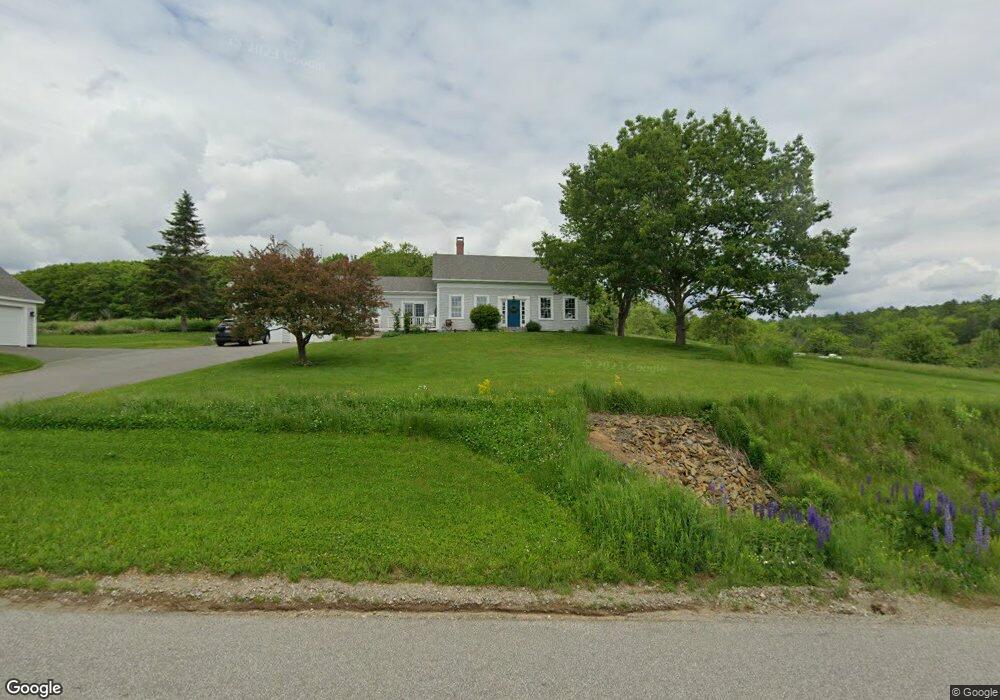
67 Kaler Rd Belfast, ME 04915
Estimated Value: $256,000 - $546,645
3
Beds
3
Baths
1,097
Sq Ft
$396/Sq Ft
Est. Value
About This Home
This home is located at 67 Kaler Rd, Belfast, ME 04915 and is currently estimated at $434,161, approximately $395 per square foot. 67 Kaler Rd is a home located in Waldo County with nearby schools including Cornerspring Children's House.
Ownership History
Date
Name
Owned For
Owner Type
Purchase Details
Closed on
Sep 28, 2020
Sold by
Terry Donald B
Bought by
Terry Donald B and Terry Lori A
Current Estimated Value
Purchase Details
Closed on
May 27, 2014
Sold by
Elaine S Kennedy Lt and Kennedy
Bought by
Terry Donald B and Terry Nicola G
Create a Home Valuation Report for This Property
The Home Valuation Report is an in-depth analysis detailing your home's value as well as a comparison with similar homes in the area
Home Values in the Area
Average Home Value in this Area
Purchase History
| Date | Buyer | Sale Price | Title Company |
|---|---|---|---|
| Terry Donald B | -- | None Available | |
| Terry Donald B | -- | None Available | |
| Terry Donald B | -- | -- | |
| Terry Donald B | -- | -- |
Source: Public Records
Tax History
| Year | Tax Paid | Tax Assessment Tax Assessment Total Assessment is a certain percentage of the fair market value that is determined by local assessors to be the total taxable value of land and additions on the property. | Land | Improvement |
|---|---|---|---|---|
| 2025 | $8,266 | $505,900 | $71,500 | $434,400 |
| 2024 | $7,771 | $504,600 | $71,500 | $433,100 |
| 2023 | $7,067 | $351,600 | $80,600 | $271,000 |
| 2022 | $7,287 | $340,500 | $80,600 | $259,900 |
| 2021 | $7,491 | $340,500 | $80,600 | $259,900 |
| 2020 | $7,538 | $323,500 | $80,600 | $242,900 |
| 2019 | $7,145 | $312,000 | $80,600 | $231,400 |
| 2018 | $7,082 | $312,000 | $80,600 | $231,400 |
| 2017 | $6,642 | $303,300 | $80,600 | $222,700 |
| 2016 | $7,017 | $306,400 | $64,600 | $241,800 |
| 2015 | $6,863 | $306,400 | $64,600 | $241,800 |
| 2014 | $6,634 | $306,400 | $64,600 | $241,800 |
| 2013 | $6,373 | $306,400 | $64,600 | $241,800 |
Source: Public Records
Map
Nearby Homes
- 0 Robbins Rd Unit 1634953
- 17 Marsh Rd
- 388 High St
- 225 Waldo Ave
- 000 Merriam Rd
- 162 Waldo Ave
- 37 Jacobs Rd
- 99 Waterville Rd
- 86 Oak Hill Rd
- 73 Swan Lake Ave
- 101 Waldo Ave Unit 3-1
- 2 Swan Lake Ave
- Lot 5 Waukeag Way
- 050-C-1 W Waldo Rd
- 12 Ashley Dr
- 20 Springbrook Dr Unit TH-6
- 18 Waldo Ave
- 183 Main St
- 9 James St
- 53 Lincolnville Ave
- 71 Kaler Rd
- 70 Kaler Rd
- 8 Kaler Rd
- 0 W Swanville Rd Unit 512913
- 0 Discontinued West Swanville Rd
- 0 W Swanville Rd Unit 231149
- 0 W Swanville Rd Unit 1215749
- 72 Kaler Rd
- Lot 6 Rt141 Swanville
- Lot 3 Rt 141 Swanville
- 1 Staples Rd
- 20 W Swanville Rd
- 20 W Swanville Rd
- 84 Kaler Rd
- 00 W Swanville Rd
- 93 Kaler Rd
- 75 City Point Rd
- 97 Kaler Rd
- 0 Kaler Rd
- 76 City Point Rd
Your Personal Tour Guide
Ask me questions while you tour the home.