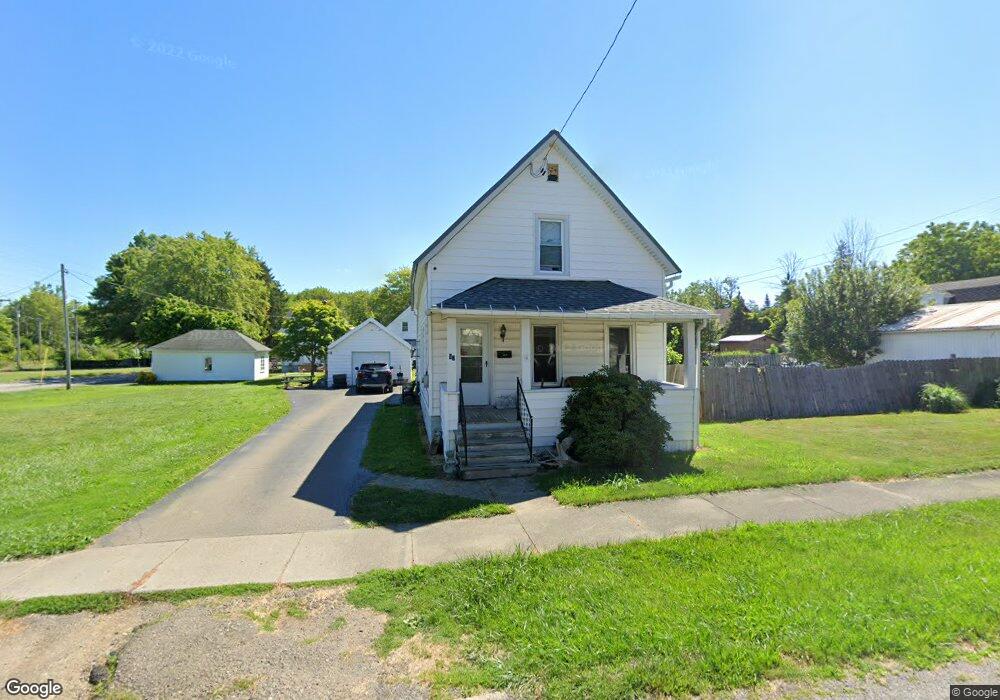
67 Kosciuszko Ave Dunkirk, NY 14048
Estimated Value: $118,000 - $144,239
4
Beds
1
Bath
1,500
Sq Ft
$87/Sq Ft
Est. Value
About This Home
This home is located at 67 Kosciuszko Ave, Dunkirk, NY 14048 and is currently estimated at $130,060, approximately $86 per square foot. 67 Kosciuszko Ave is a home located in Chautauqua County with nearby schools including Dunkirk Intermediate School, Northern Chautauqua Catholic School, and Central Christian Academy.
Ownership History
Date
Name
Owned For
Owner Type
Purchase Details
Closed on
Jan 7, 2011
Sold by
Anson Diane M
Bought by
Fred Brenda J
Current Estimated Value
Home Financials for this Owner
Home Financials are based on the most recent Mortgage that was taken out on this home.
Original Mortgage
$5,000
Outstanding Balance
$3,321
Interest Rate
4.4%
Mortgage Type
Unknown
Estimated Equity
$126,739
Create a Home Valuation Report for This Property
The Home Valuation Report is an in-depth analysis detailing your home's value as well as a comparison with similar homes in the area
Home Values in the Area
Average Home Value in this Area
Purchase History
| Date | Buyer | Sale Price | Title Company |
|---|---|---|---|
| Fred Brenda J | $52,000 | Neil Robinson |
Source: Public Records
Mortgage History
| Date | Status | Borrower | Loan Amount |
|---|---|---|---|
| Open | Fred Brenda J | $5,000 | |
| Open | Fred Brenda J | $50,298 |
Source: Public Records
Tax History
| Year | Tax Paid | Tax Assessment Tax Assessment Total Assessment is a certain percentage of the fair market value that is determined by local assessors to be the total taxable value of land and additions on the property. | Land | Improvement |
|---|---|---|---|---|
| 2024 | $1,892 | $47,000 | $4,300 | $42,700 |
| 2023 | $1,853 | $47,000 | $4,300 | $42,700 |
| 2022 | $1,631 | $47,000 | $4,300 | $42,700 |
| 2021 | $1,634 | $47,000 | $4,300 | $42,700 |
| 2020 | $1,116 | $47,000 | $4,300 | $42,700 |
| 2019 | $1,094 | $47,000 | $4,300 | $42,700 |
| 2018 | $1,094 | $47,000 | $4,300 | $42,700 |
| 2017 | $1,057 | $47,000 | $4,300 | $42,700 |
| 2016 | $1,024 | $47,000 | $4,300 | $42,700 |
| 2015 | -- | $47,000 | $4,300 | $42,700 |
| 2014 | -- | $47,000 | $4,300 | $42,700 |
Source: Public Records
Map
Nearby Homes
- 236 Townsend St
- 250 Townsend St
- 172 S Margay St
- 146 Hoyt St
- 0 W Benton & Ruggles St Unit R1631836
- 115 Nevins St
- 140 S Martin St
- 134 S Martin St
- 21 E Benton St
- 447 Hoyt St
- 120 S Ocelot St
- 112 S Warsaw St
- 0 Urban Rd Unit R1658439
- 245 Lake Shore Dr E
- 15 N Ocelot St
- 129 E 2nd St
- 228 King St
- 101 King St
- 58 Ruggles St
- 26 N Ermine St
- 80 Mcdonough St
- 76 Mcdonough St
- 57 Kosciuszko Ave
- 74 Mcdonough St
- 68 Kosciuszko Ave
- 70 Mcdonough St
- 64 Kosciuszko Ave
- 76 Kosciuszko Ave
- 56 Kosciuszko Ave
- 66 Mcdonough St
- 0 Mcdonough St
- 0 Mcdonough St Unit 1020336
- 0 Mcdonough St Unit 1024731
- 0 Mcdonough St Unit 1025371
- 0 Mcdonough St Unit 1027813
- 0 Mcdonough St Unit 1032021
- 0 Mcdonough St Unit 1033567
- 0 Mcdonough St Unit 1040765
- 0 Mcdonough St Unit 1041946
- 0 Mcdonough St Unit 1043469
Your Personal Tour Guide
Ask me questions while you tour the home.