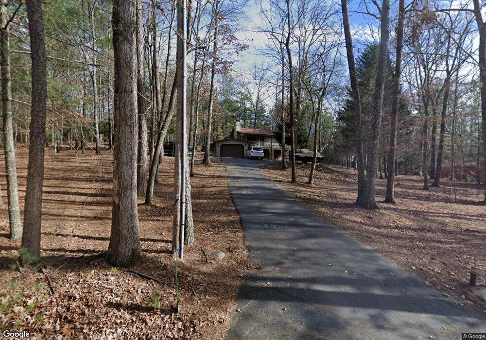
67 Lakeside Dr Blairsville, GA 30512
Ivylog NeighborhoodEstimated Value: $275,000 - $330,000
3
Beds
3
Baths
1,022
Sq Ft
$295/Sq Ft
Est. Value
About This Home
This home is located at 67 Lakeside Dr, Blairsville, GA 30512 and is currently estimated at $301,427, approximately $294 per square foot. 67 Lakeside Dr is a home located in Union County with nearby schools including Union County Primary School, Union County Elementary School, and Union County Middle School.
Ownership History
Date
Name
Owned For
Owner Type
Purchase Details
Closed on
Feb 10, 2022
Sold by
Eddins Rentals Llc
Bought by
Arnold Harry S and Arnold Margaret A
Current Estimated Value
Purchase Details
Closed on
Apr 2, 2020
Sold by
Eddins Properties Llc
Bought by
Eddins Rentals Llc
Purchase Details
Closed on
Mar 13, 2015
Sold by
Eddins Properties Llc
Bought by
Burdzilauskas Marguerite
Purchase Details
Closed on
Oct 19, 2013
Sold by
Stanton Neal
Bought by
Eddins Properties Llc
Purchase Details
Closed on
Mar 24, 2006
Sold by
Obrien George F
Bought by
Stanton Neal
Purchase Details
Closed on
Oct 6, 1999
Bought by
O'Brian George F and O'Brian J
Purchase Details
Closed on
May 24, 1999
Sold by
Chrisstoffels Anneke
Bought by
O'Brian George F
Purchase Details
Closed on
Apr 6, 1998
Sold by
Schmidt Hans
Bought by
Chrisstoffels Anneke
Purchase Details
Closed on
Sep 9, 1991
Bought by
Schmidt Hans
Create a Home Valuation Report for This Property
The Home Valuation Report is an in-depth analysis detailing your home's value as well as a comparison with similar homes in the area
Home Values in the Area
Average Home Value in this Area
Purchase History
| Date | Buyer | Sale Price | Title Company |
|---|---|---|---|
| Arnold Harry S | $225,000 | -- | |
| Eddins Rentals Llc | -- | -- | |
| Burdzilauskas Marguerite | -- | -- | |
| Eddins Properties Llc | $83,900 | -- | |
| Stanton Neal | $163,900 | -- | |
| O'Brian George F | $10,500 | -- | |
| O'Brian George F | $75,000 | -- | |
| Chrisstoffels Anneke | -- | -- | |
| Schmidt Hans | $57,000 | -- |
Source: Public Records
Tax History Compared to Growth
Tax History
| Year | Tax Paid | Tax Assessment Tax Assessment Total Assessment is a certain percentage of the fair market value that is determined by local assessors to be the total taxable value of land and additions on the property. | Land | Improvement |
|---|---|---|---|---|
| 2024 | $1,159 | $106,000 | $6,360 | $99,640 |
| 2023 | $1,198 | $98,440 | $6,360 | $92,080 |
| 2022 | $1,019 | $76,560 | $5,880 | $70,680 |
| 2021 | $1,017 | $64,560 | $5,880 | $58,680 |
| 2020 | $929 | $49,124 | $11,900 | $37,224 |
| 2019 | $879 | $49,124 | $11,900 | $37,224 |
| 2018 | $863 | $49,124 | $11,900 | $37,224 |
| 2017 | $863 | $49,124 | $11,900 | $37,224 |
| 2016 | $863 | $49,124 | $11,900 | $37,224 |
| 2015 | $871 | $49,124 | $11,900 | $37,224 |
| 2013 | -- | $53,681 | $5,950 | $47,731 |
Source: Public Records
Map
Nearby Homes
- Lot 1 Serenity Dr
- Lot 1 Serenity Ridge Ln
- Lot 2 Serenity Ridge Ln
- 136 Anchorage Dr
- 600 Lakeside Dr
- 993 Lakeside Dr
- 359 New Water Way
- 1243 Forest Dr
- 290 Bayside Ln
- Lot 46 Bayside Ln
- LT 37 Hidden Harbor
- LT 44 Hidden Harbor
- 101 Christian Ct
- 302 Brook Green Ct
- Lot 45 Sweetwater Ln
- 1250 Owen Glen Dr
- 402 Eagle Dr
- 1048 Hawks Claw Rd
- 332 Talon Trace
- 67 Lakeside Dr Unit 67
- 67 Lakeside Dr
- 3218 Robin Rd
- 3178 Robin Rd
- 103 Lakeside Dr
- 60 Lakeside Dr
- 23 Lakeside Dr
- 107 Serenity Dr
- 113 Lakeside Dr
- 313 Forest Dr
- 4721 Redbird Dr
- 99 Serenity Dr
- 102 Serenity Dr
- 247 Forest Dr
- 26 Redbird Dr
- 159 Lakeside Dr
- 82 Serenity Dr
- 75 Serenity Dr
- 17 Redbird Dr
- 17 Redbird Dr