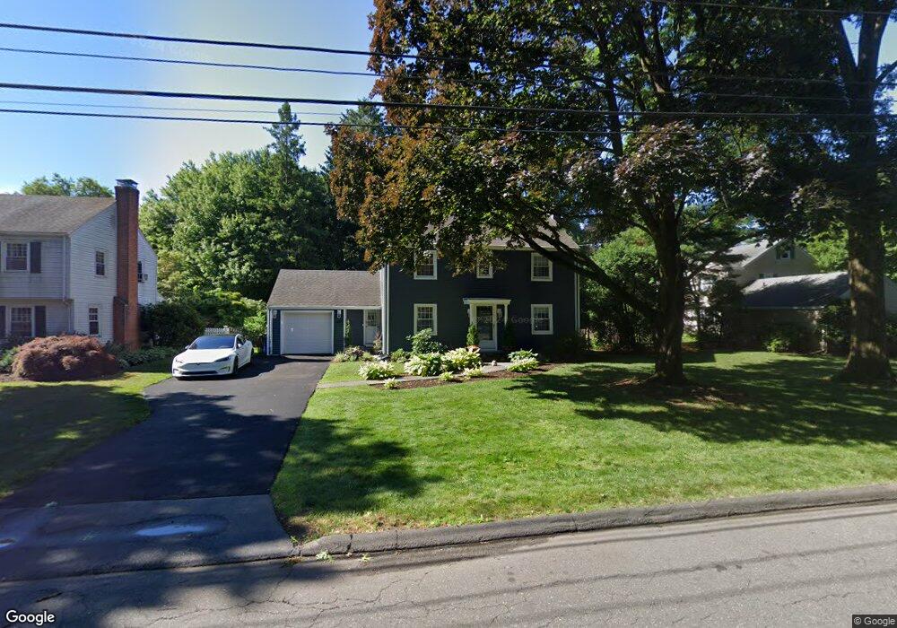
67 Longlane Rd West Hartford, CT 06117
Estimated Value: $488,000 - $541,000
3
Beds
2
Baths
1,560
Sq Ft
$327/Sq Ft
Est. Value
About This Home
This home is located at 67 Longlane Rd, West Hartford, CT 06117 and is currently estimated at $510,406, approximately $327 per square foot. 67 Longlane Rd is a home located in Hartford County with nearby schools including Norfeldt School, King Philip Middle School, and Hall High School.
Ownership History
Date
Name
Owned For
Owner Type
Purchase Details
Closed on
Jul 30, 2019
Sold by
November Jamie A
Bought by
Nielsen Cassandra O
Current Estimated Value
Home Financials for this Owner
Home Financials are based on the most recent Mortgage that was taken out on this home.
Original Mortgage
$283,221
Outstanding Balance
$251,971
Interest Rate
4.5%
Mortgage Type
FHA
Estimated Equity
$258,435
Purchase Details
Closed on
Dec 2, 2008
Sold by
Martocci Albert J
Bought by
November-Zeff James A
Home Financials for this Owner
Home Financials are based on the most recent Mortgage that was taken out on this home.
Original Mortgage
$100,000
Interest Rate
6.47%
Purchase Details
Closed on
May 28, 1996
Sold by
Steven Dacosta Llc
Bought by
Detrick William
Create a Home Valuation Report for This Property
The Home Valuation Report is an in-depth analysis detailing your home's value as well as a comparison with similar homes in the area
Home Values in the Area
Average Home Value in this Area
Purchase History
| Date | Buyer | Sale Price | Title Company |
|---|---|---|---|
| Nielsen Cassandra O | $293,000 | -- | |
| November-Zeff James A | $276,000 | -- | |
| Detrick William | $230,000 | -- |
Source: Public Records
Mortgage History
| Date | Status | Borrower | Loan Amount |
|---|---|---|---|
| Open | Nielsen Cassandra O | $283,221 | |
| Previous Owner | Detrick William | $50,000 | |
| Previous Owner | Detrick William | $125,000 | |
| Previous Owner | Detrick William | $25,000 | |
| Previous Owner | Detrick William | $100,000 |
Source: Public Records
Tax History Compared to Growth
Tax History
| Year | Tax Paid | Tax Assessment Tax Assessment Total Assessment is a certain percentage of the fair market value that is determined by local assessors to be the total taxable value of land and additions on the property. | Land | Improvement |
|---|---|---|---|---|
| 2025 | $9,664 | $215,810 | $94,500 | $121,310 |
| 2024 | $9,140 | $215,810 | $94,500 | $121,310 |
| 2023 | $8,831 | $215,810 | $94,500 | $121,310 |
| 2022 | $8,779 | $215,810 | $94,500 | $121,310 |
| 2021 | $8,766 | $206,640 | $90,930 | $115,710 |
| 2020 | $7,988 | $191,100 | $82,880 | $108,220 |
| 2019 | $7,988 | $191,100 | $82,880 | $108,220 |
| 2018 | $7,835 | $191,100 | $82,880 | $108,220 |
| 2017 | $7,843 | $191,100 | $82,880 | $108,220 |
| 2016 | $7,456 | $188,720 | $78,400 | $110,320 |
| 2015 | $7,230 | $188,720 | $78,400 | $110,320 |
| 2014 | $7,052 | $188,720 | $78,400 | $110,320 |
Source: Public Records
Map
Nearby Homes
- 14 Gledhill Ln
- 2645 Albany Ave
- 53 Whitehill Dr
- 100 Richmond Ln
- 35 W Ridge Dr
- 6 Old Oak Rd
- 30 Farmstead Ln
- 2581 Albany Ave
- 592 Mountain Rd Unit A
- 64 Harvest Ln
- 64 Avondale Rd
- 62 Blue Ridge Ln
- 2 Ferncliff Dr
- 8 Tanglewood Rd
- 124 Ferncliff Dr
- 51 Sky View Dr Unit 4
- 105 Hilldale Rd
- 1 King Philip Dr Unit 207
- 7 Mountainside Rd
- 139 Mohawk Dr