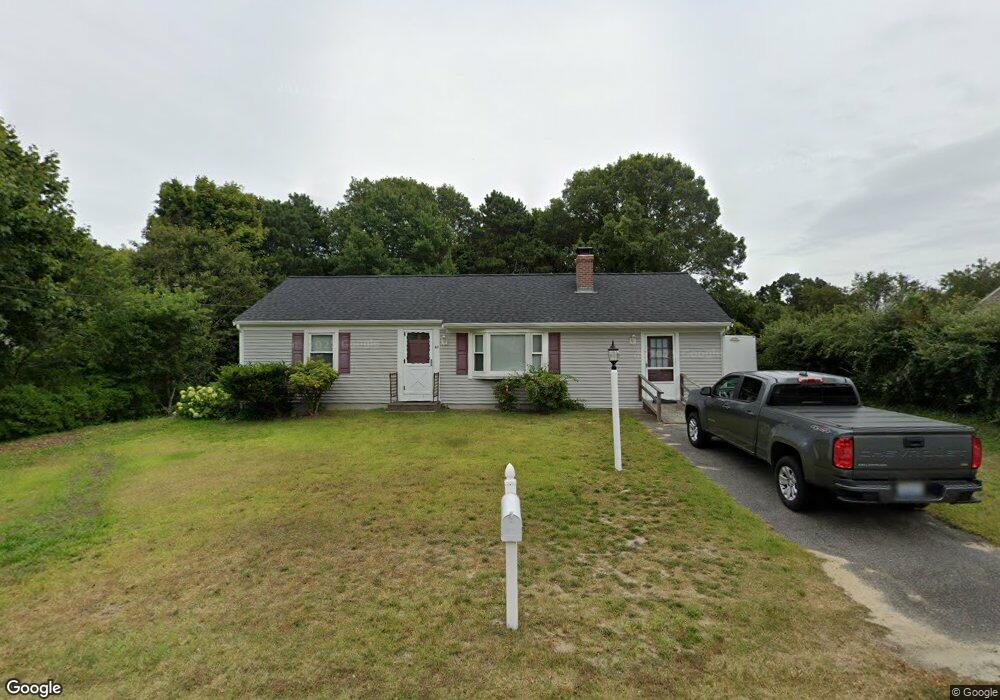
67 Lower Brook Rd South Yarmouth, MA 02664
South Yarmouth NeighborhoodEstimated Value: $506,000 - $540,000
2
Beds
1
Bath
1,200
Sq Ft
$436/Sq Ft
Est. Value
About This Home
This home is located at 67 Lower Brook Rd, South Yarmouth, MA 02664 and is currently estimated at $523,533, approximately $436 per square foot. 67 Lower Brook Rd is a home located in Barnstable County with nearby schools including Dennis-Yarmouth Regional High School, Sturgis Charter Public School, and St. Pius X. School.
Ownership History
Date
Name
Owned For
Owner Type
Purchase Details
Closed on
Apr 5, 2021
Sold by
Mcgourty Charles G
Bought by
Mcgourty Sharon A and Perkins Daniel R
Current Estimated Value
Purchase Details
Closed on
Nov 25, 2009
Sold by
Mcgourty Joan M
Bought by
Mcgourty Charles G
Create a Home Valuation Report for This Property
The Home Valuation Report is an in-depth analysis detailing your home's value as well as a comparison with similar homes in the area
Home Values in the Area
Average Home Value in this Area
Purchase History
| Date | Buyer | Sale Price | Title Company |
|---|---|---|---|
| Mcgourty Sharon A | $75,000 | None Available | |
| Mcgourty Charles G | -- | -- |
Source: Public Records
Tax History Compared to Growth
Tax History
| Year | Tax Paid | Tax Assessment Tax Assessment Total Assessment is a certain percentage of the fair market value that is determined by local assessors to be the total taxable value of land and additions on the property. | Land | Improvement |
|---|---|---|---|---|
| 2025 | $3,287 | $464,300 | $177,500 | $286,800 |
| 2024 | $3,051 | $413,400 | $150,100 | $263,300 |
| 2023 | $2,947 | $363,400 | $129,900 | $233,500 |
| 2022 | $3,012 | $328,100 | $118,100 | $210,000 |
| 2021 | $2,826 | $295,600 | $118,100 | $177,500 |
| 2020 | $2,761 | $276,100 | $118,100 | $158,000 |
| 2019 | $2,472 | $244,800 | $118,100 | $126,700 |
| 2018 | $2,339 | $227,300 | $100,600 | $126,700 |
| 2017 | $2,234 | $223,000 | $96,300 | $126,700 |
| 2016 | $2,138 | $214,200 | $87,500 | $126,700 |
| 2015 | $2,023 | $201,500 | $87,500 | $114,000 |
Source: Public Records
Map
Nearby Homes
- 48 Captain Dore Rd
- 18 Captain Stanley Rd
- 35 Captain Percival Rd
- 24 Fast Brook Rd
- 3 Saturn Ln
- 11 Bob-O-link Ln
- 147 Captain Bacon Rd
- 49 Captain Besse Rd
- 68 Bob-O-link Ln
- 33 Lake Rd
- 21 Hazelmoor Rd
- 23 Circuit Rd N
- 17 South St
- 72 Quartermaster Row
- 22 Powhatan Rd
- 15 Sharon Rd
- 33 Sparrow Way
- 7 Sunset Pines Rd
- 745 Willow St
- 844 Route 28 Unit 2A
- 61 Lower Brook Rd
- 71 Lower Brook Rd
- 70 Lower Brook Rd
- 1 Spinning Brook Rd
- 0 Autumn Dr
- 19 Autumn Dr
- 43 Autumn Dr
- 10 Spinning Brook Rd
- 12 Village Brook Rd
- 54 Lower Brook Rd
- 7 Spinning Brook Rd
- 121 Rebecca Ln
- 49 Lower Brook Rd
- 22 Amelia Way
- 15 Autumn Dr
- 20 Village Brook Rd
- 22 Autumn Dr
- 11 Spinning Brook Rd
- 14 Amelia Way
- 16 Spinning Brook Rd