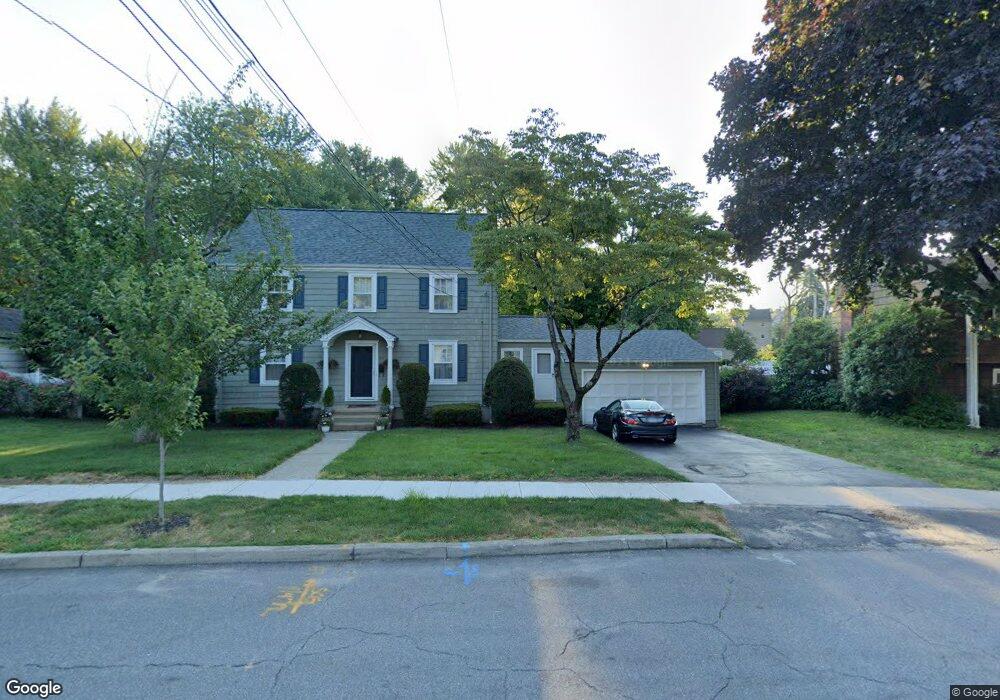
67 Lynnbrook Rd Fairfield, CT 06825
Tunxis Hill NeighborhoodEstimated Value: $584,000 - $637,000
3
Beds
2
Baths
1,696
Sq Ft
$365/Sq Ft
Est. Value
About This Home
This home is located at 67 Lynnbrook Rd, Fairfield, CT 06825 and is currently estimated at $619,822, approximately $365 per square foot. 67 Lynnbrook Rd is a home located in Fairfield County with nearby schools including Mckinley Elementary School, Tomlinson Middle School, and Fairfield Warde High School.
Ownership History
Date
Name
Owned For
Owner Type
Purchase Details
Closed on
Oct 17, 2001
Sold by
Powell Allyn H and Arnold Eleanor F
Bought by
Vigeant Gary M and Vigeant Stacie L
Current Estimated Value
Purchase Details
Closed on
Jul 26, 1996
Sold by
Andres John C and Andres Tama B
Bought by
Powell Allyn H
Create a Home Valuation Report for This Property
The Home Valuation Report is an in-depth analysis detailing your home's value as well as a comparison with similar homes in the area
Home Values in the Area
Average Home Value in this Area
Purchase History
| Date | Buyer | Sale Price | Title Company |
|---|---|---|---|
| Vigeant Gary M | $320,000 | -- | |
| Vigeant Gary M | $320,000 | -- | |
| Powell Allyn H | $206,000 | -- | |
| Powell Allyn H | $206,000 | -- |
Source: Public Records
Mortgage History
| Date | Status | Borrower | Loan Amount |
|---|---|---|---|
| Open | Powell Allyn H | $110,200 | |
| Open | Powell Allyn H | $248,000 |
Source: Public Records
Tax History
| Year | Tax Paid | Tax Assessment Tax Assessment Total Assessment is a certain percentage of the fair market value that is determined by local assessors to be the total taxable value of land and additions on the property. | Land | Improvement |
|---|---|---|---|---|
| 2025 | $8,160 | $287,420 | $169,050 | $118,370 |
| 2024 | $8,019 | $287,420 | $169,050 | $118,370 |
| 2023 | $7,907 | $287,420 | $169,050 | $118,370 |
| 2022 | $7,829 | $287,420 | $169,050 | $118,370 |
| 2021 | $6,479 | $287,420 | $169,050 | $118,370 |
| 2020 | $6,389 | $270,900 | $140,910 | $129,990 |
| 2019 | $7,257 | $270,900 | $140,910 | $129,990 |
| 2018 | $8,634 | $270,900 | $140,910 | $129,990 |
| 2017 | $6,995 | $270,900 | $140,910 | $129,990 |
| 2016 | $6,894 | $270,900 | $140,910 | $129,990 |
| 2015 | $6,362 | $256,620 | $146,650 | $109,970 |
| 2014 | $6,262 | $256,620 | $146,650 | $109,970 |
Source: Public Records
Map
Nearby Homes
- 860 Briarwood Ave
- 155 Brooklawn Ave
- 80 Cartright St Unit 5D
- 80 Cartright St Unit PHA
- 84 Algonquin Rd
- 26 Essex St
- 25 Cartright St Unit 5D
- 366 Brooklawn Ave
- 2370 North Ave Unit 3F
- 64 Moody Ave
- 74 Carleton Ave
- 155 Moody Ave
- 61 Astoria Ave
- 30 Pacific St Unit 32
- 301 Poplar St Unit 303
- 1285 Norman St
- 697 Laurel Ave
- 700 Laurel Ave
- 1036 Maplewood Ave Unit 1038
- 412 Dewey St
- 75 Lynnbrook Rd
- 89 Lynnbrook Rd
- 55 Lynnbrook Rd
- 70 Renwick Place
- 72 Lynnbrook Rd
- 105 Lynnbrook Rd
- 34 Lynnbrook Rd
- 54 Lynnbrook Rd
- 41 Lynnbrook Rd
- 102 Lynnbrook Rd
- 55 Dora Cir
- 45 Dora Cir
- 60 Renwick Place
- 121 Lynnbrook Rd
- 114 Lynnbrook Rd
- 44 Renwick Place
- 33 Dora Cir
- 27 Lynnbrook Rd
- 20 Lynnbrook Rd
- 62 Lewis Dr
Your Personal Tour Guide
Ask me questions while you tour the home.