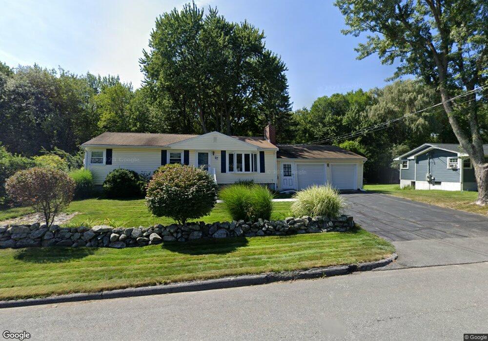
67 Mercury Dr Shrewsbury, MA 01545
Estimated Value: $562,000 - $679,000
3
Beds
2
Baths
1,008
Sq Ft
$601/Sq Ft
Est. Value
About This Home
This home is located at 67 Mercury Dr, Shrewsbury, MA 01545 and is currently estimated at $605,666, approximately $600 per square foot. 67 Mercury Dr is a home located in Worcester County with nearby schools including Spring Street Elementary School, Sherwood Middle School, and Oak Middle School.
Ownership History
Date
Name
Owned For
Owner Type
Purchase Details
Closed on
Sep 29, 2011
Sold by
Carr Diane C and Harrold Cheryl A
Bought by
Middlesworth Ryan P
Current Estimated Value
Home Financials for this Owner
Home Financials are based on the most recent Mortgage that was taken out on this home.
Original Mortgage
$205,000
Outstanding Balance
$139,643
Interest Rate
4.15%
Mortgage Type
Purchase Money Mortgage
Estimated Equity
$466,023
Purchase Details
Closed on
Jul 31, 2000
Sold by
Davidson Andrew K and Oconnor-Davidson Joyce
Bought by
Carr Diane C and Harrold Cheryl A
Purchase Details
Closed on
Apr 30, 1997
Sold by
Pelletier Paul O
Bought by
Davidson Andrew K and Davidson Joyce
Create a Home Valuation Report for This Property
The Home Valuation Report is an in-depth analysis detailing your home's value as well as a comparison with similar homes in the area
Home Values in the Area
Average Home Value in this Area
Purchase History
| Date | Buyer | Sale Price | Title Company |
|---|---|---|---|
| Middlesworth Ryan P | $270,000 | -- | |
| Middlesworth Ryan P | $270,000 | -- | |
| Middlesworth Ryan P | $270,000 | -- | |
| Carr Diane C | $200,000 | -- | |
| Carr Diane C | $200,000 | -- | |
| Davidson Andrew K | $137,500 | -- | |
| Davidson Andrew K | $137,500 | -- |
Source: Public Records
Mortgage History
| Date | Status | Borrower | Loan Amount |
|---|---|---|---|
| Open | Middlesworth Ryan P | $205,000 | |
| Closed | Middlesworth Ryan P | $205,000 | |
| Previous Owner | Davidson Andrew K | $148,000 |
Source: Public Records
Tax History Compared to Growth
Tax History
| Year | Tax Paid | Tax Assessment Tax Assessment Total Assessment is a certain percentage of the fair market value that is determined by local assessors to be the total taxable value of land and additions on the property. | Land | Improvement |
|---|---|---|---|---|
| 2025 | $64 | $533,600 | $285,200 | $248,400 |
| 2024 | $5,793 | $467,900 | $271,600 | $196,300 |
| 2023 | $5,849 | $445,800 | $271,600 | $174,200 |
| 2022 | $5,231 | $370,700 | $213,400 | $157,300 |
| 2021 | $4,759 | $360,800 | $213,400 | $147,400 |
| 2020 | $4,406 | $353,300 | $213,400 | $139,900 |
| 2019 | $4,185 | $332,900 | $198,500 | $134,400 |
| 2018 | $3,890 | $307,300 | $185,200 | $122,100 |
| 2017 | $3,719 | $289,900 | $167,800 | $122,100 |
| 2016 | $3,663 | $281,800 | $156,800 | $125,000 |
| 2015 | $3,489 | $264,300 | $141,400 | $122,900 |
Source: Public Records
Map
Nearby Homes
- 2 Applewood Cir
- 251 Boylston St Unit 253
- 17 Wilder Rd
- 11 Adin Dr
- 11 Cranbrook Rd
- 20 Rawson Hill Dr
- 5 Highland Hill Dr
- 20 Browning Rd
- 10 Karen Ave
- 20 Olde Colony Dr
- 3 Merriam Ave
- 7 Holman Heights Cir
- Lot 11 High St
- 7 Northland Rd
- 148 Spring St
- 34 Gates Rd
- 11 Country Way
- 40 High St
- 26 Blackthorn Rd
- 70 Colonial Dr