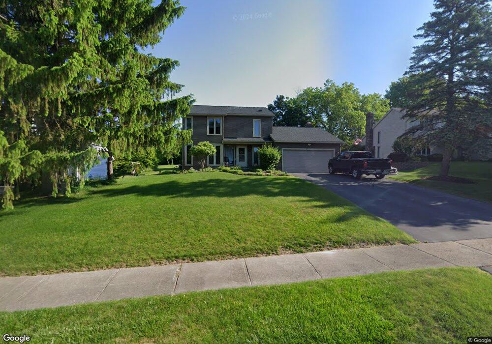
67 Misty Pine Rd Fairport, NY 14450
Estimated Value: $374,000 - $411,000
3
Beds
3
Baths
1,875
Sq Ft
$210/Sq Ft
Est. Value
About This Home
This home is located at 67 Misty Pine Rd, Fairport, NY 14450 and is currently estimated at $394,664, approximately $210 per square foot. 67 Misty Pine Rd is a home located in Monroe County with nearby schools including Brooks Hill School, Johanna Perrin Middle School, and Minerva Deland School.
Ownership History
Date
Name
Owned For
Owner Type
Purchase Details
Closed on
Mar 4, 2011
Sold by
Sanford Samantha A and Tumminelli Samantha
Bought by
Sanford Samantha A and Mereau Matthew
Current Estimated Value
Home Financials for this Owner
Home Financials are based on the most recent Mortgage that was taken out on this home.
Original Mortgage
$130,000
Outstanding Balance
$5,762
Interest Rate
4.16%
Mortgage Type
New Conventional
Estimated Equity
$388,902
Purchase Details
Closed on
May 30, 2000
Sold by
Giordano Tina
Bought by
Sanford Samantha
Purchase Details
Closed on
Mar 14, 2000
Sold by
Giordano Tina L
Bought by
Giordano Tina L
Purchase Details
Closed on
Sep 30, 1999
Sold by
Harrington George J
Bought by
Giordano Tina L
Create a Home Valuation Report for This Property
The Home Valuation Report is an in-depth analysis detailing your home's value as well as a comparison with similar homes in the area
Home Values in the Area
Average Home Value in this Area
Purchase History
| Date | Buyer | Sale Price | Title Company |
|---|---|---|---|
| Sanford Samantha A | -- | Chicago Title Insurance Co | |
| Sanford Samantha | $146,500 | Peter Tumminelli | |
| Giordano Tina L | -- | -- | |
| Giordano Tina L | $143,500 | Timothy Mccuskey |
Source: Public Records
Mortgage History
| Date | Status | Borrower | Loan Amount |
|---|---|---|---|
| Open | Sanford Samantha A | $130,000 |
Source: Public Records
Tax History
| Year | Tax Paid | Tax Assessment Tax Assessment Total Assessment is a certain percentage of the fair market value that is determined by local assessors to be the total taxable value of land and additions on the property. | Land | Improvement |
|---|---|---|---|---|
| 2024 | $9,525 | $209,900 | $45,000 | $164,900 |
| 2023 | $9,050 | $209,900 | $45,000 | $164,900 |
| 2022 | $9,344 | $209,900 | $45,000 | $164,900 |
| 2021 | $9,366 | $209,900 | $45,000 | $164,900 |
| 2020 | $8,537 | $209,900 | $45,000 | $164,900 |
| 2019 | $6,170 | $209,900 | $45,000 | $164,900 |
| 2018 | $8,086 | $209,900 | $45,000 | $164,900 |
| 2017 | $3,855 | $190,800 | $45,000 | $145,800 |
| 2016 | $6,170 | $190,800 | $45,000 | $145,800 |
| 2015 | -- | $190,800 | $45,000 | $145,800 |
| 2014 | -- | $190,800 | $45,000 | $145,800 |
Source: Public Records
Map
Nearby Homes
- 26 Misty Pine Rd
- 17 Freshfield Rise
- 3 Freshfield Rise
- 10 Margo Dr
- 95 Summit St
- 14 Port Meadow Trail
- 21 High Gate Trail Unit 4
- 142 S Main St
- 27 South Ave
- 27 Garrison Dr
- 18 Eagle Hollow
- 6 Eagle Hollow
- 85 E Pointe
- 9 Hollingham Rise
- 30 Nettlecreek Rd
- 38 Huxley Way
- 76-78 High St Unit 76
- 70 High St
- 26 Hanningfield Cir
- 11 Canton Meadow
- 65 Misty Pine Rd
- 69 Misty Pine Rd
- 71 Misty Pine Rd
- 63 Misty Pine Rd
- 66 Misty Pine Rd
- 64 Misty Pine Rd
- 68 Misty Pine Rd
- 49 Misty Pine Rd
- 47 Misty Pine Rd
- 51 Misty Pine Rd
- 62 Misty Pine Rd
- 70 Misty Pine Rd
- 45 Misty Pine Rd
- 73 Misty Pine Rd
- 60 Misty Pine Rd
- 72 Misty Pine Rd
- 43 Misty Pine Rd
- 75 Misty Pine Rd
- 46 Misty Pine Rd
- 74 Misty Pine Rd
Your Personal Tour Guide
Ask me questions while you tour the home.